
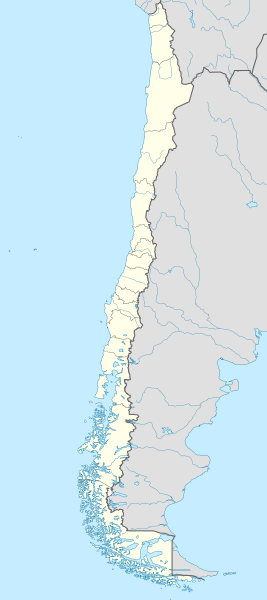
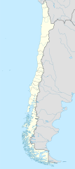
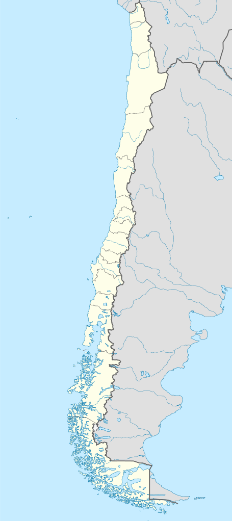
Акс:Chile location map.svg

Ҳаҷми пешнамоиши PNG барои файли кунунии SVG: 267 × 600 пиксел. Дигар кайфиятҳо: 107 × 240 пиксел | 213 × 480 пиксел | 342 × 768 пиксел | 455 × 1 024 пиксел | 911 × 2 048 пиксел | 1 183 × 2 658 пиксел.
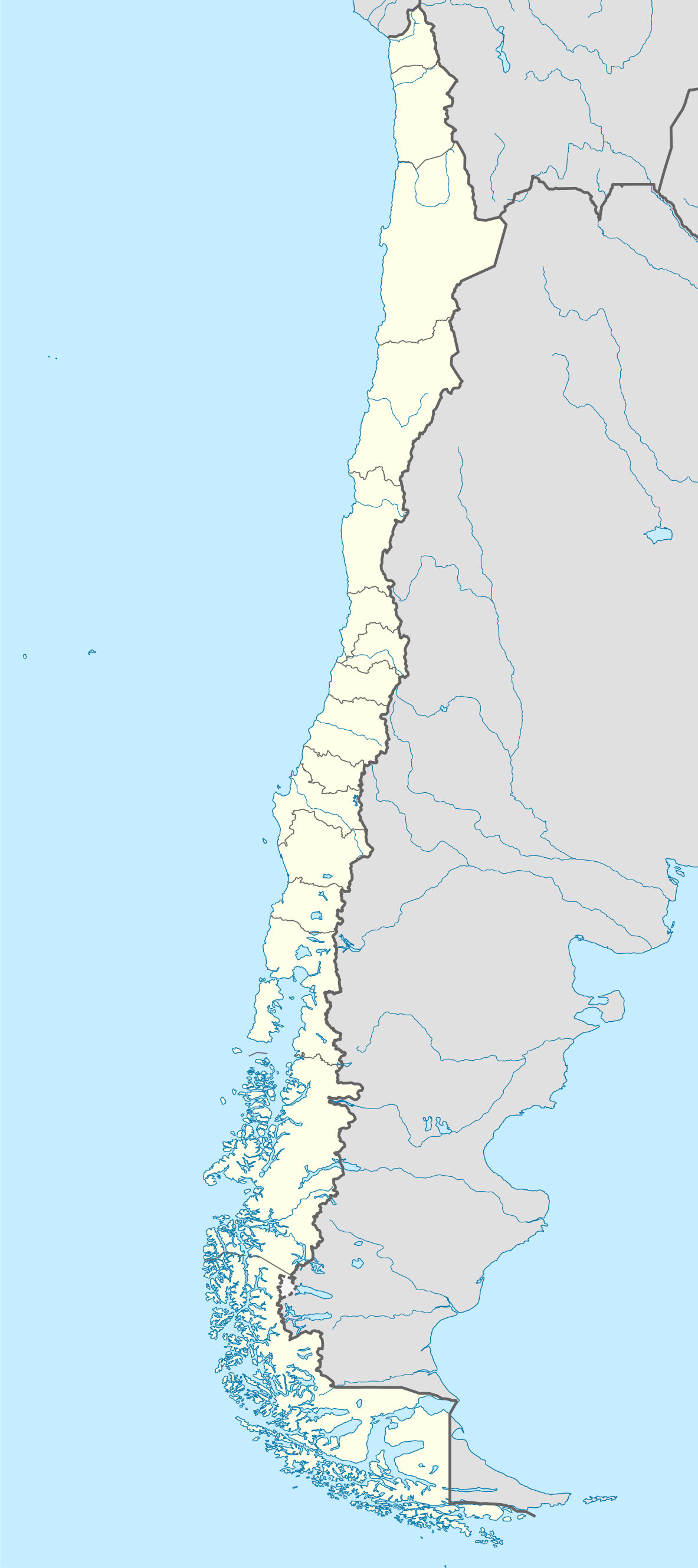
Акси аслӣ (SVG парванда, исмӣ 1 183 × 2 658 пиксел, андозаи парванда: 925 кбайт)
Хулоса
| Тавсифот |
Deutsch: Positionskarte von Chile
Quadratische Plattkarte, N-S-Streckung 115 %. Geographische Begrenzung der Karte:
English: Location map of Chile
Equirectangular projection, N/S stretching 115 %. Geographic limits of the map:
Español: Mapa de localización de Chile
Proyección Equirectangular, N/S con una extensión de 115 %. Límites geográficos del mapa:
|
| Сана | |
| Манбаъ |
own work, using
|
| Муаллиф | NordNordWest |
| Other versions |
Derivative works of this file:
|
.svg)
.svg)
.svg)
.svg)

|
This map has been made or improved in the German Kartenwerkstatt (Map Lab). You can propose maps to improve as well.
|
Иҷозатнома
I, the copyright holder of this work, hereby publish it under the following licenses:

|
Permission is granted to copy, distribute and/or modify this document under the terms of the GNU Free Documentation License, Version 1.2 or any later version published by the Free Software Foundation; with no Invariant Sections, no Front-Cover Texts, and no Back-Cover Texts. A copy of the license is included in the section entitled GNU Free Documentation License. |
This file is licensed under the Creative Commons Attribution-Share Alike 3.0 Unported license.
- Шумо озодед:
- мубодилот намудан – копӣ, паҳн ва фиристадани асар
- ремикс кардан – татбиқи кор
- Under the following conditions:
- тахсис – You must give appropriate credit, provide a link to the license, and indicate if changes were made. You may do so in any reasonable manner, but not in any way that suggests the licensor endorses you or your use.
- саҳми яксон – If you remix, transform, or build upon the material, you must distribute your contributions under the same or compatible license as the original.
Шумо иҷозатномаи хостаи худро интихоб карда метавонед.
Таърихи файл
Рӯи таърихҳо клик кунед то нусхаи марбути парвандаро бубинед.
| Таърих | Бандангуштӣ | Андоза | Корбар | Тавзеҳ | |
|---|---|---|---|---|---|
| нусхаи феълӣ | 22:46, 15 августи 2023 | | 1 183 × 2 658 (925 кбайт) | Janitoalevic | Fixed Aysén & Magallanes and Chilean Antarctica Regions border. |
| 22:54, 5 сентябри 2018 |  | 1 183 × 2 658 (925 кбайт) | Janitoalevic | Ñuble Region | |
| 20:30, 3 Декабри 2017 |  | 1 183 × 2 658 (921 кбайт) | Janitoalevic | color error. | |
| 20:28, 3 Декабри 2017 |  | 1 183 × 2 658 (921 кбайт) | Janitoalevic | Fixed Argentina's Lake Nahuel Huapi | |
| 20:25, 3 Декабри 2017 |  | 1 183 × 2 658 (920 кбайт) | Janitoalevic | . | |
| 21:50, 2 Декабри 2017 |  | 1 183 × 2 658 (920 кбайт) | Janitoalevic | Fixed Argentina-Bolivia border | |
| 21:46, 2 Декабри 2017 |  | 1 183 × 2 658 (920 кбайт) | Janitoalevic | . | |
| 00:42, 30 августи 2017 |  | 1 183 × 2 658 (919 кбайт) | Janitoalevic | Fixed size | |
| 23:30, 20 августи 2017 |  | 1 262 × 2 835 (910 кбайт) | Janitoalevic | Removed Ñuble Region (Will be fully implemented in 2018) | |
| 01:00, 20 августи 2017 |  | 1 262 × 2 835 (914 кбайт) | Janitoalevic | Added Ñuble Region & more precise borders |
Пайвандҳо
Саҳифаҳои зерин ба ин акс пайванданд:
Истифодаи саросарии парванда
Викиҳои дигари зерин ин файлро истифода мекунанд:
- Истифода дар af.wikipedia.org
- Antofagasta
- Pichilemu
- FIFA Sokker-Wêreldbekertoernooi in 1962
- Chillán
- Los Ángeles (Chili)
- Talcahuano
- Quinta Normal
- Temuco
- Puerto Montt
- Punta Arenas
- Coyhaique
- Valdivia
- Castro (Chili)
- San Pedro de la Paz
- Villa Alemana
- Sjabloon:Liggingkaart Chili
- Penco
- Hualpén
- Chiguayante
- Hualqui
- Coronel (Chili)
- Lota
- Tomé
- La Serena
- Arica
- Monte Águila (Chili)
- Arturo Merino Benítez Internasionale Lughawe
- Истифода дар als.wikipedia.org
- Истифода дар an.wikipedia.org
View more global usage of this file.