
Акс:IranOMC.png
Андозаи ин пешнамоиш: 708 × 600 пиксел. Дигар кайфиятҳо: 283 × 240 пиксел | 567 × 480 пиксел | 930 × 788 пиксел.
Акси аслӣ ((930 × 788 пиксел, ҳаҷми парванда: 53 кбайт, навъи MIME: image/png))
Хулоса
| Тавсифот |
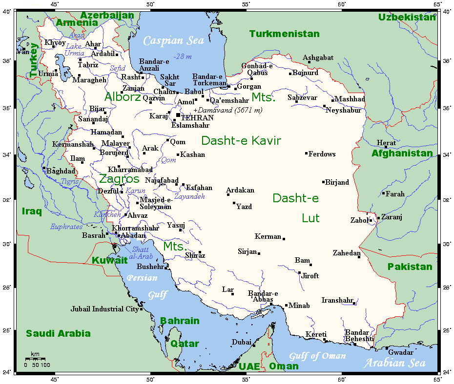
English: A map showing Iran's cities and main towns. This map's source is here, with the uploader's modifications, and the GMT homepage says that the tools are released under the GNU General Public License. |
| Сана | 6 август 2007 (original upload date) |
| Манбаъ | Transferred from en.wikipedia to Commons. |
| Муаллиф | Kelisi at Англисӣ Википедия |
Иҷозатнома
Kelisi from en.wikipedia.org, the copyright holder of this work, hereby publishes it under the following license:
| This file is licensed under the Creative Commons Attribution-Share Alike 3.0 Unported license. Subject to disclaimers. | ||
| Тахсис: Kelisi from en.wikipedia.org | ||
| ||
| This licensing tag was added to this file as part of the GFDL licensing update. |

|
Permission is granted to copy, distribute and/or modify this document under the terms of the GNU Free Documentation License, Version 1.2 or any later version published by the Free Software Foundation; with no Invariant Sections, no Front-Cover Texts, and no Back-Cover Texts. A copy of the license is included in the section entitled GNU Free Documentation License. Subject to disclaimers. |
Original upload log
The original description page was here. All following user names refer to en.wikipedia.
- 2007-08-06 16:05 Kelisi 930×788× (54211 bytes) == Summary == A map showing Iran's cities and main towns. This map's source is [http://www.aquarius.ifm-geomar.de/ here], with the uploader's modifications, and the [http://gmt.soest.hawaii.edu/ GMT homepage] says that the tools are released under the GNU
Таърихи файл
Рӯи таърихҳо клик кунед то нусхаи марбути парвандаро бубинед.
| Таърих | Бандангуштӣ | Андоза | Корбар | Тавзеҳ | |
|---|---|---|---|---|---|
| нусхаи феълӣ | 05:59, 27 ноябри 2011 | | 930 × 788 (53 кбайт) | Urdangaray | {{Information |Description={{en|A map showing Iran's cities and main towns. This map's source is [http://www.aquarius.ifm-geomar.de/ here], with the uploader's modifications, and the [http://gmt.soest.hawaii.edu/ GMT homepage] says that the tools are rele |
Пайвандҳо
Саҳифаҳои зерин ба ин акс пайванданд:
Истифодаи саросарии парванда
Викиҳои дигари зерин ин файлро истифода мекунанд:
- Истифода дар ast.wikipedia.org
- Истифода дар en.wikipedia.org
- Истифода дар es.wikipedia.org
- Истифода дар eu.wikipedia.org
- Истифода дар fa.wikipedia.org
- Истифода дар fr.wikipedia.org
- Истифода дар hi.wikipedia.org
- Истифода дар id.wikipedia.org
- Истифода дар mg.wikipedia.org
- Истифода дар ms.wikipedia.org
- Истифода дар my.wikipedia.org
- Истифода дар nn.wikipedia.org
- Истифода дар se.wikipedia.org
- Истифода дар sl.wikipedia.org
- Истифода дар smn.wikipedia.org
- Истифода дар uk.wikipedia.org
- Истифода дар zh.wikipedia.org