
Акс:Kurdistan governorates 2012.png
Андозаи ин пешнамоиш: 643 × 600 пиксел. Дигар кайфиятҳо: 257 × 240 пиксел | 515 × 480 пиксел | 1 000 × 933 пиксел.
Акси аслӣ ((1 000 × 933 пиксел, ҳаҷми парванда: 53 кбайт, навъи MIME: image/png))
Хулоса
| Тавсифот |
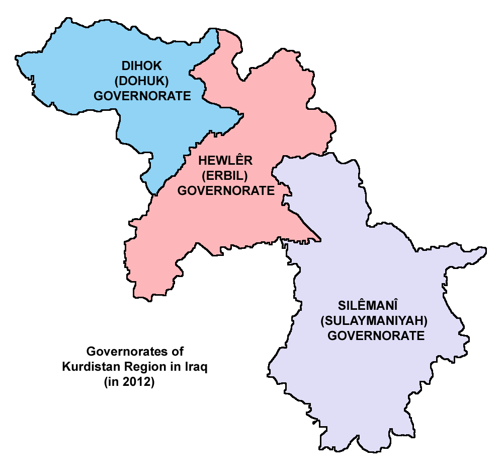
English: Map showing the governorates of Kurdistan Region in Iraq (in 2012). |
| Сана | |
| Манбаъ | Кори худ |
| Муаллиф | PANONIAN |
Иҷозатнома
I, the copyright holder of this work, hereby publish it under the following license:
| This file is made available under the Creative Commons CC0 1.0 Universal Public Domain Dedication. | |
| The person who associated a work with this deed has dedicated the work to the public domain by waiving all of their rights to the work worldwide under copyright law, including all related and neighboring rights, to the extent allowed by law. You can copy, modify, distribute and perform the work, even for commercial purposes, all without asking permission.
|
Refences
Borders of Kurdistan Region governorates are made in accordance with these maps provided by the Kurdistan Region Statistics Office:
- http://www.krso.net/en/maps
- http://www.krso.net/documents/78/SubDistricts%20of%20the%20Governorates%20of%20Kurdistan%20Region.jpg
- http://www.krso.net/documents/38/Districts%20of%20the%20Governorates%20of%20Kurdistan%20Region.jpg
- http://www.krso.net/pdf/KRG-map-english.jpg
Таърихи файл
Рӯи таърихҳо клик кунед то нусхаи марбути парвандаро бубинед.
| Таърих | Бандангуштӣ | Андоза | Корбар | Тавзеҳ | |
|---|---|---|---|---|---|
| нусхаи феълӣ | 10:24, 6 сентябри 2014 | | 1 000 × 933 (53 кбайт) | PANONIAN | {{Information |Description ={{en|1=Map showing the governorates of Kurdistan Region in Iraq (in 2012).}} |Source ={{own}} |Author =PANONIAN |Date =2014 |Permission = |other_versions = }} |
Пайвандҳо
Саҳифаҳои зерин ба ин акс пайванданд:
Истифодаи саросарии парванда
Викиҳои дигари зерин ин файлро истифода мекунанд:
- Истифода дар arc.wikipedia.org
- Истифода дар arz.wikipedia.org
- Истифода дар be.wikipedia.org
- Истифода дар bg.wikipedia.org
- Истифода дар bn.wikipedia.org
- Истифода дар ca.wikipedia.org
- Истифода дар ckb.wikipedia.org
- Истифода дар cs.wikipedia.org
- Истифода дар cy.wikipedia.org
- Истифода дар da.wikipedia.org
- Истифода дар eo.wikipedia.org
- Истифода дар es.wikipedia.org
- Истифода дар et.wikipedia.org
- Истифода дар fr.wikipedia.org
- Истифода дар hi.wikipedia.org
- Истифода дар hu.wikipedia.org
- Истифода дар id.wikipedia.org
- Истифода дар it.wikipedia.org
- Истифода дар ja.wikipedia.org
- Истифода дар kk.wikipedia.org
- Истифода дар ko.wikipedia.org
- Истифода дар ku.wikipedia.org
View more global usage of this file.