
Акс:Matekaneairrunway.jpg

Андозаи ин пешнамоиш: 442 × 599 пиксел. Дигар кайфиятҳо: 177 × 240 пиксел | 354 × 480 пиксел | 566 × 768 пиксел | 755 × 1 024 пиксел | 1 510 × 2 048 пиксел | 3 425 × 4 645 пиксел.
Акси аслӣ ((3 425 × 4 645 пиксел, ҳаҷми парванда: 857 кбайт, навъи MIME: image/jpeg))
| Тавсифот |
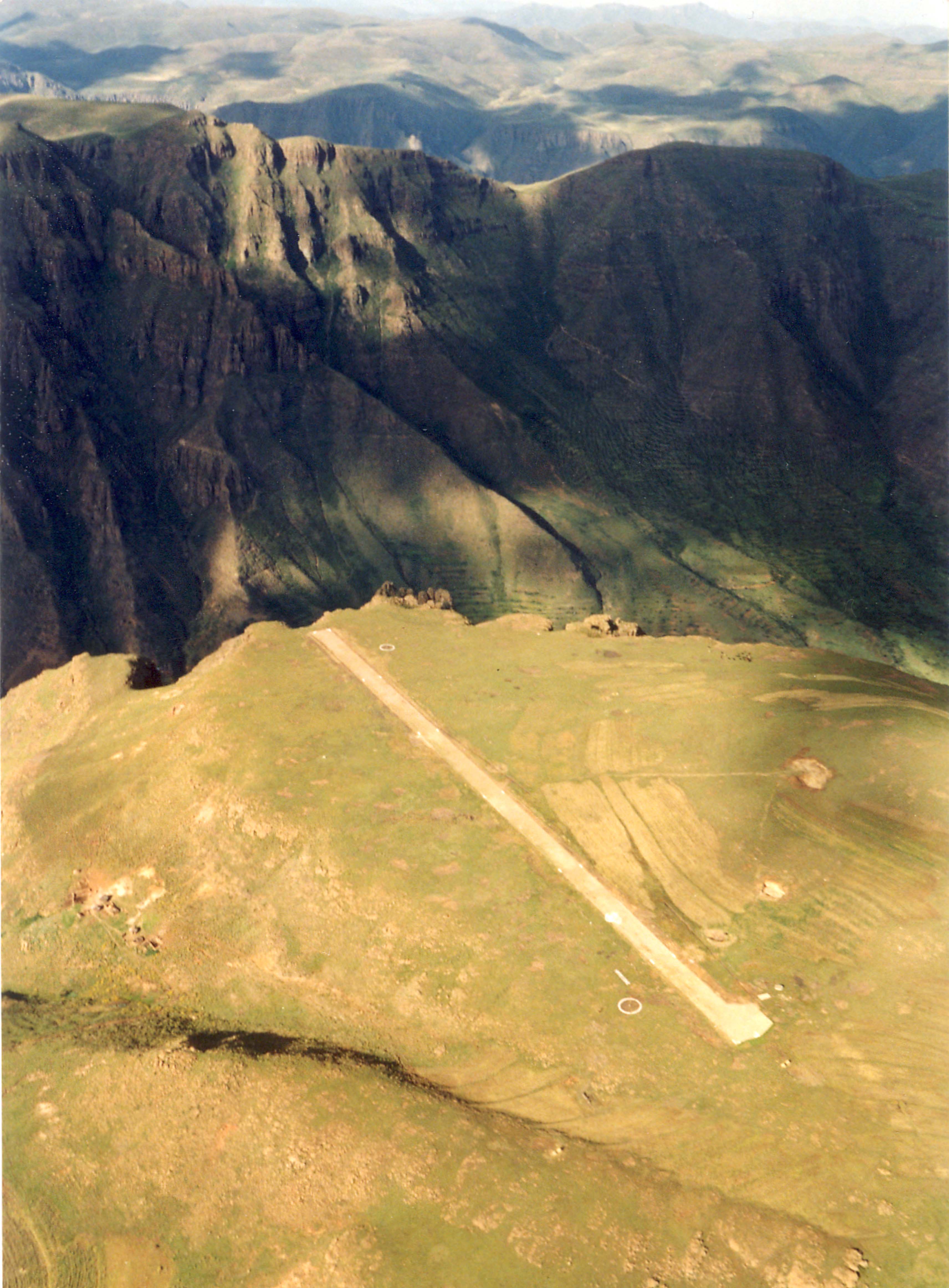
English: The airstrip at Matekane (ICAO: FXME) |
| Сана | |
| Манбаъ | http://www.claytor.com/photographs/ (http://www.claytor.com/photographs/images/picLesothoMatekaneAirstripTomClaytor.jpg) |
| Муаллиф | Tom Claytor; http://www.claytor.com |
| Иҷозат (Пешроҳандозии ин парванда) |
http://www.claytor.com/photographs/ |
| Object location | | View this and other nearby images on: OpenStreetMap |
|---|
Иҷозатнома
This file is licensed under the Creative Commons Attribution 4.0 International license.
Тахсис: Photo courtesy of Tom Claytor - www.claytor.com
- Шумо озодед:
- мубодилот намудан – копӣ, паҳн ва фиристадани асар
- ремикс кардан – татбиқи кор
- Under the following conditions:
- тахсис – You must give appropriate credit, provide a link to the license, and indicate if changes were made. You may do so in any reasonable manner, but not in any way that suggests the licensor endorses you or your use.
This file, which was originally posted to
http://www.claytor.com/photographs/, was reviewed on 21 June 2016 by reviewer Wdwd, who confirmed that it was available there under the stated license on that date.
|
Original upload log
Transferred from en.wikipedia to Commons by OhanaUnited.
The original description page was here. All following user names refer to en.wikipedia.
- 2009-02-26 21:05 Einsteinbud 3425×4645× (877606 bytes) {{Information |Description= The airstrip at Matekane |Source= http://www.claytor.com/photographs/images/picLesothoMatekaneAirstripTomClaytor.jpg |Date= |Author= Tom Claytor |Permission= released on public domain |other_versions= }}
Таърихи файл
Рӯи таърихҳо клик кунед то нусхаи марбути парвандаро бубинед.
| Таърих | Бандангуштӣ | Андоза | Корбар | Тавзеҳ | |
|---|---|---|---|---|---|
| нусхаи феълӣ | 22:42, 15 ноябри 2009 | | 3 425 × 4 645 (857 кбайт) | OhanaUnited | {{Information |Description={{en|The airstrip at Matekane}} |Source=Transferred from [http://en.wikipedia.org en.wikipedia]; transfer was stated to be made by User:OhanaUnited.<br/> (Original text : ''http://www.claytor.com/photographs/images/picLesoth |
Пайвандҳо
Саҳифаҳои зерин ба ин акс пайванданд:
Истифодаи саросарии парванда
Викиҳои дигари зерин ин файлро истифода мекунанд:
- Истифода дар ast.wikipedia.org
- Истифода дар en.wikipedia.org
- Истифода дар es.wikipedia.org
- Истифода дар fa.wikipedia.org
- Истифода дар fr.wikipedia.org
- Истифода дар hu.wikipedia.org
- Истифода дар hu.wikibooks.org
- Истифода дар ja.wikipedia.org
- Истифода дар nl.wikipedia.org
- Истифода дар pl.wikipedia.org
- Истифода дар ru.wikipedia.org
- Истифода дар www.wikidata.org
- Истифода дар zh.wikipedia.org