
Акс:Panama location map.svg

Ҳаҷми пешнамоиши PNG барои файли кунунии SVG: 800 × 403 пиксел. Дигар кайфиятҳо: 320 × 161 пиксел | 640 × 323 пиксел | 1 024 × 516 пиксел | 1 280 × 645 пиксел | 2 560 × 1 290 пиксел | 1 246 × 628 пиксел.
Акси аслӣ (SVG парванда, исмӣ 1 246 × 628 пиксел, андозаи парванда: 327 кбайт)
Хулоса
| Тавсифот |
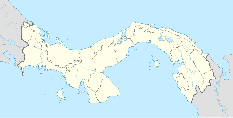
English: Location map of Panama
Equirectangular projection. Geographic limits of the map:
Deutsch: Positionskarte von Panama
Quadratische Plattkarte. Geographische Begrenzung der Karte:
|
| Сана | |
| Манбаъ | Кори худ |
| Муаллиф | Alexrk |
| Other versions |
|


|
This map has been made or improved in the German Kartenwerkstatt (Map Lab). You can propose maps to improve as well.
|
Иҷозатнома
I, the copyright holder of this work, hereby publish it under the following licenses:

|
Permission is granted to copy, distribute and/or modify this document under the terms of the GNU Free Documentation License, Version 1.2 or any later version published by the Free Software Foundation; with no Invariant Sections, no Front-Cover Texts, and no Back-Cover Texts. A copy of the license is included in the section entitled GNU Free Documentation License. |
This file is licensed under the Creative Commons Attribution-Share Alike 3.0 Unported license.
- Шумо озодед:
- мубодилот намудан – копӣ, паҳн ва фиристадани асар
- ремикс кардан – татбиқи кор
- Under the following conditions:
- тахсис – You must give appropriate credit, provide a link to the license, and indicate if changes were made. You may do so in any reasonable manner, but not in any way that suggests the licensor endorses you or your use.
- саҳми яксон – If you remix, transform, or build upon the material, you must distribute your contributions under the same or compatible license as the original.
Шумо иҷозатномаи хостаи худро интихоб карда метавонед.
Таърихи файл
Рӯи таърихҳо клик кунед то нусхаи марбути парвандаро бубинед.
| Таърих | Бандангуштӣ | Андоза | Корбар | Тавзеҳ | |
|---|---|---|---|---|---|
| нусхаи феълӣ | 16:43, 28 Декабри 2020 | | 1 246 × 628 (327 кбайт) | Milenioscuro | new comarca: Naso Tjerdi (created December 4, 2020) + improvements in limits of some provinces |
| 17:55, 1 Январ 2014 |  | 1 246 × 628 (296 кбайт) | NordNordWest | + Panama Oeste | |
| 16:24, 22 июли 2009 |  | 1 246 × 628 (530 кбайт) | Alexrk2 | Admingrenzen verbessert | |
| 14:18, 19 июли 2009 |  | 1 246 × 628 (528 кбайт) | Alexrk2 | Admingrenzen korrigiert, +Flüsse | |
| 17:27, 31 май 2009 |  | 1 246 × 628 (347 кбайт) | Alexrk | Update Admin-Grenzen | |
| 17:03, 31 май 2009 |  | 1 246 × 628 (331 кбайт) | Alexrk | + Panamakanal | |
| 16:42, 31 май 2009 |  | 1 246 × 628 (330 кбайт) | Alexrk | Farben korr | |
| 15:54, 31 май 2009 |  | 1 246 × 628 (331 кбайт) | Alexrk | {{Information |Description={{en|1=Location map of Panama Equirectangular projection. Geographic limits of the map: * N: 10.28° N * S: 6.79° N * W: 83.56° W * O: 76.64° W}} {{de|1=Positionskarte von Panama Quadratische Pla |
Пайвандҳо
Саҳифаҳои зерин ба ин акс пайванданд:
- Фурудгоҳи Ачутупо
- Фурудгоҳи биналмилалӣ букос дил тру оисло кулун
- Фурудгоҳи биналмилалӣ олбрук моркус брндзину глобрт
- Фурудгоҳи биналмилалӣ тукомн
- Фурудгоҳи биналмилалӣ чонгуинуло купӣ мнюл нину
- Фурудгоҳи клзодо лорго
- Фурудгоҳи обе фнлн фолз дарёча острҷюн
- Фурудгоҳи пункри
- Фурудгоҳи рею ҳоту
- Фурудгоҳи рубн конту
- Фурудгоҳи чом
- Шаблон:Location map Panama
Истифодаи саросарии парванда
Викиҳои дигари зерин ин файлро истифода мекунанд:
- Истифода дар af.wikipedia.org
- Истифода дар als.wikipedia.org
- Истифода дар an.wikipedia.org
- Истифода дар ar.wikipedia.org
- Истифода дар arz.wikipedia.org
- Истифода дар ast.wikipedia.org
- Ponte de les Amériques
- Canal de Panamá
- Ciudá de Panamá
- Módulu:Mapa de llocalización/datos/Panamá
- Módulu:Mapa de llocalización/datos/Panamá/usu
- Aeropuertu Internacional Enrique Malek
- Aeropuertu Internacional de Tocumen
- Puertu de Balboa
- Terminal Internacional de Manzanillo
- Terminal Internacional de PSA Panamá
- Academia Panameña de la Llingua
- Истифода дар az.wikipedia.org
- Истифода дар ba.wikipedia.org
- Истифода дар be-tarask.wikipedia.org
- Истифода дар be.wikipedia.org
- Истифода дар bg.wikipedia.org
- Истифода дар bn.wikipedia.org
- Истифода дар bs.wikipedia.org
View more global usage of this file.