
Акс:Chabahar coast.jpg
Нусхаи ҳаҷман ва сифатан баландтар дастрас нест.
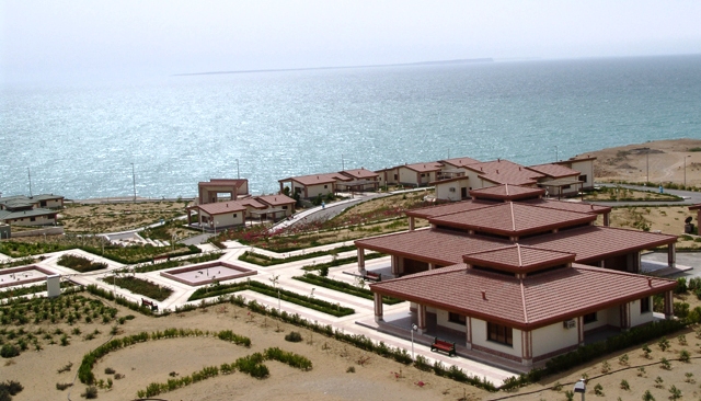
Chabahar_coast.jpg ((640 × 366 пиксел, ҳаҷми парванда: 196 кбайт, навъи MIME: image/jpeg))
Хулоса
Chabahar coast, Iran. Image provided by Nightryder84
Иҷозатнома
| This file is licensed under the Creative Commons Attribution-Share Alike 3.0 Unported license. Subject to disclaimers. | ||
| ||
| This licensing tag was added to this file as part of the GFDL licensing update. |

|
Permission is granted to copy, distribute and/or modify this document under the terms of the GNU Free Documentation License, Version 1.2 or any later version published by the Free Software Foundation; with no Invariant Sections, no Front-Cover Texts, and no Back-Cover Texts. A copy of the license is included in the section entitled GNU Free Documentation License. Subject to disclaimers. |
| Тавсифот | Chabahar coast, Iran |
| Сана | (UTC) |
| Манбаъ | http://en.wikipedia.org/wiki/Image:Chabahar_coast.jpg |
| Муаллиф | Nightryder84 |
| Иҷозат (Пешроҳандозии ин парванда) |
GDFL |
| Camera location | | View this and other nearby images on: OpenStreetMap |
|---|
Таърихи файл
Рӯи таърихҳо клик кунед то нусхаи марбути парвандаро бубинед.
| Таърих | Бандангуштӣ | Андоза | Корбар | Тавзеҳ | |
|---|---|---|---|---|---|
| нусхаи феълӣ | 09:27, 1 октябри 2005 | | 640 × 366 (196 кбайт) | Kotoito | Chabahar coast, Iran. Image provided by Nightryder84 |
Пайвандҳо
Саҳифаҳои зерин ба ин акс пайванданд:
- Устони Систон ва Балучистон
- Чобаҳор
- Шаҳристони Бампур
- Шаҳристони Далгон
- Шаҳристони Даштиёрӣ
- Шаҳристони Зобул
- Шаҳристони Зоҳидон
- Шаҳристони Зуҳак
- Шаҳристони Кунорак
- Шаҳристони Меҳристон
- Шаҳристони Мирҷавеҳ
- Шаҳристони Некшаҳр
- Шаҳристони Сарбоз
- Шаҳристони Саровон
- Шаҳристони Сиб ва Сурон
- Шаҳристони Фануҷ
- Шаҳристони Хош
- Шаҳристони Чобаҳор
- Шаҳристони Эроншаҳр
- Шаҳристони Қасри Қанд
- Шаҳристони Ҳирманд
- Шаблон:Шаҳристонҳо ва шаҳрҳои устони Систон ва Балучистон
Истифодаи саросарии парванда
Викиҳои дигари зерин ин файлро истифода мекунанд:
- Истифода дар ar.wikipedia.org
- Истифода дар ar.wikinews.org
- Истифода дар arz.wikipedia.org
- Истифода дар azb.wikipedia.org
- Истифода дар bg.wikipedia.org
- Истифода дар ceb.wikipedia.org
- Истифода дар ckb.wikipedia.org
- Истифода дар cs.wikipedia.org
- Истифода дар de.wikipedia.org
- Истифода дар en.wikipedia.org
- Истифода дар fa.wikipedia.org
- Истифода дар frr.wikipedia.org
- Истифода дар fr.wikipedia.org
- Истифода дар incubator.wikimedia.org
- Истифода дар ja.wikipedia.org
- Истифода дар ko.wikipedia.org
- Истифода дар lt.wikipedia.org
- Истифода дар mg.wikipedia.org
- Истифода дар mk.wikipedia.org
- Истифода дар mt.wikipedia.org
- Истифода дар nl.wikipedia.org
- Истифода дар no.wikipedia.org
- Истифода дар pa.wikipedia.org
- Истифода дар pl.wikipedia.org
- Истифода дар pl.wikivoyage.org
- Истифода дар ro.wikipedia.org
- Истифода дар ru.wikipedia.org
- Истифода дар sco.wikipedia.org
- Истифода дар sd.wikipedia.org
- Истифода дар sh.wikipedia.org
- Истифода дар ta.wikipedia.org
- Истифода дар tr.wikipedia.org
- Истифода дар ur.wikipedia.org
- Истифода дар www.wikidata.org
- Истифода дар zh.wikipedia.org