
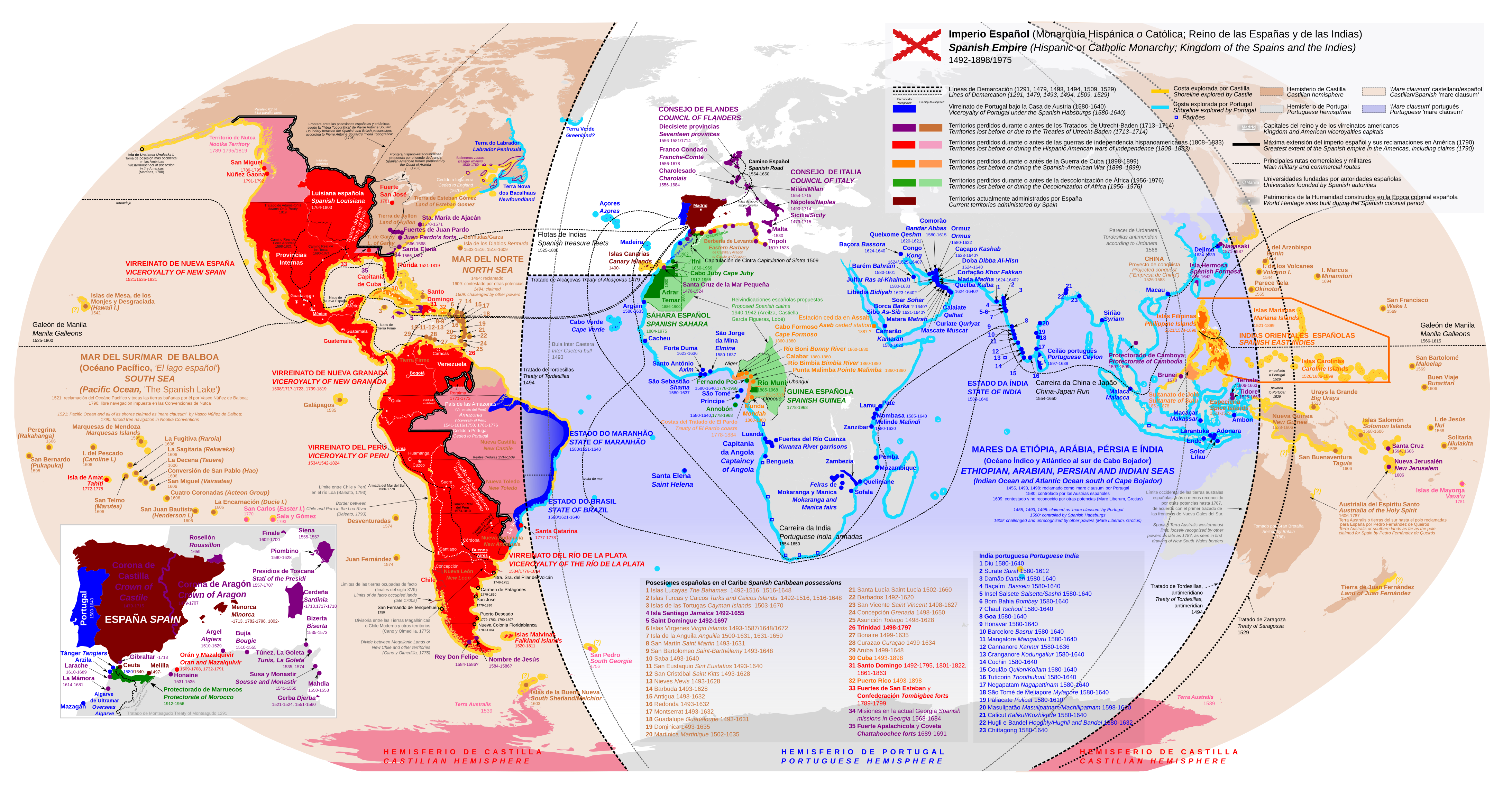
Акс:Diachronic map of the Spanish Empire.svg

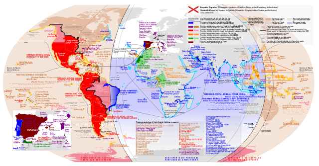
Ҳаҷми пешнамоиши PNG барои файли кунунии SVG: 800 × 418 пиксел. Дигар кайфиятҳо: 320 × 167 пиксел | 640 × 334 пиксел | 1 024 × 535 пиксел | 1 280 × 669 пиксел | 2 560 × 1 338 пиксел | 4 371 × 2 284 пиксел.
Акси аслӣ (SVG парванда, исмӣ 4 371 × 2 284 пиксел, андозаи парванда: 6,47 Мбайт)
Хулоса
| Тавсифот |
English: Diachronic map of the Spanish Empire
Español: Mapa diacrónico del Imperio Español |
| Сана | |
| Манбаъ | Original map of Trasamundo, it has been redrawn from scratch and modified including territorial claims (Nagihuin)+Small correction in colouring of the Viceroyalty of Río de La Plata |
| Муаллиф | Nagihuin |
| Other versions |
[]
|


Иҷозатнома
I, the copyright holder of this work, hereby publish it under the following license:
This file is licensed under the Creative Commons Attribution-Share Alike 4.0 International license.
- Шумо озодед:
- мубодилот намудан – копӣ, паҳн ва фиристадани асар
- ремикс кардан – татбиқи кор
- Under the following conditions:
- тахсис – You must give appropriate credit, provide a link to the license, and indicate if changes were made. You may do so in any reasonable manner, but not in any way that suggests the licensor endorses you or your use.
- саҳми яксон – If you remix, transform, or build upon the material, you must distribute your contributions under the same or compatible license as the original.
Таърихи файл
Рӯи таърихҳо клик кунед то нусхаи марбути парвандаро бубинед.
| Таърих | Бандангуштӣ | Андоза | Корбар | Тавзеҳ | |
|---|---|---|---|---|---|
| нусхаи феълӣ | 10:12, 12 августи 2023 | | 4 371 × 2 284 (6,47 Мбайт) | Nagihuin | Added references: Empresa de China, Terra Verde, Soulard's boundaries |
| 15:59, 14 феврали 2023 |  | 4 371 × 2 284 (6,47 Мбайт) | Janitoalevic | Cano y Olmedilla border, San Fernando de Tenquehuén. | |
| 17:35, 21 августи 2022 |  | 4 371 × 2 284 (6,46 Мбайт) | Janitoalevic | Text color | |
| 17:32, 21 августи 2022 |  | 4 371 × 2 284 (6,46 Мбайт) | Janitoalevic | Added Terra Australis | |
| 15:59, 21 августи 2022 |  | 4 371 × 2 284 (6,46 Мбайт) | Janitoalevic | Límite entre Chile y Perú en el río Loa (Baleato, 1793) Border between Chile and Peru in the Loa River (Baleato, 1793) | |
| 19:17, 12 Декабри 2020 |  | 4 371 × 2 284 (6,46 Мбайт) | James2813 | Typo. | |
| 11:52, 10 феврали 2020 |  | 4 371 × 2 284 (6,47 Мбайт) | Barjimoa | Restored repaired and corrected version per consensus on the talk page. JuTa's edits were on good faith. I also presented my case for keeping at the discussion for deletion so that the file can now be saved. | |
| 12:16, 6 феврали 2020 |  | 4 371 × 2 284 (6,47 Мбайт) | JuTa | The other one is still available at File:Imperio Español Completo.svg | |
| 11:31, 6 феврали 2020 |  | 4 371 × 2 284 (6,47 Мбайт) | Barjimoa | Per discussions. | |
| 21:06, 25 Январ 2020 |  | 4 371 × 2 284 (6,47 Мбайт) | JuTa | The other one is available at File:Imperio Español Completo.svg |
Пайвандҳо
Ин акс дар ҳеҷ саҳифа истифода намешавад.
Истифодаи саросарии парванда
Викиҳои дигари зерин ин файлро истифода мекунанд:
- Истифода дар af.wikipedia.org
- Истифода дар ar.wikipedia.org
- Истифода дар azb.wikipedia.org
- Истифода дар cs.wikipedia.org
- Истифода дар de.wikipedia.org
- Истифода дар el.wikipedia.org
- Истифода дар en.wikipedia.org
- Истифода дар es.wikipedia.org
- Истифода дар fr.wikipedia.org
- Истифода дар ht.wikipedia.org
- Истифода дар hu.wikipedia.org
- Истифода дар lo.wikipedia.org
- Истифода дар nl.wikipedia.org
- Истифода дар pt.wikipedia.org
- Истифода дар te.wikipedia.org
- Истифода дар tr.wikipedia.org
- Истифода дар uk.wikipedia.org
- Истифода дар vi.wikipedia.org