
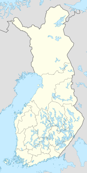
Акс:Finland location map.svg

Ҳаҷми пешнамоиши PNG барои файли кунунии SVG: 304 × 599 пиксел. Дигар кайфиятҳо: 122 × 240 пиксел | 243 × 480 пиксел | 390 × 768 пиксел | 520 × 1 024 пиксел | 1 039 × 2 048 пиксел | 872 × 1 718 пиксел.
Акси аслӣ (SVG парванда, исмӣ 872 × 1 718 пиксел, андозаи парванда: 1,1 Мбайт)
Хулоса
| Тавсифот |
Deutsch: Positionskarte von Finnland
Quadratische Plattkarte, N-S-Streckung 235 %. Geographische Begrenzung der Karte:
English: Location map of Finland
Equirectangular projection, N/S stretching 235 %. Geographic limits of the map:
|
| Сана | |
| Манбаъ | own work, using United States National Imagery and Mapping Agency data |
| Муаллиф | NordNordWest |

|
This map has been made or improved in the German Kartenwerkstatt (Map Lab). You can propose maps to improve as well.
|
Иҷозатнома
I, the copyright holder of this work, hereby publish it under the following licenses:

|
Permission is granted to copy, distribute and/or modify this document under the terms of the GNU Free Documentation License, Version 1.2 or any later version published by the Free Software Foundation; with no Invariant Sections, no Front-Cover Texts, and no Back-Cover Texts. A copy of the license is included in the section entitled GNU Free Documentation License. |
This file is licensed under the Creative Commons Attribution-Share Alike 3.0 Unported license.
- Шумо озодед:
- мубодилот намудан – копӣ, паҳн ва фиристадани асар
- ремикс кардан – татбиқи кор
- Under the following conditions:
- тахсис – You must give appropriate credit, provide a link to the license, and indicate if changes were made. You may do so in any reasonable manner, but not in any way that suggests the licensor endorses you or your use.
- саҳми яксон – If you remix, transform, or build upon the material, you must distribute your contributions under the same or compatible license as the original.
Шумо иҷозатномаи хостаи худро интихоб карда метавонед.
Таърихи файл
Рӯи таърихҳо клик кунед то нусхаи марбути парвандаро бубинед.
| Таърих | Бандангуштӣ | Андоза | Корбар | Тавзеҳ | |
|---|---|---|---|---|---|
| нусхаи феълӣ | 12:06, 26 Январ 2021 | | 872 × 1 718 (1,1 Мбайт) | Fenn-O-maniC | Updated regional borders as per https://asiointi.maanmittauslaitos.fi/karttapaikka/ |
| 10:50, 9 марти 2011 |  | 872 × 1 718 (1,07 Мбайт) | NordNordWest | upd | |
| 20:41, 20 Январ 2010 |  | 872 × 1 536 (1,2 Мбайт) | NordNordWest | update | |
| 18:12, 5 августи 2008 |  | 873 × 1 536 (1,07 Мбайт) | NordNordWest | ||
| 11:54, 30 июли 2008 |  | 873 × 1 536 (1,01 Мбайт) | NordNordWest | optimized | |
| 18:55, 8 июли 2008 |  | 873 × 1 536 (1,33 Мбайт) | NordNordWest | ||
| 14:05, 7 июли 2008 |  | 873 × 1 536 (1,28 Мбайт) | NordNordWest | ||
| 19:31, 30 июни 2008 |  | 873 × 1 536 (1,38 Мбайт) | NordNordWest | ||
| 20:35, 29 июни 2008 |  | 873 × 1 536 (1,38 Мбайт) | NordNordWest | {{Information |Description= {{de|Positionskarte von Finnland}} Quadratische Plattkarte, N-S-Streckung 210 %. Geographische Begrenzung der Karte: * N: 70.4° N * S: 59.5° N * W: 19° W * O: 32° W {{en|Location map of [[:en:Finland|Finlan |
Пайвандҳо
Саҳифаҳои зерин ба ин акс пайванданд:
- Болгардгоҳи Ҳернесаарӣ
- Пойгоҳи ҳавои Кауҳаҷокӣ
- Пойгоҳи ҳавоии Рааҳе-Паттийоки
- Пойгоҳи ҳавоии Раискала
- Пойгоҳи ҳавоии Рантасалми
- Пойгоҳи ҳавоии Рануа
- Пойгоҳи ҳавоии Раутаваара
- Фурудгоҳи Коҳово
- Фурудгоҳи августе
- Фурудгоҳи витосори
- Фурудгоҳи вмпуло
- Фурудгоҳи волло
- Фурудгоҳи воркоеҳвс
- Фурудгоҳи восо
- Фурудгоҳи камӣ турню
- Фурудгоҳи китило
- Фурудгоҳи киёни
- Фурудгоҳи купю
- Фурудгоҳи кусому
- Фурудгоҳи лопнронто
- Фурудгоҳи микли
- Фурудгоҳи овлу
- Фурудгоҳи оюолу
- Фурудгоҳи пӯр
- Фурудгоҳи рдб
- Фурудгоҳи руними
- Фурудгоҳи саҳро иомиоруи
- Фурудгоҳи саҳро камӣёрӯ
- Фурудгоҳи саҳро кий
- Фурудгоҳи саҳро колоюки
- Фурудгоҳи саҳро конус
- Фурудгоҳи саҳро корсомоки
- Фурудгоҳи саҳро кумлинг
- Фурудгоҳи саҳро куҳму
- Фурудгоҳи саҳро кюиёрӯ
- Фурудгоҳи саҳро ликсо-нурмз
- Фурудгоҳи саҳро лопинлоҳти
- Фурудгоҳи саҳро овоҳлуко
- Фурудгоҳи саҳро оврипо
- Фурудгоҳи саҳро оизоломи
- Фурудгоҳи саҳро оимуло
- Фурудгоҳи саҳро оловус
- Фурудгоҳи саҳро оҳмусу
- Фурудгоҳи саҳро пииксомоки
- Фурудгоҳи саҳро пудосиоруи
- Фурудгоҳи саҳро пункоҳорҷу
- Фурудгоҳи саҳро ҳминкуру
- Фурудгоҳи саҳро ҳоилуту
- Фурудгоҳи саҳро ҳонку
- Фурудгоҳи саҳро ҳоповси
- Фурудгоҳи саҳро ҳюинко
- Фурудгоҳи саҳроии Киюрувесӣ
- Фурудгоҳи саҳроии Пиҳасалми
- Фурудгоҳи синолфҷуки
- Фурудгоҳи сумусолми
- Фурудгоҳи сунлинно
- Фурудгоҳи томпр-приколо
- Фурудгоҳи турку
- Фурудгоҳи юеҳнсу
- Фурудгоҳи юоскило
- Фурудгоҳи ҳлсинки
- Фурудгоҳи ҳлсинки-мол
- Фурудгоҳи ҳоле
- Шаблон:Location map Finland
Истифодаи саросарии парванда
Викиҳои дигари зерин ин файлро истифода мекунанд:
- Истифода дар am.wikipedia.org
- Истифода дар an.wikipedia.org
- Истифода дар arz.wikipedia.org
- Истифода дар av.wikipedia.org
- Истифода дар bg.wikipedia.org
- Истифода дар bs.wikipedia.org
- Истифода дар ca.wikipedia.org
- Истифода дар ceb.wikipedia.org
View more global usage of this file.