
Акс:Greater london outline map bw.png
Нусхаи ҳаҷман ва сифатан баландтар дастрас нест.
Greater_london_outline_map_bw.png ((600 × 500 пиксел, ҳаҷми парванда: 199 кбайт, навъи MIME: image/png))

|
File:Greater London UK location map 2.svg is a vector version of this file. It should be used in place of this PNG file when not inferior.
File:Greater london outline map bw.png → File:Greater London UK location map 2.svg
For more information, see Help:SVG. |
 |
Хулоса
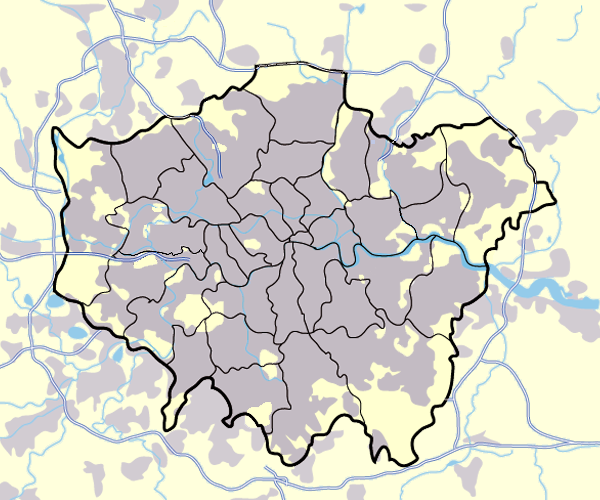
Image:Greater_london_outline_map.png showing built up areas in grey, motorways in blue, water-bodies in light-blue and London borough and county boundaries in black.
Based on a map originally by User:ChrisO.
Revised to correct motorways. DavidCane 19:42, 31 March 2007 (UTC)
Иҷозатнома

|
Permission is granted to copy, distribute and/or modify this document under the terms of the GNU Free Documentation License, Version 1.2 or any later version published by the Free Software Foundation; with no Invariant Sections, no Front-Cover Texts, and no Back-Cover Texts. A copy of the license is included in the section entitled GNU Free Documentation License. |
| This file is licensed under the Creative Commons Attribution-Share Alike 3.0 Unported license. | ||
| ||
| This licensing tag was added to this file as part of the GFDL licensing update. |
| Annotations | This image is annotated: View the annotations at Commons |
Таърихи файл
Рӯи таърихҳо клик кунед то нусхаи марбути парвандаро бубинед.
| Таърих | Бандангуштӣ | Андоза | Корбар | Тавзеҳ | |
|---|---|---|---|---|---|
| нусхаи феълӣ | 17:13, 11 марти 2008 | | 600 × 500 (199 кбайт) | Jza84 | slight alteration making the boundaries clearer between Newham and Barking and Dagenham - Ealing and Hounslow - and City of London and the City of Westminster |
| 19:40, 31 марти 2007 |  | 600 × 500 (217 кбайт) | DavidCane | ||
| 14:33, 19 марти 2007 |  | 600 × 500 (512 кбайт) | Jza84 | minor colour correction | |
| 14:30, 19 марти 2007 |  | 600 × 500 (512 кбайт) | Jza84 | yellowed white backdrop and altered blue of water bodies inline with UK mapping | |
| 11:16, 15 марти 2007 |  | 600 × 500 (552 кбайт) | Jza84 | Corrected some issues with Motorways and borough boundaries. | |
| 19:22, 25 феврали 2007 |  | 600 × 500 (476 кбайт) | Jza84 | Map of Greater London and area. Self made and released to public domain. | |
| 18:09, 18 ноябри 2006 |  | 600 × 500 (21 кбайт) | Dtcdthingy~commonswiki | Image:Greater_london_outline_map.png with toned down colour scheme. Originally by User:ChrisO. |
Пайвандҳо
Саҳифаҳои зерин ба ин акс пайванданд:
Истифодаи саросарии парванда
Викиҳои дигари зерин ин файлро истифода мекунанд:
- Истифода дар ast.wikipedia.org
- Истифода дар be.wikipedia.org
- Истифода дар bg.wikipedia.org
- Истифода дар ca.wikipedia.org
- Истифода дар da.wikipedia.org
- EFL League Championship
- Brugerdiskussion:Lindberg
- Westminster
- Charing Cross
- Skabelon:Kortpositioner Greater London
- Seven Sisters
- Tottenham
- Premier League
- Chelsea (London)
- Premier League 2013-14
- Premier League 2014-15
- Premier League 2015-16
- Attentatet i Finsbury Park 2017
- Premier League 2016-17
- The Football League 1927-28
- The Football League 1928-29
- The Football League 1929-30
- The Football League 1930-31
- The Football League 1931-32
- The Football League 1932-33
- Истифода дар de.wikipedia.org
- Истифода дар en.wikipedia.org
- Истифода дар en.wikinews.org
- Истифода дар eo.wikipedia.org
- Истифода дар es.wikipedia.org
- Истифода дар eu.wikipedia.org
- Истифода дар fa.wikipedia.org
- Истифода дар fr.wikipedia.org
- Истифода дар gu.wikipedia.org
- Истифода дар hy.wikipedia.org
View more global usage of this file.