
Акс:Kars Panorama.JPG
Андозаи ин пешнамоиш: 800 × 343 пиксел. Дигар кайфиятҳо: 320 × 137 пиксел | 640 × 274 пиксел | 1 024 × 439 пиксел | 1 280 × 549 пиксел | 2 560 × 1 097 пиксел | 5 647 × 2 420 пиксел.
Акси аслӣ ((5 647 × 2 420 пиксел, ҳаҷми парванда: 4,82 Мбайт, навъи MIME: image/jpeg))
|
Хулоса
| Тавсифот |
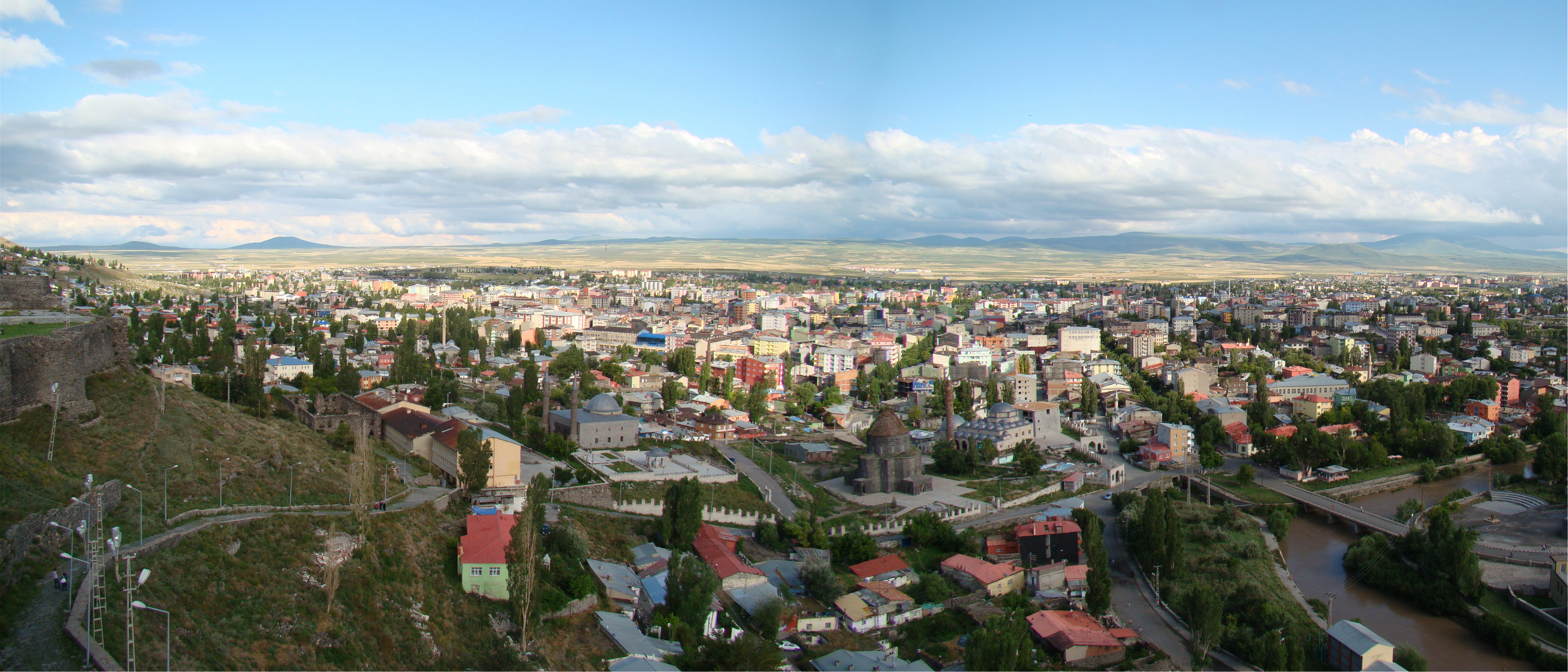
English: A panorama from the fortress above Kars, Turkey, looking south-west from the north-east side of the city. On the left edge of the photo you can see some of the fortress walls, and a graveyard in the distance. Below the hill straight ahead is the original Armenian Church of the Apostles dating from 939 AD, which since 1998 has been a mosque. Behind it on the right is the Evliya Mosque
The water flowing past the church/mosque is the Kars Canal. |
| Сана | |
| Манбаъ | Own work by uploader, http://bjornfree.com/galleries.html |
| Муаллиф | Bjørn Christian Tørrissen |
| Camera location | | View this and other nearby images on: OpenStreetMap |
|---|
Иҷозатнома
I, the copyright holder of this work, hereby publish it under the following licenses:
This file is licensed under the Creative Commons Attribution-Share Alike 3.0 Unported license.
- Шумо озодед:
- мубодилот намудан – копӣ, паҳн ва фиристадани асар
- ремикс кардан – татбиқи кор
- Under the following conditions:
- тахсис – You must give appropriate credit, provide a link to the license, and indicate if changes were made. You may do so in any reasonable manner, but not in any way that suggests the licensor endorses you or your use.
- саҳми яксон – If you remix, transform, or build upon the material, you must distribute your contributions under the same or compatible license as the original.

|
Permission is granted to copy, distribute and/or modify this document under the terms of the GNU Free Documentation License, Version 1.2 or any later version published by the Free Software Foundation; with no Invariant Sections, no Front-Cover Texts, and no Back-Cover Texts. A copy of the license is included in the section entitled GNU Free Documentation License. |
Шумо иҷозатномаи хостаи худро интихоб карда метавонед.
Таърихи файл
Рӯи таърихҳо клик кунед то нусхаи марбути парвандаро бубинед.
| Таърих | Бандангуштӣ | Андоза | Корбар | Тавзеҳ | |
|---|---|---|---|---|---|
| нусхаи феълӣ | 19:08, 1 ноябри 2009 | | 5 647 × 2 420 (4,82 Мбайт) | Uspn | {{Information |Description={{en|1=A panorama from the fortress above Kars, Turkey. On the left edge of the photo you can see some of the fortress walls, and a graveyard in the distance. Below the hill straight ahead is the original Armenian Church of the |
Пайвандҳо
Саҳифаҳои зерин ба ин акс пайванданд:
Истифодаи саросарии парванда
Викиҳои дигари зерин ин файлро истифода мекунанд:
- Истифода дар ab.wikipedia.org
- Истифода дар ar.wikipedia.org
- Истифода дар arz.wikipedia.org
- Истифода дар ast.wikipedia.org
- Истифода дар be.wikipedia.org
- Истифода дар ca.wikipedia.org
- Истифода дар ce.wikipedia.org
- Истифода дар da.wikipedia.org
- Истифода дар de.wikivoyage.org
- Истифода дар diq.wikipedia.org
- Истифода дар el.wikipedia.org
- Истифода дар en.wikipedia.org
- Истифода дар en.wikivoyage.org
- Истифода дар eu.wikipedia.org
- Истифода дар fa.wikipedia.org
- Истифода дар fr.wikivoyage.org
- Истифода дар he.wikipedia.org
- Истифода дар hyw.wikipedia.org
- Истифода дар id.wikipedia.org
- Истифода дар it.wikipedia.org
- Истифода дар ko.wikipedia.org
- Истифода дар lv.wikipedia.org
- Истифода дар mdf.wikipedia.org
- Истифода дар mk.wikipedia.org
- Истифода дар mrj.wikipedia.org
- Истифода дар nl.wikipedia.org
- Истифода дар nn.wikipedia.org
- Истифода дар pl.wikipedia.org
- Истифода дар pnb.wikipedia.org
- Истифода дар ro.wikipedia.org
- Истифода дар ru.wikipedia.org
- Истифода дар sco.wikipedia.org
- Истифода дар sh.wikipedia.org
- Истифода дар so.wikipedia.org
- Истифода дар sq.wikipedia.org
- Истифода дар sr.wikipedia.org
- Истифода дар th.wikipedia.org
- Истифода дар tl.wikipedia.org
- Истифода дар tr.wikipedia.org
View more global usage of this file.