Акс:Khaleej ajam.jpg

Page contents not supported in other languages.
Мавод аз Википедиа — донишномаи озод

Акси аслӣ((400 × 618 пиксел, ҳаҷми парванда: 98 кбайт, навъи MIME: image/jpeg))

Ин файл аз Викианбор ва дар дигар лоиҳаҳо метавонад истифода шавад. Тафсилоти ин файл саҳифаи тафсилоти файл дар зер нишон дода шудааст.

Хулоса

Тавсифот
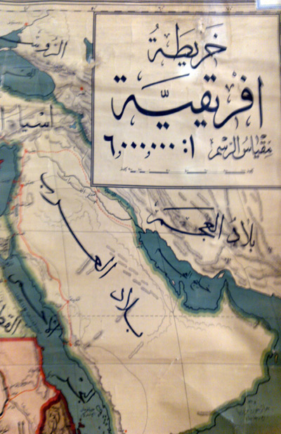
فارسی: نقشهٔ ایران در سال 1908 میلادی
othoman map of mamlekat Ajam=persia
English: The map of the Persian Empire in 1908 Egypt library alazhar university
Сана
Манбаъ http://www.parssea.persianblog.ir
Муаллиф ibrahim. othoman maps
Иҷозат
(Пешроҳандозии ин парванда)
This is a faithful photographic reproduction of a two-dimensional, public domain work of art. The work of art itself is in the public domain for the following reason:
Public domain

This work is in the public domain in its country of origin and other countries and areas where the copyright term is the author's life plus 70 years or fewer.


You must also include a United States public domain tag to indicate why this work is in the public domain in the United States. Note that a few countries have copyright terms longer than 70 years: Mexico has 100 years, Jamaica has 95 years, Colombia has 80 years, and Guatemala and Samoa have 75 years. This image may not be in the public domain in these countries, which moreover do not implement the rule of the shorter term. Honduras has a general copyright term of 75 years, but it does implement the rule of the shorter term. Copyright may extend on works created by French who died for France in World War II (more information), Russians who served in the Eastern Front of World War II (known as the Great Patriotic War in Russia) and posthumously rehabilitated victims of Soviet repressions (more information).

The official position taken by the Wikimedia Foundation is that "faithful reproductions of two-dimensional public domain works of art are public domain".
This photographic reproduction is therefore also considered to be in the public domain in the United States. In other jurisdictions, re-use of this content may be restricted; see Reuse of PD-Art photographs for details.
{{PD-Art}} template without license parameter: please specify why the underlying work is public domain in both the source country and the United States
(Usage: {{PD-Art|1=|deathyear=''year of author's death''|country=''source country''}}, where parameter #1 can be PD-old-auto, PD-old-auto-expired, PD-old-auto-1996, PD-old-100 or similar. See Commons:Multi-license copyright tags for more information.)
Other versions it has a explanation in the book [1]

The map of the Persia in 1908 .

Иҷозатнома

I, the copyright holder of this work, hereby publish it under the following license:
w:en:Creative Commons
тахсис саҳми яксон
This file is licensed under the Creative Commons Attribution-Share Alike 3.0 Unported license.
Шумо озодед:
  • мубодилот намудан – копӣ, паҳн ва фиристадани асар
  • ремикс кардан – татбиқи кор
Under the following conditions:
  • тахсис – You must give appropriate credit, provide a link to the license, and indicate if changes were made. You may do so in any reasonable manner, but not in any way that suggests the licensor endorses you or your use.
  • саҳми яксон – If you remix, transform, or build upon the material, you must distribute your contributions under the same or compatible license as the original.

Хулоса

Тавсифот
English: خلیج عــــــــجم
Сана
Манбаъ Кори худ
Муаллиф Maahmaah
Иҷозат
(Пешроҳандозии ин парванда)
Public domain I, the copyright holder of this work, release this work into the public domain. This applies worldwide.
In some countries this may not be legally possible; if so:
I grant anyone the right to use this work for any purpose, without any conditions, unless such conditions are required by law.
it has a explanation in the book Documents_on_the_Persian_Gulf [2]
Perfectably legit photo. Author provides sufficient justification. Definitely a keeper. I vote to KEEP. 24.189.251.105 05:01, 22 March 2012 (UTC)
  • no copy right for those maps.
  • IN THIS PROGRAM IN PERSIAN BROADCAST LIVE[3] IN RADIO I.R. IRAN REPRESENTATIVE OF THE IRANIAN government & MFA EXPLAIN THAT THOSE ATLASES HAVE BEEN DISTRIBUTED FREE AND THERE IS NO COPY RIGHT. THE WRITER M.AJAM ALSO EXPLAIN "HE HAS DISTRIBUTED HIS BOOK FREE and it is free to be copied and used in any mass media my aim was non benefit just awaken and TO INFORM PEOPLE OF THE BACKGROUND OF THE MAPS AND HISTORY OF THE PERSIAN GULF".

or [4] [5] I, the copyright holder of this work, hereby publish it under the following license:free for use in public mass medi a

i have also published it befor for free

Иҷозатнома

I, the copyright holder of this work, hereby publish it under the following license:
w:en:Creative Commons
тахсис саҳми яксон
This file is licensed under the Creative Commons Attribution-Share Alike 3.0 Unported license.
Шумо озодед:
  • мубодилот намудан – копӣ, паҳн ва фиристадани асар
  • ремикс кардан – татбиқи кор
Under the following conditions:
  • тахсис – You must give appropriate credit, provide a link to the license, and indicate if changes were made. You may do so in any reasonable manner, but not in any way that suggests the licensor endorses you or your use.
  • саҳми яксон – If you remix, transform, or build upon the material, you must distribute your contributions under the same or compatible license as the original.

Captions

Add a one-line explanation of what this file represents

Items portrayed in this file

тавсифҳо

29 ноябри 2011

source of file Англисӣ

Таърихи файл

Рӯи таърихҳо клик кунед то нусхаи марбути парвандаро бубинед.

ТаърихБандангуштӣАндозаКорбарТавзеҳ
нусхаи феълӣ10:26, 29 ноябри 2011Акси бандангуштӣ аз нусхаи то 10:26, 29 ноябри 2011400 × 618 (98 кбайт)Maahmaah

Саҳифаҳои зерин ба ин акс пайванданд:

Истифодаи саросарии парванда

Викиҳои дигари зерин ин файлро истифода мекунанд: