
Акс:Location map Tahiti.png

Андозаи ин пешнамоиш: 757 × 600 пиксел. Дигар кайфиятҳо: 303 × 240 пиксел | 606 × 480 пиксел | 866 × 686 пиксел.
Акси аслӣ ((866 × 686 пиксел, ҳаҷми парванда: 588 кбайт, навъи MIME: image/png))
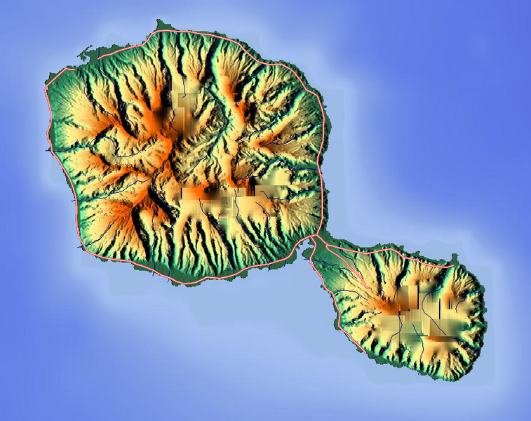
Хулоса
| Тавсифот |
English: Map of Tahiti
Geographic limits of the map:
|
| Сана | |
| Манбаъ | Maps for Free |
| Муаллиф | Dr. Blofeld |
Иҷозатнома
This file is licensed under the Creative Commons Attribution-Share Alike 2.0 Generic license.
- Шумо озодед:
- мубодилот намудан – копӣ, паҳн ва фиристадани асар
- ремикс кардан – татбиқи кор
- Under the following conditions:
- тахсис – You must give appropriate credit, provide a link to the license, and indicate if changes were made. You may do so in any reasonable manner, but not in any way that suggests the licensor endorses you or your use.
- саҳми яксон – If you remix, transform, or build upon the material, you must distribute your contributions under the same or compatible license as the original.
Таърихи файл
Рӯи таърихҳо клик кунед то нусхаи марбути парвандаро бубинед.
| Таърих | Бандангуштӣ | Андоза | Корбар | Тавзеҳ | |
|---|---|---|---|---|---|
| нусхаи феълӣ | 09:44, 29 июни 2011 | | 866 × 686 (588 кбайт) | Blofeld Dr. | {{Information |Description ={{en|1=v}} |Source =v |Author =v |Date =v |Permission = |other_versions = }} |
Пайвандҳо
Саҳифаҳои зерин ба ин акс пайванданд:
Истифодаи саросарии парванда
Викиҳои дигари зерин ин файлро истифода мекунанд:
- Истифода дар ar.wikipedia.org
- Истифода дар bs.wikipedia.org
- Истифода дар ceb.wikipedia.org
- Истифода дар fr.wikipedia.org
- Истифода дар id.wikipedia.org
- Истифода дар kn.wikipedia.org
- Истифода дар ky.wikipedia.org
- Истифода дар os.wikipedia.org
- Истифода дар ru.wikipedia.org
- Истифода дар sq.wikipedia.org
- Истифода дар tr.wikipedia.org
- Истифода дар war.wikipedia.org