
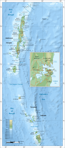
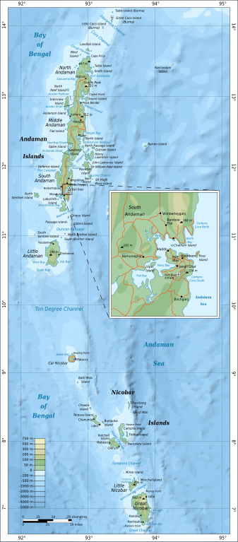
Акс:Map of Nicobar and Andaman Islands-en.svg

Ҳаҷми пешнамоиши PNG барои файли кунунии SVG: 263 × 598 пиксел. Дигар кайфиятҳо: 105 × 240 пиксел | 211 × 480 пиксел | 337 × 768 пиксел | 450 × 1 024 пиксел | 900 × 2 048 пиксел | 906 × 2 060 пиксел.
Акси аслӣ (SVG парванда, исмӣ 906 × 2 060 пиксел, андозаи парванда: 621 кбайт)
Хулоса
| Тавсифот | |
| Сана | |
| Манбаъ | Кори худ. Self-made in Inkscape. Based on the 1976 CIA Indian Ocean Atlas (Andaman nicobar 76.jpg); bathymetry and topography from SRTM30_PLUS. |
| Муаллиф | Oona Räisänen (Mysid) |
| Other versions |
Derivative works of this file: |
| SVG genesis |
Иҷозатнома
I, the copyright holder of this work, hereby publish it under the following licenses:
This file is licensed under the Creative Commons Attribution-Share Alike 3.0 Unported license.
- Шумо озодед:
- мубодилот намудан – копӣ, паҳн ва фиристадани асар
- ремикс кардан – татбиқи кор
- Under the following conditions:
- тахсис – You must give appropriate credit, provide a link to the license, and indicate if changes were made. You may do so in any reasonable manner, but not in any way that suggests the licensor endorses you or your use.
- саҳми яксон – If you remix, transform, or build upon the material, you must distribute your contributions under the same or compatible license as the original.

|
Permission is granted to copy, distribute and/or modify this document under the terms of the GNU Free Documentation License, Version 1.2 or any later version published by the Free Software Foundation; with no Invariant Sections, no Front-Cover Texts, and no Back-Cover Texts. A copy of the license is included in the section entitled GNU Free Documentation License. |
Шумо иҷозатномаи хостаи худро интихоб карда метавонед.
Таърихи файл
Рӯи таърихҳо клик кунед то нусхаи марбути парвандаро бубинед.
| Таърих | Бандангуштӣ | Андоза | Корбар | Тавзеҳ | |
|---|---|---|---|---|---|
| нусхаи феълӣ | 16:24, 15 сентябри 2010 | | 906 × 2 060 (621 кбайт) | Mysid | {{Information |Description={{en|1=Map of the Nicobar and Andaman Islands.}} |Source={{own}}. Self-made in Inkscape. Based on the 1976 CIA Indian Ocean Atlas (File:Andaman nicobar 76.jpg); bathymetry and topography from SRTM30_PLUS. |Author=[[w:User:M |
Пайвандҳо
Саҳифаҳои зерин ба ин акс пайванданд:
Истифодаи саросарии парванда
Викиҳои дигари зерин ин файлро истифода мекунанд:
- Истифода дар af.wikipedia.org
- Истифода дар ar.wikipedia.org
- Истифода дар ast.wikipedia.org
- Истифода дар az.wikipedia.org
- Истифода дар be.wikipedia.org
- Истифода дар br.wikipedia.org
- Истифода дар ca.wikipedia.org
- Истифода дар en.wikipedia.org
- Истифода дар eo.wikipedia.org
- Истифода дар es.wikipedia.org
- Истифода дар fi.wikipedia.org
- Истифода дар fi.wiktionary.org
- Истифода дар fr.wikipedia.org
- Истифода дар ga.wikipedia.org
- Истифода дар gom.wikipedia.org
- Истифода дар ha.wikipedia.org
- Истифода дар hi.wikipedia.org
- Истифода дар hi.wikibooks.org
- Истифода дар hy.wikipedia.org
- Истифода дар it.wikipedia.org
- Истифода дар ja.wikipedia.org
- Истифода дар mr.wikipedia.org
- Истифода дар oc.wikipedia.org
- Истифода дар pl.wikipedia.org
- Истифода дар pnb.wikipedia.org
- Истифода дар ru.wikipedia.org
- Истифода дар sw.wikipedia.org
- Истифода дар te.wikipedia.org
- Истифода дар uk.wikipedia.org
- Истифода дар ur.wikipedia.org
- Истифода дар www.wikidata.org
- Истифода дар zh.wikipedia.org