
Акс:Map of federal subjects of Russia (2014).svg

Ҳаҷми пешнамоиши PNG барои файли кунунии SVG: 800 × 440 пиксел. Дигар кайфиятҳо: 320 × 176 пиксел | 640 × 352 пиксел | 1 024 × 563 пиксел | 1 280 × 704 пиксел | 2 560 × 1 409 пиксел | 5 029 × 2 767 пиксел.
Акси аслӣ (SVG парванда, исмӣ 5 029 × 2 767 пиксел, андозаи парванда: 711 кбайт)
.svg)

|
The boundaries on this map show the de facto situation. This is just one of several different views on the subject (see COM:NPOV). |
Хулоса
| Тавсифот |
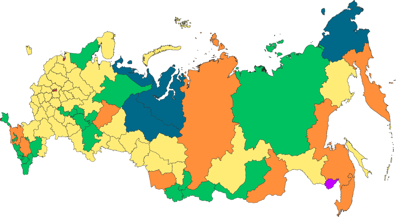
Русский: Федеративное устройство Российской Федерации с 18 марта 2014 года |
| Сана | |
| Манбаъ | Кори худ |
| Муаллиф | Roman Poulvas |
| Other versions | File:Map of federal subjects of Russia 2014, disputed Crimea.svg |
Иҷозатнома
I, the copyright holder of this work, hereby publish it under the following license:
This file is licensed under the Creative Commons Attribution-Share Alike 4.0 International license.
- Шумо озодед:
- мубодилот намудан – копӣ, паҳн ва фиристадани асар
- ремикс кардан – татбиқи кор
- Under the following conditions:
- тахсис – You must give appropriate credit, provide a link to the license, and indicate if changes were made. You may do so in any reasonable manner, but not in any way that suggests the licensor endorses you or your use.
- саҳми яксон – If you remix, transform, or build upon the material, you must distribute your contributions under the same or compatible license as the original.
| Annotations | This image is annotated: View the annotations at Commons |
Таърихи файл
Рӯи таърихҳо клик кунед то нусхаи марбути парвандаро бубинед.
| Таърих | Бандангуштӣ | Андоза | Корбар | Тавзеҳ | |
|---|---|---|---|---|---|
| нусхаи феълӣ | 13:58, 5 марти 2022 | | 5 029 × 2 767 (711 кбайт) | Foghe | The law of the Federation does not account for "occupied peninsula". |
| 18:43, 2 марти 2022 |  | 512 × 282 (723 кбайт) | Mzajac | Hatching for occupied Crimean peninsula | |
| 02:20, 2 марти 2022 |  | 5 029 × 2 767 (711 кбайт) | Spesh531 | Removing duplicate objects, and fixing minor mistake. Bolshoy Begichev Island was shown as part of Krasnoyarsk Krai instead of Sakha Republic. | |
| 17:44, 27 Январ 2020 |  | 512 × 282 (512 кбайт) | Takhirgeran Umar | уточнение | |
| 10:47, 9 марти 2019 |  | 512 × 282 (499 кбайт) | AndreyKva | Optimized. | |
| 17:16, 30 октябри 2018 |  | 512 × 282 (2,4 Мбайт) | Roman Poulvas | По данным из шейп-файлов с нормальной проекцией: Projection: Lambert_Azimuthal_Equal_Area False_Easting: 0,0 False_Northing: 0,0 Central_Meridian: 100,0 Latitude_Of_Origin: 54,0 Linear Unit: Meter (1,0) | |
| 10:35, 13 Декабри 2016 |  | 1 608 × 936 (129 кбайт) | Roman Poulvas | Уточнены границы, добавлены примечания | |
| 13:41, 5 май 2015 |  | 1 025 × 600 (163 кбайт) | Roman Poulvas | Исправлены Коми и Удмуртия | |
| 15:35, 4 май 2015 |  | 1 025 × 600 (163 кбайт) | Roman Poulvas | User created page with UploadWizard |
Пайвандҳо
Саҳифаҳои зерин ба ин акс пайванданд:
Истифодаи саросарии парванда
Викиҳои дигари зерин ин файлро истифода мекунанд:
- Истифода дар alt.wikipedia.org
- Истифода дар ami.wikipedia.org
- Истифода дар arz.wikipedia.org
- Истифода дар av.wikipedia.org
- Истифода дар azb.wikipedia.org
- Истифода дар az.wikipedia.org
- Истифода дар be-tarask.wikipedia.org
- Истифода дар bs.wikipedia.org
- Истифода дар ce.wikipedia.org
- Истифода дар cs.wikipedia.org
- Истифода дар cv.wikipedia.org
- Истифода дар cy.wikipedia.org
- Истифода дар da.wikipedia.org
- Истифода дар en.wikipedia.org
- Истифода дар fi.wikipedia.org
- Истифода дар fr.wikipedia.org
- Истифода дар ha.wikipedia.org
- Истифода дар hu.wikipedia.org
- Истифода дар inh.wikipedia.org
- Истифода дар km.wikipedia.org
- Истифода дар ko.wikipedia.org
- Истифода дар lld.wikipedia.org
- Истифода дар mhr.wikipedia.org
- Истифода дар mk.wikipedia.org
- Истифода дар mnw.wikipedia.org
- Истифода дар ms.wikipedia.org
- Истифода дар myv.wikipedia.org
- Истифода дар pl.wikipedia.org
- Истифода дар ro.wikipedia.org
- Истифода дар ru.wikipedia.org
- Истифода дар sd.wikipedia.org
- Истифода дар simple.wikipedia.org
- Истифода дар sl.wikipedia.org
- Истифода дар sq.wikipedia.org
- Истифода дар sr.wikipedia.org
View more global usage of this file.
.svg)
.svg)