
Акс:Sweden Stockholm location map.svg

Ҳаҷми пешнамоиши PNG барои файли кунунии SVG: 456 × 599 пиксел. Дигар кайфиятҳо: 182 × 240 пиксел | 365 × 480 пиксел | 584 × 768 пиксел | 779 × 1 024 пиксел | 1 558 × 2 048 пиксел | 874 × 1 149 пиксел.
Акси аслӣ (SVG парванда, исмӣ 874 × 1 149 пиксел, андозаи парванда: 433 кбайт)
Хулоса
| Тавсифот |
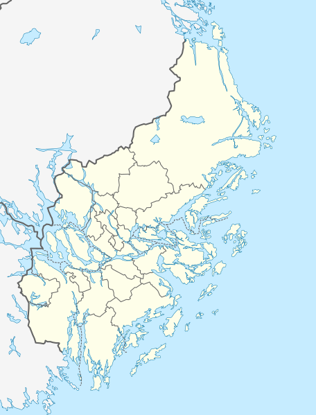
English: Location map of Stockholm County in Sweden
Equirectangular projection, N/S stretching 197 %. Geographic limits of the map:
Deutsch: Positionskarte von Stockholms län in Schweden
Quadratische Plattkarte, N-S-Streckung 197 %. Geographische Begrenzung der Karte:
|
| Сана | |
| Манбаъ | Кори худ |
| Муаллиф | Erik Frohne |
Иҷозатнома
I, the copyright holder of this work, hereby publish it under the following licenses:

|
Permission is granted to copy, distribute and/or modify this document under the terms of the GNU Free Documentation License, Version 1.2 or any later version published by the Free Software Foundation; with no Invariant Sections, no Front-Cover Texts, and no Back-Cover Texts. A copy of the license is included in the section entitled GNU Free Documentation License. |
This file is licensed under the Creative Commons Attribution 3.0 Unported license.
- Шумо озодед:
- мубодилот намудан – копӣ, паҳн ва фиристадани асар
- ремикс кардан – татбиқи кор
- Under the following conditions:
- тахсис – You must give appropriate credit, provide a link to the license, and indicate if changes were made. You may do so in any reasonable manner, but not in any way that suggests the licensor endorses you or your use.
Шумо иҷозатномаи хостаи худро интихоб карда метавонед.
Таърихи файл
Рӯи таърихҳо клик кунед то нусхаи марбути парвандаро бубинед.
| Таърих | Бандангуштӣ | Андоза | Корбар | Тавзеҳ | |
|---|---|---|---|---|---|
| нусхаи феълӣ | 18:34, 5 феврали 2009 | | 874 × 1 149 (433 кбайт) | Erik Frohne | {{Information |Description={{en|1=Location map of Stockholm county in Sweden Equirectangular projection, N/S stretching 197 %. Geographic limits of the map: * N: 60.30° N * S: 58.70° N * W: 17.10° E * E: 19.50° E}} {{de|1=Positionskarte von Stockhol |
Пайвандҳо
Ин акс дар ҳеҷ саҳифа истифода намешавад.
Истифодаи саросарии парванда
Викиҳои дигари зерин ин файлро истифода мекунанд:
- Истифода дар az.wikipedia.org
- Истифода дар cs.wikipedia.org
- Истифода дар de.wikipedia.org
- Stockholm
- Södertälje
- Flughafen Stockholm/Arlanda
- Djurgården
- Råsundastadion
- Sigtuna
- Märsta
- Olympiastadion Stockholm
- Avicii Arena
- Grisslehamn
- Nacka
- Upplands Väsby
- Täby
- Saltsjöbaden
- Järna
- Lidingö
- Vaxholm
- Ekerö
- Helgö (Mälaren)
- Rindö
- Gustavsberg
- Tumba (Schweden)
- Norrtälje
- Nynäshamn
- Söderstadion
- Jakobsberg (Schweden)
- Utö (Schweden)
- Vallentuna
- Danderyd
- Åkersberga
- Grinda
- Flughafen Stockholm/Bromma
- Brunnsviken
- Riddarfjärden
- Långholmen
- Vinterviken
- Benutzer Diskussion:Vorlage/da bin ich her
- Årstaviken
- Kungens kurva
- Nykvarn
- Beckholmen
- Handen
View more global usage of this file.