
Акс:The Levant 3.png

Андозаи ин пешнамоиш: 558 × 600 пиксел. Дигар кайфиятҳо: 223 × 240 пиксел | 447 × 480 пиксел | 922 × 991 пиксел.
Акси аслӣ ((922 × 991 пиксел, ҳаҷми парванда: 290 кбайт, навъи MIME: image/png))
Хулоса
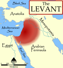
| Тавсифот | The Levant, based on a NormanEinstein's Image:Fertile Crescent blank base map.png. |
| Сана | 3 Октябр 2006 (original upload date) |
| Манбаъ | No machine-readable source provided. Own work assumed (based on copyright claims). |
| Муаллиф | No machine-readable author provided. MapMaster assumed (based on copyright claims). |
| Other versions |
[]
|


References
- The American Heritage Dictionary of the English Language, Fourth Edition, Houghton Mifflin Company. "The countries bordering on the eastern Mediterranean Sea from Turkey to Egypt."
- Random House Dictionary, Random House, Inc. 2009. "The lands bordering the E shores of the Mediterranean Sea."
- Harris, William W. (2005) The Levant: a fractured mosaic, Markus Wiener, Second Edition, map p. 4, quote p. 1. "The Mediterranean littoral between the mountains of Cilicia and the Sinai peninsula."
- Oriental Institute, "Levant Site Map", University of Chicago, accessed 15 Dec 2009.
- Council for British Research in the Levant, "The CBRL is the British Academy sponsored society that supports research in the humanities and social sciences in the countries of the Levant: Cyprus, Israel, Jordan, Lebanon, Palestine and Syria, . . .", accessed 15 Dec 2009.
- Biblical and Levantine studies at UCLA, "The ancient cultures of the Levant are defined to include those of western Syria, Lebanon, Israel, Jordan, the Palestinian territories, the Egyptian Sinai, and Cyprus."
Иҷозатнома
I, the copyright holder of this work, hereby publish it under the following licenses:

|
Permission is granted to copy, distribute and/or modify this document under the terms of the GNU Free Documentation License, Version 1.2 or any later version published by the Free Software Foundation; with no Invariant Sections, no Front-Cover Texts, and no Back-Cover Texts. A copy of the license is included in the section entitled GNU Free Documentation License. |
| This file is licensed under the Creative Commons Attribution-Share Alike 3.0 Unported license. | ||
| ||
| This licensing tag was added to this file as part of the GFDL licensing update. |
Шумо иҷозатномаи хостаи худро интихоб карда метавонед.
derivative works
Derivative works of this file: The Levant-ar.png

|
This locator map image could be re-created using vector graphics as an SVG file. This has several advantages; see Commons:Media for cleanup for more information. If an SVG form of this image is available, please upload it and afterwards replace this template with
{{vector version available|new image name}}.
It is recommended to name the SVG file “The Levant 3.svg”—then the template Vector version available (or Vva) does not need the new image name parameter. |
Таърихи файл
Рӯи таърихҳо клик кунед то нусхаи марбути парвандаро бубинед.
| Таърих | Бандангуштӣ | Андоза | Корбар | Тавзеҳ | |
|---|---|---|---|---|---|
| нусхаи феълӣ | 18:57, 11 октябри 2014 | | 922 × 991 (290 кбайт) | Spiridon Ion Cepleanu | Minor change : diffuse limits |
| 01:32, 4 октябри 2006 |  | 922 × 991 (237 кбайт) | MapMaster | Fixed some problems | |
| 03:54, 3 октябри 2006 |  | 922 × 991 (215 кбайт) | MapMaster | The Levant, based on a NormanEinstein's Image:Fertile Crescent blank base map.png. |
Пайвандҳо
Саҳифаҳои зерин ба ин акс пайванданд:
Истифодаи саросарии парванда
Викиҳои дигари зерин ин файлро истифода мекунанд:
- Истифода дар ast.wikipedia.org
- Истифода дар az.wikipedia.org
- Истифода дар ba.wikipedia.org
- Истифода дар be.wikipedia.org
- Истифода дар bg.wikipedia.org
- Истифода дар ca.wikipedia.org
- Истифода дар ckb.wikipedia.org
- Истифода дар cs.wikipedia.org
- Истифода дар cs.wiktionary.org
- Истифода дар cv.wikipedia.org
- Истифода дар de.wikipedia.org
- Истифода дар diq.wikipedia.org
- Истифода дар el.wiktionary.org
- Истифода дар en.wikipedia.org
- User:Dimadick
- Coele-Syria
- Talk:Pre-Islamic Arabia
- User:Zdunne
- User:Antoine75
- User:Teemu08
- User:MapMaster
- User:Gwilym84
- User:Zozoulia
- User:Motacilla
- User:James H. Jenkins
- User:Winter queen lizzie
- User:Aus Chia
- User:Imeriki al-Shimoni
- User:L.smithfield
- User:WisamFarouk
- Template:User Levantine History
- User:Jonathan48
- User:Hiram111
View more global usage of this file.