
Акс:Tutorial optimization shaded relief map with GRASS 01.jpg
Акси аслӣ ((1 280 × 1 024 пиксел, ҳаҷми парванда: 169 кбайт, навъи MIME: image/jpeg))
Хулоса
| Тавсифот |
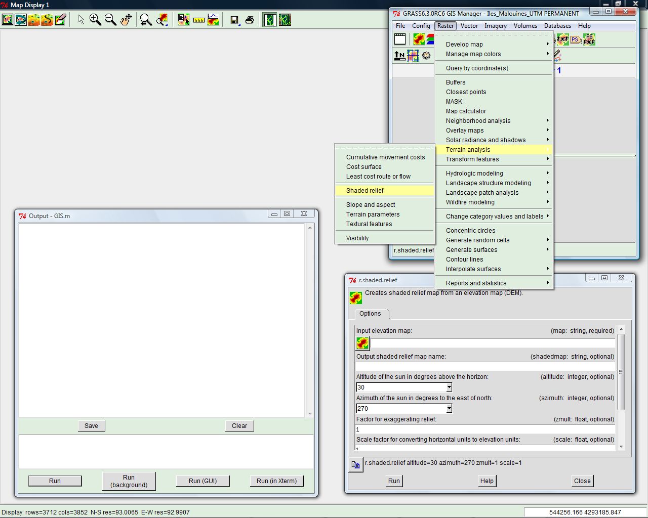
English: Screenshot made for the French speaking Atelier graphique showing a step of a tutorial made to learn how to optimize the shaded relief from a digital elevation model of the Shuttle Radar Topography Mission.
Français : Capture d'écran réalisée dans le cadre de l´Atelier graphique montrant une étape d'un didacticiel destiné à apprendre à optimiser les ombres d'un relief issu de modèles numériques de terrain de la Shuttle Radar Topography Mission. |
| Сана | |
| Манбаъ | self-made – software displayed : GRASS GIS |
| Муаллиф | Eric Gaba (Sting) |
Иҷозатнома
This screenshot either does not contain copyright-eligible parts or visuals of copyrighted software, or the author has released it under a free license (which should be indicated beneath this notice), and as such follows the licensing guidelines for screenshots of Wikimedia Commons. You may use it freely according to its particular license. Free software license:

|
This work is free software; you can redistribute it and/or modify it under the terms of the GNU General Public License as published by the Free Software Foundation; either version 2 of the License, or any later version. This work is distributed in the hope that it will be useful, but without any warranty; without even the implied warranty of merchantability or fitness for a particular purpose. See version 2 and version 3 of the GNU General Public License for more details. |
Note: if the screenshot shows any work that is not a direct result of the program code itself, such as a text or graphics that are not part of the program, the license for that work must be indicated separately.
Таърихи файл
Рӯи таърихҳо клик кунед то нусхаи марбути парвандаро бубинед.
| Таърих | Бандангуштӣ | Андоза | Корбар | Тавзеҳ | |
|---|---|---|---|---|---|
| нусхаи феълӣ | 00:57, 29 апрели 2008 | | 1 280 × 1 024 (169 кбайт) | Sting | == Summary == {{Information |Description={{en|Screenshot made for the French speaking ''Atelier graphique'' showing a step of a tutorial made to learn how to optimize the shaded relief from a digital elevation model of |
Пайвандҳо
Саҳифаҳои зерин ба ин акс пайванданд:
Истифодаи саросарии парванда
Викиҳои дигари зерин ин файлро истифода мекунанд:
- Истифода дар en.wikipedia.org
- Истифода дар fr.wikipedia.org