
Акс:Aerial View of Tehran 26.11.2008 04-35-03.JPG

Акси аслӣ ((2 048 × 1 536 пиксел, ҳаҷми парванда: 2,37 Мбайт, навъи MIME: image/jpeg))

|
Copyright warning: A subject in this image is protected by copyright.
This image features an architectural or artistic work, photographed from a public space in Iran. There is no freedom of panorama exception in the 1970 Act for Protection of Authors, Composers and Artists Rights, the copyright law of Iran, which means that copyrighted architectural or artistic works cannot be photographed freely for anything other than personal or private uses. See also: COM:CRT/Iran#Freedom of panorama. If a copyrighted architectural or artistic work is contained in this image and it is a substantial reproduction, this photo cannot be licensed under a free license, and will be deleted. Framing this image to focus on the copyrighted work is also a copyright violation. Before reusing this content, ensure that you have the right to do so. You are solely responsible for ensuring that you do not infringe someone else's copyrights. See our general disclaimer for more information. |

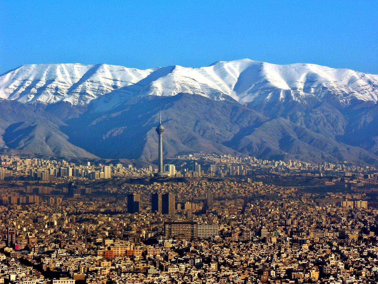
| Тавсифот | Aerial View of Tehran |
| Сана | Taken on 26 ноябр 2008, 04:35:03 |
| Манбаъ | Кори худ |
| Муаллиф | Hansueli Krapf |
| Иҷозат (Пешроҳандозии ин парванда) |
Attribution ShareAlike 3.0 |
| Camera location | | View this and other nearby images on: OpenStreetMap |
|---|
- Шумо озодед:
- мубодилот намудан – копӣ, паҳн ва фиристадани асар
- ремикс кардан – татбиқи кор
- Under the following conditions:
- тахсис – You must give appropriate credit, provide a link to the license, and indicate if changes were made. You may do so in any reasonable manner, but not in any way that suggests the licensor endorses you or your use.
- саҳми яксон – If you remix, transform, or build upon the material, you must distribute your contributions under the same or compatible license as the original.
Таърихи файл
Рӯи таърихҳо клик кунед то нусхаи марбути парвандаро бубинед.
| Таърих | Бандангуштӣ | Андоза | Корбар | Тавзеҳ | |
|---|---|---|---|---|---|
| нусхаи феълӣ | 02:48, 13 апрели 2014 | | 2 048 × 1 536 (2,37 Мбайт) | Iranianson | Fixing the light and contrast |
| 02:25, 29 ноябри 2013 |  | 2 048 × 1 536 (2,31 Мбайт) | Chronus | {{Information |Description=Aerial View of Tehran |Source={{Own}} |Date=see metadata |Author=Hansueli Krapf |Permission=Attribution ShareAlike 3.0 |other_versions= }} {{Location|35|40|27.8868|N|51|22|4.0692|E|alt:1338_source:exif_heading... | |
| 19:57, 19 июни 2009 |  | 2 048 × 1 536 (1,06 Мбайт) | Simisa | {{Information |Description=Aerial View of Tehran |Source=Own Work |Date=see metadata |Author=Hansueli Krapf |Permission=Attribution ShareAlike 3.0 |other_versions= }} {{cc-by-sa-3.0}} Category:Aerial photographs of Iran [[Category:Te |
Пайвандҳо
Ин акс дар ҳеҷ саҳифа истифода намешавад.
Истифодаи саросарии парванда
Викиҳои дигари зерин ин файлро истифода мекунанд:
- Истифода дар ady.wikipedia.org
- Истифода дар af.wikipedia.org
- Истифода дар ar.wikipedia.org
- Истифода дар ast.wikipedia.org
- Истифода дар bxr.wikipedia.org
- Истифода дар ca.wikipedia.org
- Истифода дар csb.wikipedia.org
- Истифода дар cs.wikipedia.org
- Истифода дар da.wikipedia.org
- Истифода дар en.wikipedia.org
- Истифода дар en.wikinews.org
- Истифода дар es.wikipedia.org
- Истифода дар fa.wikipedia.org
- Истифода дар fa.wikiquote.org
- Истифода дар fa.wikivoyage.org
- Истифода дар fi.wikipedia.org
- Истифода дар fr.wikipedia.org
- Истифода дар fy.wikipedia.org
- Истифода дар he.wikipedia.org
- Истифода дар hy.wikipedia.org
- Истифода дар incubator.wikimedia.org
- Истифода дар ja.wikipedia.org
- Истифода дар ko.wikipedia.org
- Истифода дар ky.wikipedia.org
- Истифода дар la.wikipedia.org
- Истифода дар ml.wikipedia.org
- Истифода дар mn.wikipedia.org
- Истифода дар mzn.wikipedia.org
View more global usage of this file.