Акс:Austria Vorarlberg relief location map.jpg

Page contents not supported in other languages.
Мавод аз Википедиа — донишномаи озод

Акси аслӣ((965 × 1 338 пиксел, ҳаҷми парванда: 468 кбайт, навъи MIME: image/jpeg))

Ин файл аз Викианбор ва дар дигар лоиҳаҳо метавонад истифода шавад. Тафсилоти ин файл саҳифаи тафсилоти файл дар зер нишон дода шудааст.

Хулоса

Тавсифот
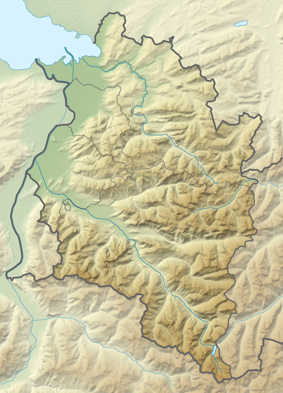
Deutsch: Positionskarte von Vorarlberg

Quadratische Plattkarte. Geographische Begrenzung der Karte:

  • N: 47.62 N
  • S: 46.82 N
  • W: 9.45 O
  • O: 10.3 O
English: Location map of Vorarlberg

Equirectangular projection. Geographic limits of the map:

  • N: 47.62 N
  • S: 46.82 N
  • W: 9.45 E
  • E: 10.3 E
Сана
Манбаъ

Кори худ using

Муаллиф NordNordWest
Иҷозат
(Пешроҳандозии ин парванда)

I have published this file as author NordNordWest under the "CC-BY-SA-3.0-DE" in Wikipedia. This means that free, commercial usage outside of Wikipedia is permitted under the following licence terms:

Please send me a specimen copy or the URL of the website where the file is used.

Please write an email to nnwest[at]web.de if you

  • need my postal address for sending a specimen copy
  • have further questions about the terms of the licence

PS: In case of refusal of the above terms the author reserves the right to take legal action.

w:en:Creative Commons
тахсис саҳми яксон
This file is licensed under the Creative Commons Attribution-Share Alike 3.0 Germany license.
Шумо озодед:
  • мубодилот намудан – копӣ, паҳн ва фиристадани асар
  • ремикс кардан – татбиқи кор
Under the following conditions:
  • тахсис – You must give appropriate credit, provide a link to the license, and indicate if changes were made. You may do so in any reasonable manner, but not in any way that suggests the licensor endorses you or your use.
  • саҳми яксон – If you remix, transform, or build upon the material, you must distribute your contributions under the same or compatible license as the original.
Other versions
Kartenwerkstatt
This map has been made or improved in the German Kartenwerkstatt (Map Lab). You can propose maps to improve as well.

Captions

Add a one-line explanation of what this file represents

Items portrayed in this file

тавсифҳо

2 декабри 2011

source of file Англисӣ

media type Англисӣ

image/jpeg

checksum Англисӣ

1278c88a5ff2362ca760e5dfefed47f60be623fd

data size Англисӣ

479125 Байт

1338 pixel

965 pixel

Таърихи файл

Рӯи таърихҳо клик кунед то нусхаи марбути парвандаро бубинед.

ТаърихБандангуштӣАндозаКорбарТавзеҳ
нусхаи феълӣ20:13, 2 Декабри 2011Акси бандангуштӣ аз нусхаи то 20:13, 2 Декабри 2011965 × 1 338 (468 кбайт)NordNordWest== {{int:filedesc}} == {{Information |Description={{de|1=Positionskarte von Vorarlberg Quadratische Plattkarte. Geographische Begrenzung der Karte: * N: 47.62 N * S: 46.82 N * W: 9.45 O * O: 10.3 O}} {{en|1=Location map of [[:en:Vorarlb

Саҳифаҳои зерин ба ин акс пайванданд:

Истифодаи саросарии парванда

Метадода