
Акс:Berkshire UK location map.svg

Ҳаҷми пешнамоиши PNG барои файли кунунии SVG: 800 × 416 пиксел. Дигар кайфиятҳо: 320 × 166 пиксел | 640 × 333 пиксел | 1 024 × 532 пиксел | 1 280 × 666 пиксел | 2 560 × 1 331 пиксел | 1 425 × 741 пиксел.
Акси аслӣ (SVG парванда, исмӣ 1 425 × 741 пиксел, андозаи парванда: 1,51 Мбайт)
| Тавсифот |
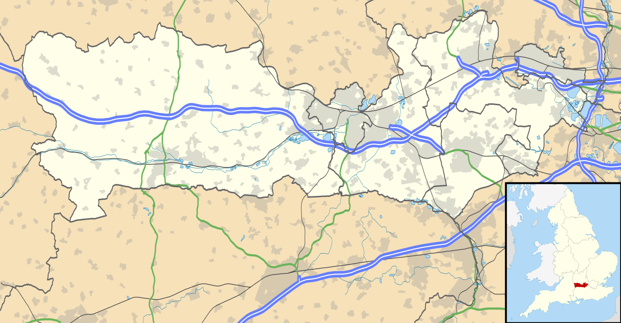
Map of Berkshire, UK with the following information shown:
Equirectangular map projection on WGS 84 datum, with N/S stretched 160% Geographic limits:
|
| Сана | |
| Манбаъ |
|
| Муаллиф | Nilfanion, created using Ordnance Survey data |
| Иҷозат (Пешроҳандозии ин парванда) |
This file is licensed under the Creative Commons Attribution-Share Alike 3.0 Unported license. Тахсис: Contains Ordnance Survey data © Crown copyright and database right
|
| Other versions | File:Berkshire UK district map (blank).svg - Blank map |
.svg)
Таърихи файл
Рӯи таърихҳо клик кунед то нусхаи марбути парвандаро бубинед.
| Таърих | Бандангуштӣ | Андоза | Корбар | Тавзеҳ | |
|---|---|---|---|---|---|
| нусхаи феълӣ | 17:56, 26 сентябри 2010 | | 1 425 × 741 (1,51 Мбайт) | Nilfanion | {{Information |Description=Map of Berkshire, UK with the following information shown: *Administrative borders *Coastline, lakes and rivers *Roads and railways *Urban areas Equirectangular map projection on WGS 84 datum, with N/S stretched |
Пайвандҳо
Саҳифаҳои зерин ба ин акс пайванданд:
Истифодаи саросарии парванда
Викиҳои дигари зерин ин файлро истифода мекунанд:
- Истифода дар ar.wikipedia.org
- Истифода дар azb.wikipedia.org
- Истифода дар bg.wikipedia.org
- Истифода дар bn.wikipedia.org
- Истифода дар ceb.wikipedia.org
- Истифода дар en.wikipedia.org
- Slough
- Newbury, Berkshire
- Britwell
- Chalvey
- Colnbrook
- Langley, Berkshire
- Upton, Slough
- Speen, Berkshire
- Maidenhead
- Sandhurst, Berkshire
- Bracknell
- Wraysbury
- Datchet
- Hungerford
- Windsor, Berkshire
- Caversham, Reading
- Frogmore
- Eton, Berkshire
- Ditton, Slough
- Horton, Berkshire
- Sunningdale
- Earley
- Hurley, Berkshire
View more global usage of this file.