
Акс:Berlin Karte Stahlstich 1860.jpg
Акси аслӣ ((1 560 × 1 542 пиксел, ҳаҷми парванда: 2,11 Мбайт, навъи MIME: image/jpeg))
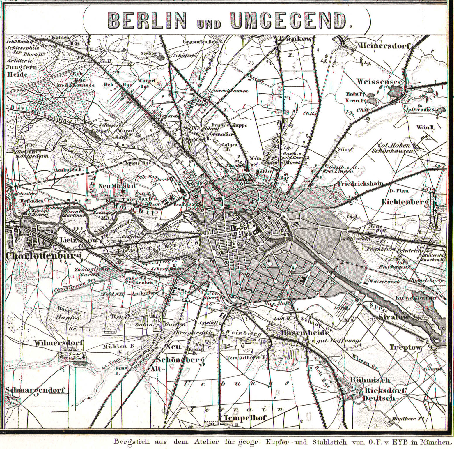
Хулоса
| Унвони мақола |
Berlin und Umgegend |
|||||||||
| Манбаъ | Hand-Atlas der Erde und des Himmels, 42nd edition (1860 printing) atlassen.info | |||||||||
| Падидоваранда |
Bearbeitet von Dr. H. Kiepert, C. Gräf, A. Gräf und Dr. C. Bruhns. |
|||||||||
| Geotemporal data | ||||||||||
| Map location | Берлин | |||||||||
| Heading |
 |
|||||||||
| Bounding box |
|
|||||||||
| Georeferencing | ||||||||||
| Bibliographic data | ||||||||||
| Забон | немисӣ | |||||||||
| Publisher |
Weimar, Geographisches Institut. |
|||||||||
Иҷозатнома
|
This work is in the public domain in its country of origin and other countries and areas where the copyright term is the author's life plus 70 years or fewer.
| |
| This file has been identified as being free of known restrictions under copyright law, including all related and neighboring rights. | |
Таърихи файл
Рӯи таърихҳо клик кунед то нусхаи марбути парвандаро бубинед.
| Таърих | Бандангуштӣ | Андоза | Корбар | Тавзеҳ | |
|---|---|---|---|---|---|
| нусхаи феълӣ | 22:51, 10 Январ 2016 | | 1 560 × 1 542 (2,11 Мбайт) | Alexrk2 | better version |
| 19:20, 8 апрели 2006 |  | 1 200 × 1 151 (374 кбайт) | Jcornelius | {{English}} * Description: Map of Berlin, steel engraving * Author: unknown * Date: 1860 * Source: [http://de.wikipedia.org/wiki/Bild:Berlin_1860.jpg German Wikipedia] * License: public domain {{Deutsch}} * Beschreibung: Karte von Berlin, Stahlstich * Au |
Пайвандҳо
Саҳифаҳои зерин ба ин акс пайванданд:
Истифодаи саросарии парванда
Викиҳои дигари зерин ин файлро истифода мекунанд:
- Истифода дар de.wikipedia.org
- Истифода дар ru.wikipedia.org