
Акс:British Isles map showing UK, Republic of Ireland, and historic counties.svg

Ҳаҷми пешнамоиши PNG барои файли кунунии SVG: 408 × 599 пиксел. Дигар кайфиятҳо: 163 × 240 пиксел | 327 × 480 пиксел | 523 × 768 пиксел | 697 × 1 024 пиксел | 1 395 × 2 048 пиксел | 1 250 × 1 835 пиксел.
Акси аслӣ (SVG парванда, исмӣ 1 250 × 1 835 пиксел, андозаи парванда: 1 003 кбайт)
Хулоса
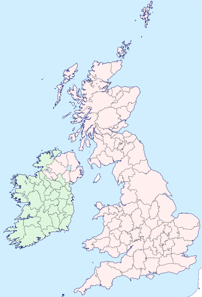
| Тавсифот | Map of the British Isles with counties |
| Сана | |
| Манбаъ | |
| Муаллиф | Visitor from Wikishire |
| Иҷозат (Пешроҳандозии ин парванда) |
This file is licensed under the Creative Commons Attribution-Share Alike 4.0 International license. Тахсис: Wikishire
|
| SVG genesis |
Таърихи файл
Рӯи таърихҳо клик кунед то нусхаи марбути парвандаро бубинед.
| Таърих | Бандангуштӣ | Андоза | Корбар | Тавзеҳ | |
|---|---|---|---|---|---|
| нусхаи феълӣ | 19:35, 13 сентябри 2019 | | 1 250 × 1 835 (1 003 кбайт) | Visitor from Wikishire | Conformed colours to Hogweard's improvements |
| 22:32, 29 май 2015 |  | 1 250 × 1 835 (1 002 кбайт) | Visitor from Wikishire | Minor refinements & optional Yorkshire Ridings layer | |
| 21:53, 11 Январ 2015 |  | 1 250 × 1 835 (933 кбайт) | Visitor from Wikishire | {{Information |Description=Map of the British Isles with counties |Source=*[http://wikishire.co.uk/vectormap/GBDefinitionA.svg Wikishire: Vector map GB Definition A] *Ireland and Ulster, counties.svg |Date=201... | |
| 22:30, 17 ноябри 2014 |  | 1 250 × 1 830 (910 кбайт) | Visitor from Wikishire | {{Information |Description=Map of the British Isles with counties |Source=*[http://wikishire.co.uk/vectormap/GBDefinitionA.svg] *Ireland and Ulster, counties.svg |Date=2014-11-17 |Author=[[:User:Visitor from W... |
Пайвандҳо
Ин акс дар ҳеҷ саҳифа истифода намешавад.
Истифодаи саросарии парванда
Викиҳои дигари зерин ин файлро истифода мекунанд:
- Истифода дар fr.wikipedia.org
- Истифода дар ku.wikipedia.org
- Cornwall
- Surrey
- Glamorgan
- Devon
- Somerset
- Dorset
- Yorkshire
- Lancashire
- County Cork
- Cumberland
- Northumberland
- Westmorland
- Kent
- Suffolk
- Norfolk
- Rutland
- Hampshire
- Wiltshire
- Berkshire
- Middlesex
- Hertfordshire
- Buckinghamshire
- Oxfordshire
- Gloucestershire
- Herefordshire
- Worcestershire
- Warwickshire
- Northamptonshire
- Bedfordshire
- Cambridgeshire
- Huntingdonshire
- Leicestershire
- Nottinghamshire
- Derbyshire
- Staffordshire
- Cheshire
- County Durham
- Lincolnshire
- Shropshire
- Şablon:Parêzgehên Giravên Brîtanî
- Angus
- Morayshire
- West Lothian
- East Lothian
- Midlothian
- Anglesey
- Brecknockshire
- Caernarfonshire
- Cardiganshire
View more global usage of this file.