
Акс:Canada Ontario location map 2.svg

Ҳаҷми пешнамоиши PNG барои файли кунунии SVG: 526 × 599 пиксел. Дигар кайфиятҳо: 211 × 240 пиксел | 421 × 480 пиксел | 674 × 768 пиксел | 899 × 1 024 пиксел | 1 798 × 2 048 пиксел | 2 032 × 2 314 пиксел.
Акси аслӣ (SVG парванда, исмӣ 2 032 × 2 314 пиксел, андозаи парванда: 1,4 Мбайт)
Хулоса
| Тавсифот |
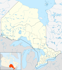
Quadratische Plattkarte, N-S-Streckung 155 %. Geographische Begrenzung der Karte:
Equirectangular projection, N/S stretching 155 %. Geographic limits of the map:
|
| Сана | |
| Манбаъ |
NordNordWest, using
|
| Муаллиф | NordNordWest |
| Иҷозат (Пешроҳандозии ин парванда) |
I, the copyright holder of this work, hereby publish it under the following license: This file is licensed under the Creative Commons Attribution-Share Alike 3.0 Unported license.
|
| Other versions |
|


Таърихи файл
Рӯи таърихҳо клик кунед то нусхаи марбути парвандаро бубинед.
| Таърих | Бандангуштӣ | Андоза | Корбар | Тавзеҳ | |
|---|---|---|---|---|---|
| нусхаи феълӣ | 21:32, 22 сентябри 2009 | | 2 032 × 2 314 (1,4 Мбайт) | Michiel1972 | {{int:filedesc}} {{Information |Description= {{de|Positionskarte von Ontario, Kanada}} Quadratische Plattkarte, N-S-Streckung 155 %. Geographische Begrenzung der Karte: * N: 57.1° N * S: 41.3° N * W: 95.5° W * O: 74.0° W |
Пайвандҳо
Саҳифаҳои зерин ба ин акс пайванданд:
Истифодаи саросарии парванда
Викиҳои дигари зерин ин файлро истифода мекунанд:
- Истифода дар af.wikipedia.org
- Истифода дар als.wikipedia.org
- Истифода дар ar.wikipedia.org
- Истифода дар ast.wikipedia.org
- Истифода дар azb.wikipedia.org
- Истифода дар ba.wikipedia.org
- Истифода дар bg.wikipedia.org
- Истифода дар bn.wikipedia.org
- Истифода дар ceb.wikipedia.org
- Истифода дар cs.wikipedia.org
- Истифода дар da.wikipedia.org
- Истифода дар en.wikipedia.org
View more global usage of this file.