
Акс:China edcp relief location map.jpg

Андозаи ин пешнамоиш: 753 × 600 пиксел. Дигар кайфиятҳо: 302 × 240 пиксел | 603 × 480 пиксел | 965 × 768 пиксел | 1 280 × 1 019 пиксел | 1 968 × 1 567 пиксел.
Акси аслӣ ((1 968 × 1 567 пиксел, ҳаҷми парванда: 562 кбайт, навъи MIME: image/jpeg))
Хулоса
| Тавсифот |
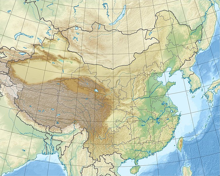
English: Location map of China.
EquiDistantConicProjection : Central parallel : * N: 36.0° N Central meridian : * E: 104.0° E Standard parallels : * 1: 30.0° N * 2: 42.0° N Latitudes on the central meridian : * top: 57.0° N * center: 37.29° N * bottom: 17.96° NMade with Natural Earth. Free vector and raster map data @ naturalearthdata.com. |
| Сана | |
| Манбаъ | Кори худ |
| Муаллиф | Uwe Dedering |
| Other versions |
|


Derivative works of this file: China edcp relief location map Sichuan.png
Иҷозатнома
I, the copyright holder of this work, hereby publish it under the following licenses:
This file is licensed under the Creative Commons Attribution-Share Alike 3.0 Unported license.
- Шумо озодед:
- мубодилот намудан – копӣ, паҳн ва фиристадани асар
- ремикс кардан – татбиқи кор
- Under the following conditions:
- тахсис – You must give appropriate credit, provide a link to the license, and indicate if changes were made. You may do so in any reasonable manner, but not in any way that suggests the licensor endorses you or your use.
- саҳми яксон – If you remix, transform, or build upon the material, you must distribute your contributions under the same or compatible license as the original.

|
Permission is granted to copy, distribute and/or modify this document under the terms of the GNU Free Documentation License, Version 1.2 or any later version published by the Free Software Foundation; with no Invariant Sections, no Front-Cover Texts, and no Back-Cover Texts. A copy of the license is included in the section entitled GNU Free Documentation License. |
Шумо иҷозатномаи хостаи худро интихоб карда метавонед.
Таърихи файл
Рӯи таърихҳо клик кунед то нусхаи марбути парвандаро бубинед.
| Таърих | Бандангуштӣ | Андоза | Корбар | Тавзеҳ | |
|---|---|---|---|---|---|
| нусхаи феълӣ | 11:47, 3 марти 2010 | | 1 968 × 1 567 (562 кбайт) | Uwe Dedering | {{Information |Description={{en|1=Location map of China. EquiDistantConicProjection. Center: * N: 36.0° N * E: 104.0° E Standard parallels: * 1: 30.0° E * 2: 42.0° E Made with Natural Earth. Free vector and raster map data @ naturalearthdata.com. |
Пайвандҳо
Саҳифаҳои зерин ба ин акс пайванданд:
Истифодаи саросарии парванда
Викиҳои дигари зерин ин файлро истифода мекунанд:
- Истифода дар ace.wikipedia.org
- Истифода дар als.wikipedia.org
- Истифода дар am.wikipedia.org
- Истифода дар ar.wikipedia.org
- Истифода дар arz.wikipedia.org
- Истифода дар ast.wikipedia.org
- Истифода дар az.wikipedia.org
- Himalay
- Sarı dəniz
- Tyanşan
- Şensi zəlzələsi (1556)
- Everest
- Qansuda zəlzələ
- Panjin çimərliyi
- Şablon:Yer xəritəsi Çin
- Şərqi Çin dənizi
- Tanşan zəlzələsi (1976)
- Ludyan zəlzələsi (2014)
- Tayvan boğazı
- Haynan boğazı
- Qərbi Koreya körfəzi
- Leyçjoubandao yarımadası
- Üç dərə SES
- Haynan
- Kukunor
- Dumtinxu
- Xanka gölü
- Təkləməkan
- Qobi
- Qaşun Qobisi
- Cunqariya
- Tibet yaylası
- Jexe yaylası
- Böyük Ussurskiy
- Üç paralel çay
- Damansk adası
- Alaşan
- Hami səhrası
- Kubuqi
- Ordos
- Mu-Us
- Tenqer (səhra)
- Badın-Jaran
- Dzosotın-Elisun
- Çaydam
- Qanqdis
View more global usage of this file.