
Акс:Costa Rica relief location map.jpg

Андозаи ин пешнамоиш: 666 × 600 пиксел. Дигар кайфиятҳо: 267 × 240 пиксел | 533 × 480 пиксел | 853 × 768 пиксел | 1 148 × 1 034 пиксел.
Акси аслӣ ((1 148 × 1 034 пиксел, ҳаҷми парванда: 841 кбайт, навъи MIME: image/jpeg))
Хулоса
| Camera location | | View this and other nearby images on: OpenStreetMap |
|---|
| Тавсифот |
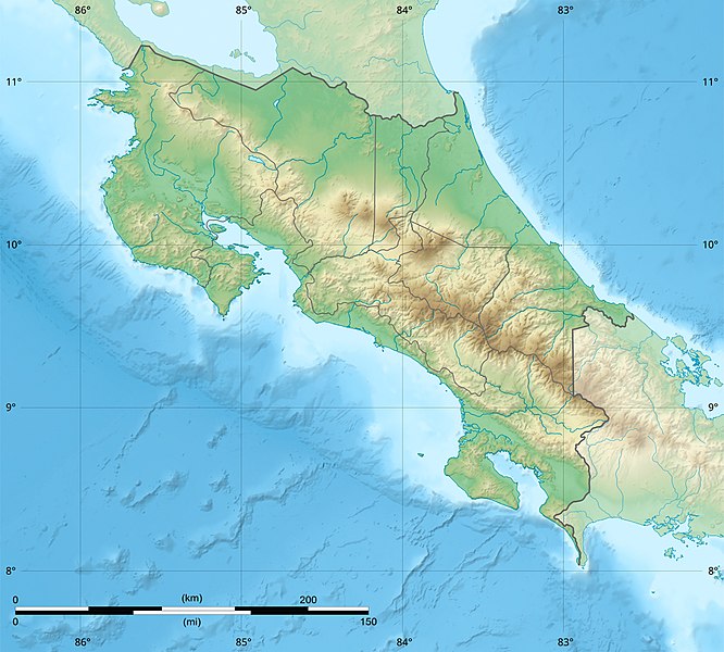
English: Blank relief map of Costa Rica for geo-location purpose.
Note : The Isla del Coco, out of the map, is not shown. Scale : 1:1,856,000 (accuracy : 464 m) Français : Carte du relief vierge du Costa Rica destinée à la géolocalisation.
Note : L´Isla del Coco, hors carte, n'est pas représentée. Échelle : 1:1 856 000 (précision : 464 m) Equirectangular projection centered on 9° 30' N – 84° 15' W, WGS84 datum * West : 86° 30' W * East : 82° W * North : 11° 30' N * South : 7° 30' N |
||
| Сана | 2008-06, updated 2022-03 | ||
| Манбаъ |
Кори худ
|
||
| Муаллиф | Eric Gaba (Sting - fr:Sting) | ||
| Иҷозат (Пешроҳандозии ин парванда) |
|
||
| Other versions |
|

Иҷозатнома
Eric Gaba (user Sting) for Wikimedia Commons using GEBCO_2021 Grid data, the copyright holder of this work, hereby publishes it under the following licenses:

|
Permission is granted to copy, distribute and/or modify this document under the terms of the GNU Free Documentation License, Version 1.2 or any later version published by the Free Software Foundation; with no Invariant Sections, no Front-Cover Texts, and no Back-Cover Texts. A copy of the license is included in the section entitled GNU Free Documentation License. |
This file is licensed under the Creative Commons Attribution-Share Alike 4.0 International, 3.0 Unported, 2.5 Generic, 2.0 Generic and 1.0 Generic license.
Тахсис: Eric Gaba (user Sting) for Wikimedia Commons using GEBCO_2021 Grid data
- Шумо озодед:
- мубодилот намудан – копӣ, паҳн ва фиристадани асар
- ремикс кардан – татбиқи кор
- Under the following conditions:
- тахсис – You must give appropriate credit, provide a link to the license, and indicate if changes were made. You may do so in any reasonable manner, but not in any way that suggests the licensor endorses you or your use.
- саҳми яксон – If you remix, transform, or build upon the material, you must distribute your contributions under the same or compatible license as the original.
Шумо иҷозатномаи хостаи худро интихоб карда метавонед.
Таърихи файл
Рӯи таърихҳо клик кунед то нусхаи марбути парвандаро бубинед.
| Таърих | Бандангуштӣ | Андоза | Корбар | Тавзеҳ | |
|---|---|---|---|---|---|
| нусхаи феълӣ | 22:51, 30 марти 2022 | | 1 148 × 1 034 (841 кбайт) | Sting | New map using new data |
| 01:32, 4 ноябри 2021 |  | 1 148 × 1 034 (906 кбайт) | RoboQwezt0x7CB | hand edited to remove non-existing waterbodies, used lower elevation green shade to bucket fill (best I can do without the tools to generate the map) particulary in the south of the country (probably an altitude render/clipping error), kept some that are hydroelectric plant's reservoirs | |
| 12:11, 19 июли 2010 |  | 1 148 × 1 034 (500 кбайт) | Sting | Color profile | |
| 15:05, 30 июли 2008 |  | 1 148 × 1 034 (491 кбайт) | Sting | - border | |
| 14:40, 13 июни 2008 |  | 1 148 × 1 034 (499 кбайт) | Sting | Several improvements | |
| 01:21, 12 июни 2008 |  | 1 148 × 1 034 (501 кбайт) | Sting | Correction on shaded layer | |
| 01:09, 12 июни 2008 |  | 1 148 × 1 034 (504 кбайт) | Sting | == Summary == {{Location|10|00|00|N|84|00|00|W|scale:2000000}} <br/> {{Information |Description={{en|Blank relief map of Costa Rica for geo-location purpose.<br/>''Note :'' The ''Isla del Coco'', out of the map, is not shown.<br/>Scale |
Пайвандҳо
Саҳифаҳои зерин ба ин акс пайванданд:
Истифодаи саросарии парванда
Викиҳои дигари зерин ин файлро истифода мекунанд:
- Истифода дар ar.wikipedia.org
- Истифода дар ast.wikipedia.org
- Истифода дар azb.wikipedia.org
- Истифода дар az.wikipedia.org
- Истифода дар ban.wikipedia.org
- Истифода дар ba.wikipedia.org
- Истифода дар be.wikipedia.org
- Истифода дар bg.wikipedia.org
- Истифода дар bn.wikipedia.org
- Истифода дар bs.wikipedia.org
- Истифода дар ca.wikipedia.org
- Истифода дар ceb.wikipedia.org
- Истифода дар ce.wikipedia.org
- Истифода дар ckb.wikipedia.org
- Истифода дар cs.wikipedia.org
View more global usage of this file.