
Акс:Golan heights border.jpg

Андозаи ин пешнамоиш: 800 × 600 пиксел. Дигар кайфиятҳо: 320 × 240 пиксел | 640 × 480 пиксел | 1 024 × 768 пиксел | 1 280 × 960 пиксел | 2 304 × 1 728 пиксел.
Акси аслӣ ((2 304 × 1 728 пиксел, ҳаҷми парванда: 625 кбайт, навъи MIME: image/jpeg))
Хулоса
| Тавсифот |
Čeština: hranice mezi izraelem a sýrií v golanských výšinách
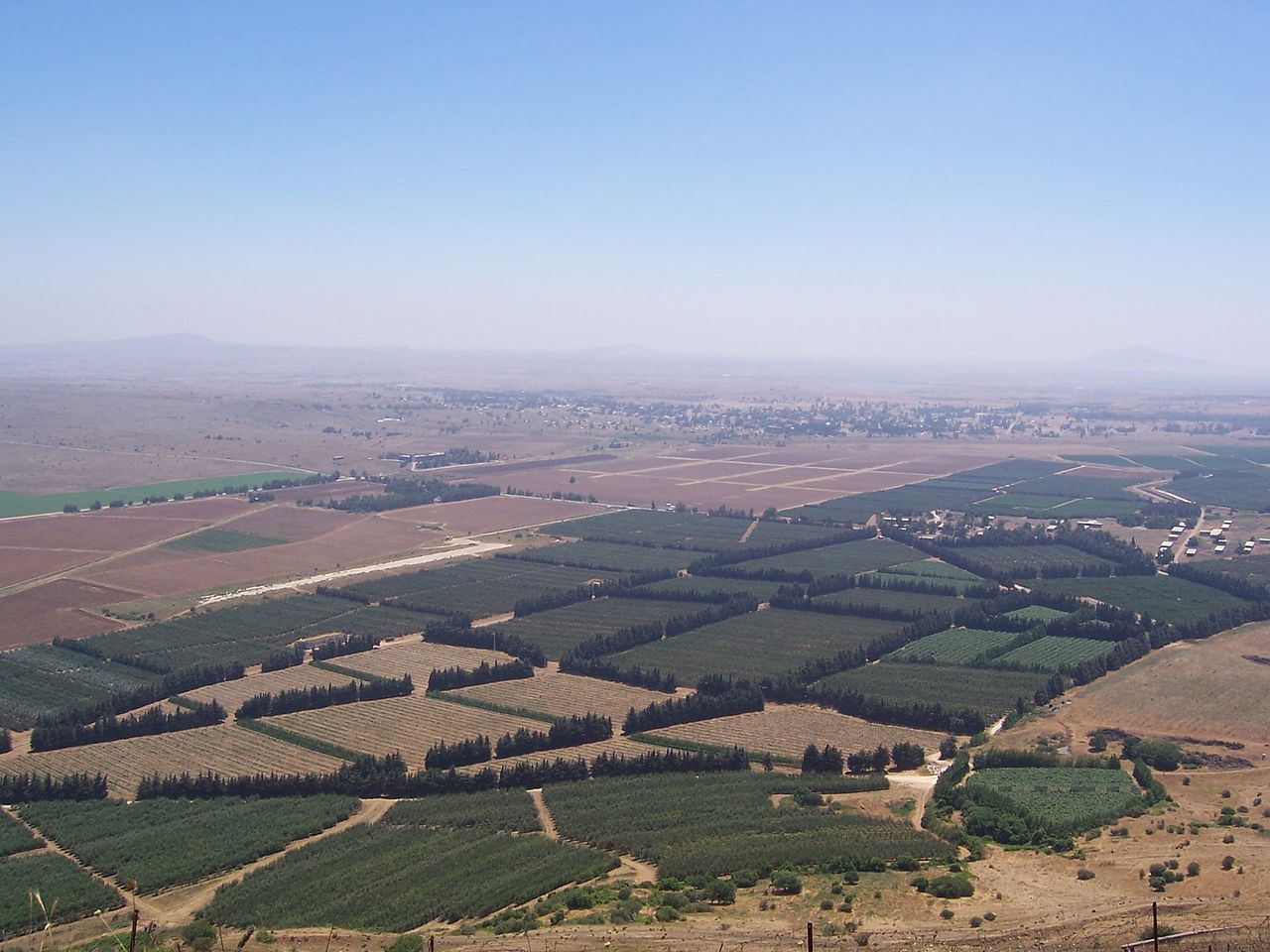
English: The Golan Heights' border with Syria proper. The Golan Heights end (and Syria begins) where the farmland ends. In the background is the deserted city of Quneitra in Syria. The white buildings on the right are mostly UN buildings.
Русский: Сирийско-израильская граница в Голанских высотах
Français : Vue sur la frontière syro-israélienne à la lisière des hauteurs du Golan. On distingue au loin la ville syrienne de Quneitra désertée. Les bâtiments de couleur claire à droite appartiennent pour la plupart à l'ONU. |
| Сана | Taken in 2004 |
| Манбаъ | Self-photographed (Original text: I took this picture.) |
| Муаллиф | Masterpjz9 at en.wikipedia |
Иҷозатнома
This file is licensed under the Creative Commons Attribution-Share Alike 2.5 Generic license.
- Шумо озодед:
- мубодилот намудан – копӣ, паҳн ва фиристадани асар
- ремикс кардан – татбиқи кор
- Under the following conditions:
- тахсис – You must give appropriate credit, provide a link to the license, and indicate if changes were made. You may do so in any reasonable manner, but not in any way that suggests the licensor endorses you or your use.
- саҳми яксон – If you remix, transform, or build upon the material, you must distribute your contributions under the same or compatible license as the original.
Original upload log
The original description page was here. All following user names refer to en.wikipedia.
- 2006-04-08 03:29 Masterpjz9 2304×1728× (639949 bytes) This is a photo of the Israeli Golan Heights border with Syria. The Golan Heights end (and Syria begins) where the farmland ends. In the background there is an deserted city of Syria, and the white buildings in the right are mostly UN buildings. I took t
Таърихи файл
Рӯи таърихҳо клик кунед то нусхаи марбути парвандаро бубинед.
| Таърих | Бандангуштӣ | Андоза | Корбар | Тавзеҳ | |
|---|---|---|---|---|---|
| нусхаи феълӣ | 02:45, 10 апрели 2012 | | 2 304 × 1 728 (625 кбайт) | OgreBot | (BOT): Uploading old version of file from en.wikipedia; originally uploaded on 2006-04-08 03:29:30 by Masterpjz9 |
| 21:09, 31 июли 2006 |  | 800 × 600 (69 кбайт) | Becherka | Israeli golan heights border with syria hranice mezi izraelem a sýrií v golanských výšinách |
Пайвандҳо
Саҳифаҳои зерин ба ин акс пайванданд:
Истифодаи саросарии парванда
Викиҳои дигари зерин ин файлро истифода мекунанд:
- Истифода дар ar.wikipedia.org
- Истифода дар be-tarask.wikipedia.org
- Истифода дар ca.wikipedia.org
- Истифода дар ckb.wikipedia.org
- Истифода дар en.wikipedia.org
- Истифода дар fa.wikipedia.org
- Истифода дар fr.wikipedia.org
- Истифода дар he.wikipedia.org
- Истифода дар hu.wikipedia.org
- Истифода дар id.wikipedia.org
- Истифода дар ja.wikipedia.org
- Истифода дар ko.wikipedia.org
- Истифода дар ms.wikipedia.org
- Истифода дар mzn.wikipedia.org
- Истифода дар nl.wikipedia.org
- Истифода дар pt.wikipedia.org
- Истифода дар ru.wikipedia.org
- Истифода дар tr.wikipedia.org
- Истифода дар vi.wikipedia.org
- Истифода дар www.wikidata.org
- Истифода дар zh.wikipedia.org