
Акс:Holborn-viaduct-map.svg

Ҳаҷми пешнамоиши PNG барои файли кунунии SVG: 654 × 599 пиксел. Дигар кайфиятҳо: 262 × 240 пиксел | 524 × 480 пиксел | 838 × 768 пиксел | 1 117 × 1 024 пиксел | 2 235 × 2 048 пиксел | 671 × 615 пиксел.
Акси аслӣ (SVG парванда, исмӣ 671 × 615 пиксел, андозаи парванда: 269 кбайт)
| Camera location | | View this and other nearby images on: OpenStreetMap |
|---|
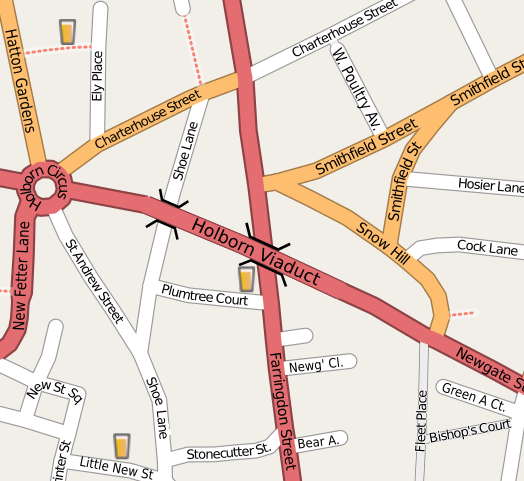
| Тавсифот | Map of the area around Holborn Viaduct (in central London) |
| Сана | |
| Манбаъ | openstreetmap.org |
| Муаллиф | Collaboratively created by the OpenStreetMap community using only free map sources and manual GPS surveying to build the map from scratch. Harry Wood exported this area to SVG format and did some cleanup work. |
| Иҷозат (Пешроҳандозии ин парванда) |
This file is licensed under the Creative Commons Attribution 2.0 Generic license.
|
| Other versions | The 'live' version of this map is available at http://www.openstreetmap.org/?lat=51.51699&lon=-0.10535&zoom=17&layers=B0FT Use the 'export' tab to get a fresh export in a variety of formats. This includes SVG (as used here) and '.osm', the underlying geolocated data. Use the 'edit' tab there to edit the map! |
Таърихи файл
Рӯи таърихҳо клик кунед то нусхаи марбути парвандаро бубинед.
| Таърих | Бандангуштӣ | Андоза | Корбар | Тавзеҳ | |
|---|---|---|---|---|---|
| нусхаи феълӣ | 09:51, 31 Декабри 2013 | | 671 × 615 (269 кбайт) | Ysangkok | scour |
| 14:52, 22 апрели 2008 |  | 671 × 615 (1,09 Мбайт) | Harry Wood | this SVG renderer didn't like the oneway arrows. Remove them | |
| 14:42, 22 апрели 2008 |  | 671 × 615 (1,11 Мбайт) | Harry Wood | try to fix 'page' boundary | |
| 14:39, 22 апрели 2008 |  | 671 × 615 (1,08 Мбайт) | Harry Wood | {{Information |Description=Map of the area around Holborn Viaduct |Source=OpenStreetMap.org |Date= |Author= |Permission={{OpenStreetMap}} |other_versions= }} |
Пайвандҳо
Саҳифаҳои зерин ба ин акс пайванданд:
Истифодаи саросарии парванда
Викиҳои дигари зерин ин файлро истифода мекунанд:
- Истифода дар de.wikipedia.org
- Истифода дар en.wikipedia.org
- Истифода дар fr.wikipedia.org