
Акс:India Madhya Pradesh location map.svg

Ҳаҷми пешнамоиши PNG барои файли кунунии SVG: 800 × 563 пиксел. Дигар кайфиятҳо: 320 × 225 пиксел | 640 × 450 пиксел | 1 024 × 720 пиксел | 1 280 × 900 пиксел | 2 560 × 1 800 пиксел | 1 041 × 732 пиксел.
Акси аслӣ (SVG парванда, исмӣ 1 041 × 732 пиксел, андозаи парванда: 180 кбайт)
Хулоса
| Тавсифот |
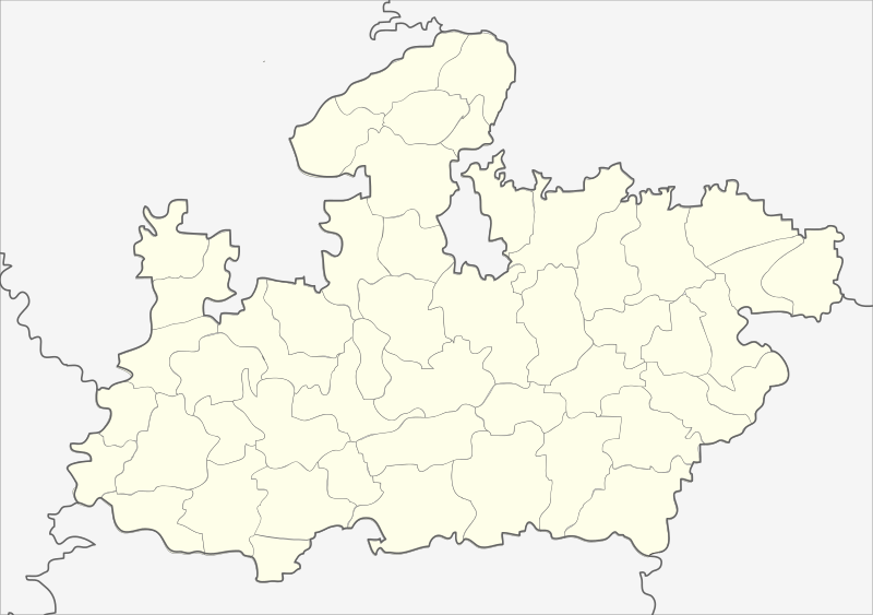
English: Locator map of Madhya Pradesh.
Geographical limits of the map:
Français : Carte de localisation du Madhya Pradesh, Inde. |
| Сана | (UTC) |
| Манбаъ | India_Madhya_Pradesh_locator_map.svg |
| Муаллиф |
India_Madhya_Pradesh_locator_map.svg: user:Planemad
|
| Other versions |
|


| This is a retouched picture, which means that it has been digitally altered from its original version. Modifications: Cropped map of madhya pradesh. The original can be viewed here: India Madhya Pradesh locator map.svg:
|
Иҷозатнома
This file is licensed under the Creative Commons Attribution-Share Alike 3.0 Unported license.
- Шумо озодед:
- мубодилот намудан – копӣ, паҳн ва фиристадани асар
- ремикс кардан – татбиқи кор
- Under the following conditions:
- тахсис – You must give appropriate credit, provide a link to the license, and indicate if changes were made. You may do so in any reasonable manner, but not in any way that suggests the licensor endorses you or your use.
- саҳми яксон – If you remix, transform, or build upon the material, you must distribute your contributions under the same or compatible license as the original.
Original upload log
This image is a derivative work of the following images:
- File:India_Madhya_Pradesh_locator_map.svg licensed with Cc-by-sa-3.0
- 2006-08-06T17:38:20Z Planemad 1639x1852 (768594 Bytes) {{WikiProject_India_Maps |Title=Madhya Pradesh locator map |Description=Locator map of the state of Madhya Pradesh, [[w:India|India]] with district boundaries. |Source=. |Date=August 6 2006 |Author=[[w:user:Nichalp]][[w:user
Uploaded with derivativeFX
| Annotations | This image is annotated: View the annotations at Commons |
Таърихи файл
Рӯи таърихҳо клик кунед то нусхаи марбути парвандаро бубинед.
| Таърих | Бандангуштӣ | Андоза | Корбар | Тавзеҳ | |
|---|---|---|---|---|---|
| нусхаи феълӣ | 22:26, 25 феврали 2013 | | 1 041 × 732 (180 кбайт) | Milenioscuro | updated new districts, colors according german map workshop and the other India location maps |
| 12:19, 25 ноябри 2010 |  | 610 × 440 (146 кбайт) | Nayvik | Changed background color | |
| 12:13, 25 ноябри 2010 |  | 610 × 440 (146 кбайт) | Nayvik | {{Information |Description=Locator map of Madhya Pradesh.<br> Geographical limits of the map: * 28.0°N * 20.0°N * 84.0°E * 72.0°E |Source=*File:India_Madhya_Pradesh_locator_map.svg |Date=2010-11-25 12:11 (UTC) |Author=*[[:Fi |
Пайвандҳо
Ин акс дар ҳеҷ саҳифа истифода намешавад.
Истифодаи саросарии парванда
Викиҳои дигари зерин ин файлро истифода мекунанд:
- Истифода дар de.wikipedia.org
- Истифода дар de.wikivoyage.org
- Истифода дар en.wikipedia.org
- Истифода дар eo.wikipedia.org
- Истифода дар fa.wikipedia.org
View more global usage of this file.