
Акс:Ivanovo Obl Myt asv2018-08 img18.jpg

Андозаи ин пешнамоиш: 800 × 450 пиксел. Дигар кайфиятҳо: 320 × 180 пиксел | 640 × 360 пиксел | 1 024 × 576 пиксел | 1 280 × 720 пиксел | 2 560 × 1 440 пиксел | 7 952 × 4 473 пиксел.
Акси аслӣ ((7 952 × 4 473 пиксел, ҳаҷми парванда: 12,03 Мбайт, навъи MIME: image/jpeg))
Хулоса
| Тавсифот |
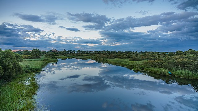
English: View of Myt, Ivanovo Oblast, Russia.
Deutsch: Blick über den Fluss Luch zum Dorf (hier: Typ Selo) Myt im Osten der Verwaltungseinheit Oblast Iwanowo in Russland bei Sonnenuntergang. Das Selo liegt etwa 370 km von Moskau entfernt.
Русский: Вид на село Мыт Верхнеландеховского района Ивановской области. |
| Сана | |
| Манбаъ | Кори худ |
| Муаллиф | A.Savin |
| Иҷозат (Пешроҳандозии ин парванда) |
.svg) Just attribute the author: «A.Savin, Wikipedia»; if you have questions — Telegram, or e-mail to wikiphotospace@gmail.com..svg) Просто укажите в качестве автора: «А.Савин, Википедия»; если есть вопрос — телеграм, или эл.почта на wikiphotospace@gmail.com. Kennzeichnen Sie einfach als Autor: «A.Savin, Wikipedia»; falls Sie Fragen haben — Telegram, oder E-Mail an wikiphotospace@gmail.com.
Thank you. |
| Camera location | | View this and other nearby images on: OpenStreetMap |
|---|

|
Эта фотография сделана в ходе вики-экспедиции по Ивановской области, август 2018.
This picture was taken during a Russian Wikivoyage expedition. |
|
Иҷозатнома
| Copyleft: This work of art is free; you can redistribute it and/or modify it according to terms of the Free Art License. You will find a specimen of this license on the Copyleft Attitude site as well as on other sites. |
Таърихи файл
Рӯи таърихҳо клик кунед то нусхаи марбути парвандаро бубинед.
| Таърих | Бандангуштӣ | Андоза | Корбар | Тавзеҳ | |
|---|---|---|---|---|---|
| нусхаи феълӣ | 16:22, 30 ноябри 2018 | | 7 952 × 4 473 (12,03 Мбайт) | A.Savin | {{User:A.Savin/F |Description= {{en|View of Myt, Ivanovo Oblast, Russia.}} {{ru|Вид на село Мыт Верхнеландеховского района Ивановской области.}} |Year=2018 |Country=Russia |Month=08 |Day=14}} {{Location|56|48|28.8|N|42|18|31|E|region:RU-IVA}} {{Wiki-expedition|2018-ivanovo}} Category:Taken with Sony ILCE-7RM3 Category:Taken with Sony FE 24-105mm F4 G OSS Category:Lukh River Category:Ensemble of churches in Myt, Ivanovo Oblast Category:Water reflections of clouds in Russia... |
Пайвандҳо
Саҳифаҳои зерин ба ин акс пайванданд:
Истифодаи саросарии парванда
Викиҳои дигари зерин ин файлро истифода мекунанд:
- Истифода дар avk.wikipedia.org
- Истифода дар ce.wikipedia.org
- Истифода дар fr.wikipedia.org
- Истифода дар hy.wikipedia.org
- Истифода дар ru.wikipedia.org
- Истифода дар uk.wikipedia.org
- Истифода дар vi.wikipedia.org
- Истифода дар www.wikidata.org