
Акс:KhitanAD1000.png
Андозаи ин пешнамоиш: 800 × 467 пиксел. Дигар кайфиятҳо: 320 × 187 пиксел | 640 × 373 пиксел | 1 024 × 597 пиксел | 1 644 × 959 пиксел.
Акси аслӣ ((1 644 × 959 пиксел, ҳаҷми парванда: 52 кбайт, навъи MIME: image/png))
Хулоса
| Тавсифот |
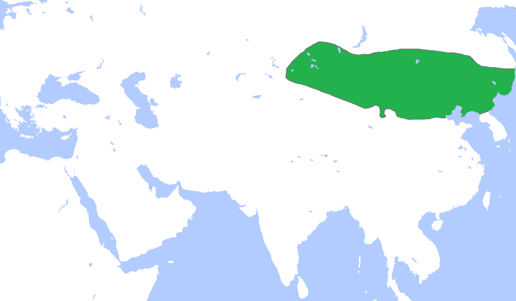
English: Locator map of the Khitan Empire, c. 1000.
(Partially based on Atlas of World History (2007) - The World 750-1000, map) |
| Сана | |
| Манбаъ | Кори худ |
| Муаллиф | Gabagool |
Иҷозатнома
I, the copyright holder of this work, hereby publish it under the following license:
This file is licensed under the Creative Commons Attribution 3.0 Unported license.
- Шумо озодед:
- мубодилот намудан – копӣ, паҳн ва фиристадани асар
- ремикс кардан – татбиқи кор
- Under the following conditions:
- тахсис – You must give appropriate credit, provide a link to the license, and indicate if changes were made. You may do so in any reasonable manner, but not in any way that suggests the licensor endorses you or your use.
Таърихи файл
Рӯи таърихҳо клик кунед то нусхаи марбути парвандаро бубинед.
| Таърих | Бандангуштӣ | Андоза | Корбар | Тавзеҳ | |
|---|---|---|---|---|---|
| нусхаи феълӣ | 02:28, 19 Декабри 2010 | | 1 644 × 959 (52 кбайт) | Tm | Reverted to version as of 16:02, 18 December 2010 |
| 00:12, 19 Декабри 2010 |  | 1 644 × 959 (52 кбайт) | Historiographer~commonswiki | See en:Goryeo–Khitan Wars. | |
| 16:02, 18 Декабри 2010 |  | 1 644 × 959 (52 кбайт) | Tm | Reverted to version as of 01:59, 18 December 2010 (please see the warning in Category:Maps_of_Korea) | |
| 09:09, 18 Декабри 2010 |  | 1 644 × 959 (52 кбайт) | Garam | Stop it. Goryeo of territory is Aprok river. Please, you can ref to wikipedia. | |
| 01:59, 18 Декабри 2010 |  | 1 644 × 959 (52 кбайт) | Tm | Reverted to version as of 00:35, 18 December 2010 | |
| 00:36, 18 Декабри 2010 |  | 1 644 × 959 (52 кбайт) | Historiographer~commonswiki | Reverted to version as of 00:34, 18 December 2010 | |
| 00:35, 18 Декабри 2010 |  | 1 644 × 959 (52 кбайт) | Evawen | Reverted to version as of 18:29, 17 December 2010 | |
| 00:34, 18 Декабри 2010 |  | 1 644 × 959 (52 кбайт) | Historiographer~commonswiki | These territory was called as a Six garrison (강동6주). You really think I'm that nationalistic? It is fact. | |
| 18:29, 17 Декабри 2010 |  | 1 644 × 959 (52 кбайт) | Tm | Reverted to version as of 19:25, 16 December 2010 (please stop this nationalistic POV pushing) | |
| 02:11, 17 Декабри 2010 |  | 1 644 × 959 (52 кбайт) | Historiographer~commonswiki | Reverted to version as of 06:10, 16 December 2010 |
Пайвандҳо
Саҳифаҳои зерин ба ин акс пайванданд:
Истифодаи саросарии парванда
Викиҳои дигари зерин ин файлро истифода мекунанд:
- Истифода дар af.wikipedia.org
- Истифода дар an.wikipedia.org
- Истифода дар ar.wikipedia.org
- Истифода дар ast.wikipedia.org
- Истифода дар be.wikipedia.org
- Истифода дар bg.wikipedia.org
- Истифода дар cdo.wikipedia.org
- Истифода дар ce.wikipedia.org
- Истифода дар ckb.wikipedia.org
- Истифода дар cs.wikipedia.org
- Истифода дар en.wikipedia.org
- Истифода дар es.wikipedia.org
- Истифода дар eu.wikipedia.org
- Истифода дар fa.wikipedia.org
- Истифода дар fr.wikipedia.org
- Истифода дар fr.wiktionary.org
- Истифода дар id.wikipedia.org
- Истифода дар ja.wikipedia.org
- Истифода дар ka.wikipedia.org
- Истифода дар kk.wikipedia.org
- Истифода дар km.wikipedia.org
- Истифода дар min.wikipedia.org
- Истифода дар mk.wikipedia.org
- Истифода дар mn.wikipedia.org
- Истифода дар ms.wikipedia.org
- Истифода дар mt.wikipedia.org
- Истифода дар nl.wikipedia.org
- Истифода дар no.wikipedia.org
View more global usage of this file.