
Акс:Madhya Pradesh districts location map big.svg

Ҳаҷми пешнамоиши PNG барои файли кунунии SVG: 800 × 563 пиксел. Дигар кайфиятҳо: 320 × 225 пиксел | 640 × 450 пиксел | 1 024 × 720 пиксел | 1 280 × 900 пиксел | 2 560 × 1 800 пиксел | 1 041 × 732 пиксел.
Акси аслӣ (SVG парванда, исмӣ 1 041 × 732 пиксел, андозаи парванда: 313 кбайт)
Хулоса
| Тавсифот |
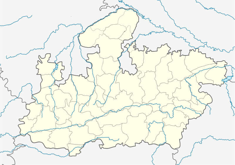
English: Locator map of Madhya Pradesh. Geographical limits of the map: * N: 27.15°N * S: 20.75°N * E: 83.1°E * W: 73.2°E Français : Carte de localisation du Madhya Pradesh, Inde. |
| Сана | |
| Манбаъ | File:India Madhya Pradesh location map.svg |
| Муаллиф | Planemad, Nayvik, Yann (talk) |
| Other versions |
|

Иҷозатнома
This file is licensed under the Creative Commons Attribution-Share Alike 3.0 Unported license.
- Шумо озодед:
- мубодилот намудан – копӣ, паҳн ва фиристадани асар
- ремикс кардан – татбиқи кор
- Under the following conditions:
- тахсис – You must give appropriate credit, provide a link to the license, and indicate if changes were made. You may do so in any reasonable manner, but not in any way that suggests the licensor endorses you or your use.
- саҳми яксон – If you remix, transform, or build upon the material, you must distribute your contributions under the same or compatible license as the original.
Таърихи файл
Рӯи таърихҳо клик кунед то нусхаи марбути парвандаро бубинед.
| Таърих | Бандангуштӣ | Андоза | Корбар | Тавзеҳ | |
|---|---|---|---|---|---|
| нусхаи феълӣ | 16:00, 21 апрели 2020 | | 1 041 × 732 (313 кбайт) | C1MM | Added rivers and new district |
| 13:59, 25 феврали 2013 |  | 1 041 × 732 (179 кбайт) | MaxxL | 9 districts color adjusted | |
| 13:29, 25 феврали 2013 |  | 1 041 × 732 (179 кбайт) | MaxxL | rectified - colors adjusted | |
| 11:48, 25 феврали 2013 |  | 1 041 × 732 (176 кбайт) | MaxxL | minor changes | |
| 20:57, 23 феврали 2013 |  | 1 041 × 732 (176 кбайт) | MaxxL | com:Graphic Lab/Map workshop#Adding new districts in Madhya Pradesh | |
| 14:12, 13 феврали 2012 |  | 1 041 × 732 (148 кбайт) | Yann | {{Information |Description={{en|Locator map of Madhya Pradesh.}} |Source=File:India Madhya Pradesh location map.svg |Date=2012 |Author= User:Planemad, User:Nayvik, ~~~ |Permission= |other_versions= <gallery> File:India |
Пайвандҳо
Ин акс дар ҳеҷ саҳифа истифода намешавад.
Истифодаи саросарии парванда
Викиҳои дигари зерин ин файлро истифода мекунанд:
- Истифода дар ar.wikipedia.org
- Истифода дар azb.wikipedia.org
- اودانخدی
- ماردانا, مادهیا پرادش
- ناسرولاقانج
- ماندهاتا
- جهیرنیا, مادهیا پرادش
- جئونارا
- سلیمان آباد
- مالپار
- رانقواسا
- سیرالی
- رامپور کالان
- ماخوری
- جاقوتی
- ماهبا (هیندوستان)
- ماقرورا
- رایپورا
- سقون, مادهیا پرادش
- وارلا, مادهیا پرادش
- هارانا, راجقاره
- پیپلیا سیسودیا
- پیپارییا ناق
- هاندیا, مادهیا پرادش
- قیاراسپور
- قوحیصار
- اوتیلا فورت
- پاوارخدا
- قوقارا
- دئولوند
- اوزار, مادهیا پرادش
- قاداسارای
- نیوالی, مادهیا پرادش
- اندوری (هیندوستان)
- چیرولا, داتیا
- چیراخان
- دودارسی
- دوراها, سهور
- ناوقاده
- دونقارقون
- دونقارقون, آقار مالوا
- بوراوان
- بورانی ویلیج
- موتالا, مادهیا پرادش
- بوهانی (هیندوستان)
- بیلهتی (هیندوستان)
- مهیدپور رواد
- بامورا خاس
- باقوانپورا, مادهیا پرادش
- سوپییا
- سویات خورد
View more global usage of this file.