
Акс:Maps template-history patch-en.svg

Ҳаҷми пешнамоиши PNG барои файли кунунии SVG: 800 × 585 пиксел. Дигар кайфиятҳо: 320 × 234 пиксел | 640 × 468 пиксел | 1 024 × 749 пиксел | 1 280 × 937 пиксел | 2 560 × 1 873 пиксел.
Акси аслӣ (SVG парванда, исмӣ 820 × 600 пиксел, андозаи парванда: 104 кбайт)
Хулоса
| Тавсифот |
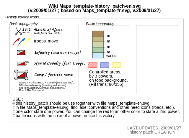
English: Template for the creation of geographic and topographic maps with the most common features used, following the current convention in WP-fr, and for some elements also in part of WP-de. Français : Modèle pour la création de cartes géographiques et topographiques avec les principaux éléments habituellement employés et qui suit les conventions cartographiques actuelles de WP-fr et pour certains éléments en partie dans WP-de. |
| Сана | (UTC) |
| Манбаъ |
Maps template-fr.svg This vector image was created with Inkscape-default |
| Муаллиф |
|
| This is a retouched picture, which means that it has been digitally altered from its original version. Modifications: Select some icones, order them : create an history_patch. The original can be viewed here: Maps template-fr.svg:
|
Иҷозатнома
I, the copyright holder of this work, hereby publish it under the following licenses:
This file is licensed under the Creative Commons Attribution 2.5 Generic license.
- Шумо озодед:
- мубодилот намудан – копӣ, паҳн ва фиристадани асар
- ремикс кардан – татбиқи кор
- Under the following conditions:
- тахсис – You must give appropriate credit, provide a link to the license, and indicate if changes were made. You may do so in any reasonable manner, but not in any way that suggests the licensor endorses you or your use.

|
Permission is granted to copy, distribute and/or modify this document under the terms of the GNU Free Documentation License, Version 1.2 or any later version published by the Free Software Foundation; with no Invariant Sections, no Front-Cover Texts, and no Back-Cover Texts. A copy of the license is included in the section entitled GNU Free Documentation License. |
| This file is licensed under the Creative Commons Attribution-Share Alike 3.0 Unported license. | ||
| ||
| This licensing tag was added to this file as part of the GFDL licensing update. |
Шумо иҷозатномаи хостаи худро интихоб карда метавонед.
Original upload log
This image is a derivative work of the following images:
- File:Maps_template-fr.svg licensed with Cc-by-2.5, Cc-by-2.5, GFDL, GFDL/en
- 2009-01-27T13:06:03Z Yug 1100x1500 (203738 Bytes) MINOR UPDATES: 2009/01/27. Add: port ; bat. judaisme, bat. chinese religions. Correct: terre principal fefee4 -> fefee9 (german usage) Add frames' titles, legend box. Move frames to more suitable place.
- 2008-09-04T00:08:14Z Sting 1100x1500 (176632 Bytes) Several little improvements
- 2008-07-15T14:45:27Z Sting 1100x1500 (170548 Bytes) Some improvements
- 2008-06-24T01:02:19Z Sting 1100x1500 (170673 Bytes) Valors for elevations and depths deleted to avoid confusion
- 2008-06-23T18:53:20Z Sémhur 1100x1500 (170836 Bytes) Change lighthouse icon, and decrease weight
- 2008-06-22T14:26:16Z Sting 1100x1500 (209351 Bytes) Additional topo colors for high elevations/permanent snow areas
- 2008-06-18T13:06:33Z Sting 1100x1500 (202960 Bytes) Additional modifications
- 2008-06-17T02:19:19Z Sting 1100x1500 (202606 Bytes) Some slight modifications
- 2008-06-13T14:51:52Z Sting 1100x1500 (202325 Bytes) Linear scales reduced to one type
- 2008-06-11T22:30:44Z Sting 1100x1500 (331785 Bytes) Some adjustments
- 2008-06-11T03:57:09Z Sting 1100x1500 (324893 Bytes) == Summary == {{Information |Description={{en|Template for the creation of geographic and topographic maps with the most common features used and following the convention to be used in the whole Wikimedia projet. *'''''Import
Uploaded with derivativeFX
Таърихи файл
Рӯи таърихҳо клик кунед то нусхаи марбути парвандаро бубинед.
| Таърих | Бандангуштӣ | Андоза | Корбар | Тавзеҳ | |
|---|---|---|---|---|---|
| нусхаи феълӣ | 21:09, 11 феврали 2009 | | 820 × 600 (104 кбайт) | Stepshep | typos |
| 15:08, 27 Январ 2009 |  | 820 × 600 (104 кбайт) | Yug | oups ^-^"... spelling mistake.... | |
| 15:05, 27 Январ 2009 |  | 820 × 600 (104 кбайт) | Yug | {{Information |Description={{en|1=sadfg}} |Source=Own work by uploader |Author=Yug |Date=today |Permission= |other_versions= }} <!--{{ImageUpload|full}}--> |
Пайвандҳо
Саҳифаҳои зерин ба ин акс пайванданд:
Истифодаи саросарии парванда
Викиҳои дигари зерин ин файлро истифода мекунанд:
- Истифода дар en.wikipedia.org
- Истифода дар id.wikipedia.org
- Истифода дар ru.wikipedia.org
- Истифода дар sl.wikipedia.org
- Истифода дар zh.wikipedia.org