
Акс:Seychelles location map.svg

Ҳаҷми пешнамоиши PNG барои файли кунунии SVG: 711 × 600 пиксел. Дигар кайфиятҳо: 285 × 240 пиксел | 569 × 480 пиксел | 910 × 768 пиксел | 1 214 × 1 024 пиксел | 2 428 × 2 048 пиксел | 1 087 × 917 пиксел.
Акси аслӣ (SVG парванда, исмӣ 1 087 × 917 пиксел, андозаи парванда: 80 кбайт)
Хулоса
| Тавсифот |
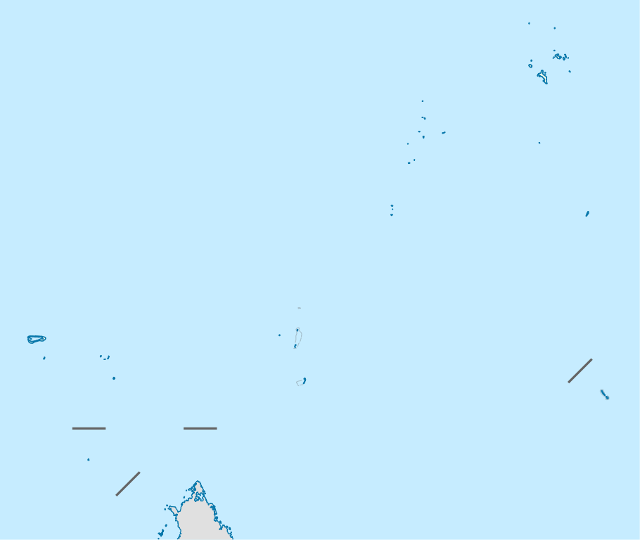
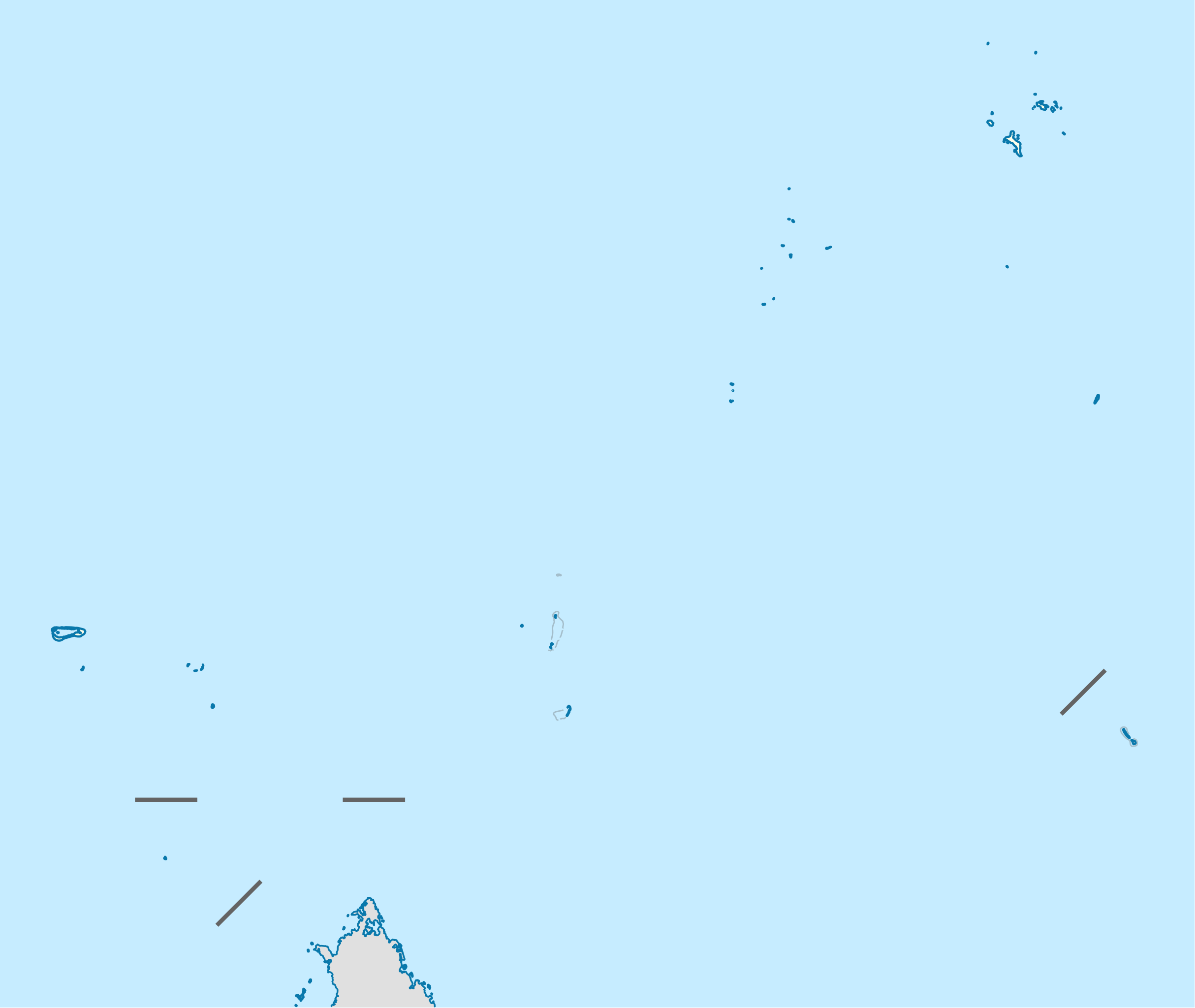
Deutsch: Positionskarte der Seychellen
Quadratische Plattkarte. Geographische Begrenzung der Karte:
English: Location map of Seychelles
Equirectangular projection. Geographic limits of the map:
|
| Сана | |
| Манбаъ | Кори худ, using United States National Imagery and Mapping Agency data |
| Муаллиф | NordNordWest |
| Иҷозат (Пешроҳандозии ин парванда) |
I, the copyright holder of this work, hereby publish it under the following license: This file is licensed under the Creative Commons Attribution-Share Alike 3.0 Unported license.
|

|
This map has been made or improved in the German Kartenwerkstatt (Map Lab). You can propose maps to improve as well.
|
Таърихи файл
Рӯи таърихҳо клик кунед то нусхаи марбути парвандаро бубинед.
| Таърих | Бандангуштӣ | Андоза | Корбар | Тавзеҳ | |
|---|---|---|---|---|---|
| нусхаи феълӣ | 14:55, 20 октябри 2009 | | 1 087 × 917 (80 кбайт) | NordNordWest | {{int:filedesc}} {{Information |Description= {{de|Positionskarte der Seychellen}} Quadratische Plattkarte. Geographische Begrenzung der Karte: * N: 3.3° S * S: 13.0° S * W: 45.7° O * O: 57.2° O {{en|Location map of [[:en:Seychelles| |
Пайвандҳо
Саҳифаҳои зерин ба ин акс пайванданд:
Истифодаи саросарии парванда
Викиҳои дигари зерин ин файлро истифода мекунанд:
- Истифода дар af.wikipedia.org
- Истифода дар am.wikipedia.org
- Истифода дар an.wikipedia.org
- Истифода дар ar.wikipedia.org
- Истифода дар ast.wikipedia.org
- Истифода дар az.wikipedia.org
- Истифода дар be-tarask.wikipedia.org
- Истифода дар be.wikipedia.org
- Истифода дар bg.wikipedia.org
- Истифода дар bn.wikipedia.org
- Истифода дар bs.wikipedia.org
- Истифода дар ceb.wikipedia.org
View more global usage of this file.