
Акс:Tuvalu location map.svg

Акси аслӣ (SVG парванда, исмӣ 532 × 673 пиксел, андозаи парванда: 16 кбайт)
Хулоса
| Тавсифот |
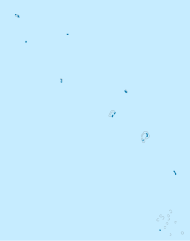
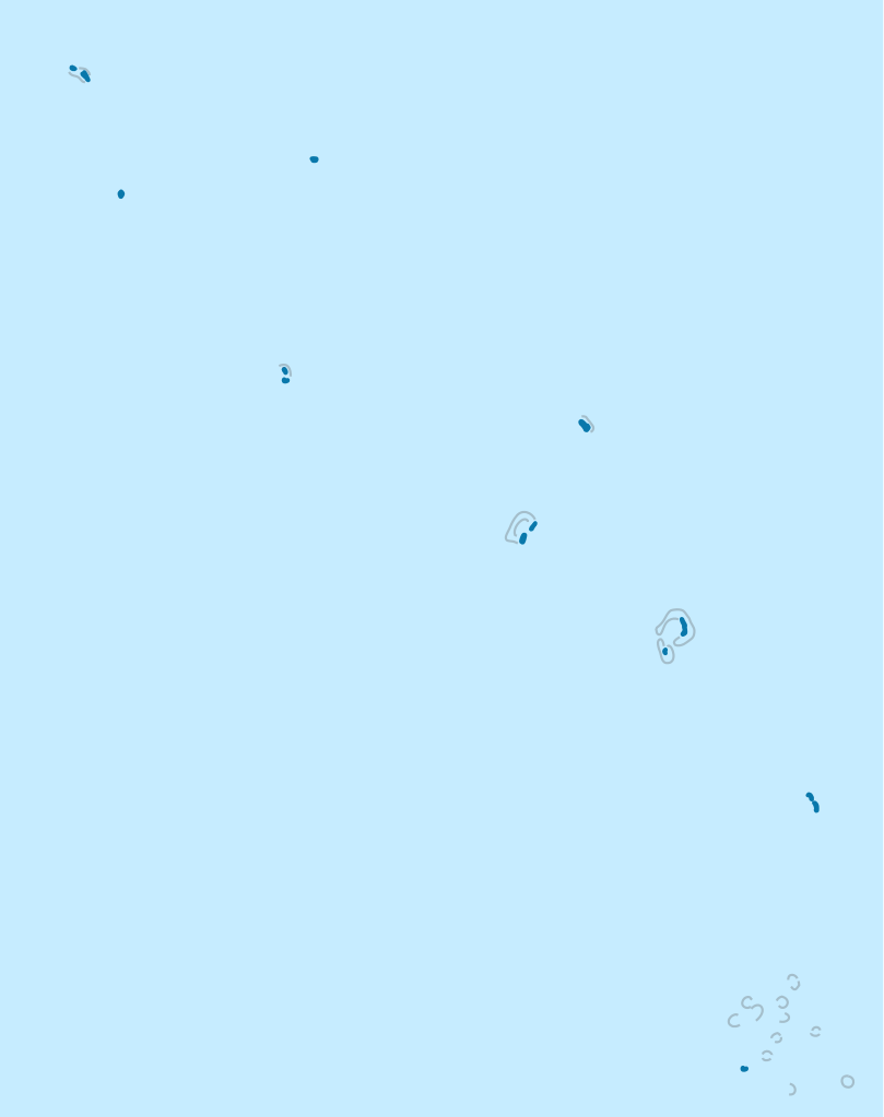
Deutsch: Positionskarte von Tuvalu
Quadratische Plattkarte. Geographische Begrenzung der Karte:
English: Location map of Tuvalu
Equirectangular projection. Geographic limits of the map:
|
|
| Сана | ||
| Манбаъ |
Кори худ, using
|
|
| Муаллиф | NordNordWest | |
| Иҷозат (Пешроҳандозии ин парванда) |
This file is licensed under the Creative Commons Attribution-Share Alike 3.0 Germany license.
 This file is licensed under the Creative Commons Attribution-Share Alike 3.0 Germany license.
|


|
This map has been made or improved in the German Kartenwerkstatt (Map Lab). You can propose maps to improve as well.
|
Таърихи файл
Рӯи таърихҳо клик кунед то нусхаи марбути парвандаро бубинед.
| Таърих | Бандангуштӣ | Андоза | Корбар | Тавзеҳ | |
|---|---|---|---|---|---|
| нусхаи феълӣ | 16:41, 26 августи 2011 | | 532 × 673 (16 кбайт) | Convallaria majalis | looks like a smaller copy of this file is damaged... |
| 11:30, 19 ноябри 2009 |  | 532 × 673 (16 кбайт) | NordNordWest | == {{int:filedesc}} == {{Information |Description= {{de|Positionskarte von Tuvalu}} Quadratische Plattkarte. Geographische Begrenzung der Karte: * N: 5.3° S * S: 11.0° S * W: 175.7° O * O: 179.8° W {{en|Location map of [[:en:Tuvalu|Tuva |
Пайвандҳо
Саҳифаҳои зерин ба ин акс пайванданд:
Истифодаи саросарии парванда
Викиҳои дигари зерин ин файлро истифода мекунанд:
- Истифода дар af.wikipedia.org
- Истифода дар an.wikipedia.org
- Истифода дар ar.wikipedia.org
- Истифода дар ast.wikipedia.org
- Истифода дар az.wikipedia.org
- Истифода дар be-tarask.wikipedia.org
- Истифода дар be.wikipedia.org
- Истифода дар bg.wikipedia.org
- Истифода дар bn.wikipedia.org
- Истифода дар bs.wikipedia.org
- Истифода дар ceb.wikipedia.org
View more global usage of this file.