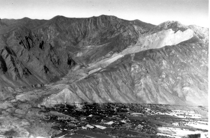
Акс:USGS Khait landslide.jpg

Page contents not supported in other languages.
Мавод аз Википедиа — донишномаи озод

USGS_Khait_landslide.jpg((700 × 463 пиксел, ҳаҷми парванда: 230 кбайт, навъи MIME: image/jpeg))

Ин файл аз Викианбор ва дар дигар лоиҳаҳо метавонад истифода шавад. Тафсилоти ин файл саҳифаи тафсилоти файл дар зер нишон дода шудааст.

Хулоса

Тавсифот
English: View of the Khait landslide triggered by the 1949 Khait earthquake, the scar on Chokhran mountain shows the origin of the slide, which overwhelmed the village of Khait
Сана
Манбаъ USGS Earthquake information bulletin 20 [1]
Муаллиф R.L. Wesson (USGS)

Иҷозатнома

Public domain
This work is in the public domain in the United States because it is a work prepared by an officer or employee of the United States Government as part of that person’s official duties under the terms of Title 17, Chapter 1, Section 105 of the US Code. Note: This only applies to original works of the Federal Government and not to the work of any individual U.S. state, territory, commonwealth, county, municipality, or any other subdivision. This template also does not apply to postage stamp designs published by the United States Postal Service since 1978. (See § 313.6(C)(1) of Compendium of U.S. Copyright Office Practices). It also does not apply to certain US coins; see The US Mint Terms of Use.

Captions

Add a one-line explanation of what this file represents

Items portrayed in this file

тавсифҳо

MIME type Англисӣ

image/jpeg

Таърихи файл

Рӯи таърихҳо клик кунед то нусхаи марбути парвандаро бубинед.

ТаърихБандангуштӣАндозаКорбарТавзеҳ
нусхаи феълӣ09:58, 30 июни 2011Акси бандангуштӣ аз нусхаи то 09:58, 30 июни 2011700 × 463 (230 кбайт)Mikenorton

Саҳифаҳои зерин ба ин акс пайванданд:

Истифодаи саросарии парванда

Викиҳои дигари зерин ин файлро истифода мекунанд:

Метадода