
Акс:Wales relief location map.jpg
Андозаи ин пешнамоиш: 502 × 600 пиксел. Дигар кайфиятҳо: 201 × 240 пиксел | 402 × 480 пиксел | 643 × 768 пиксел | 857 × 1 024 пиксел | 2 000 × 2 390 пиксел.
Акси аслӣ ((2 000 × 2 390 пиксел, ҳаҷми парванда: 742 кбайт, навъи MIME: image/jpeg))
| Тавсифот |
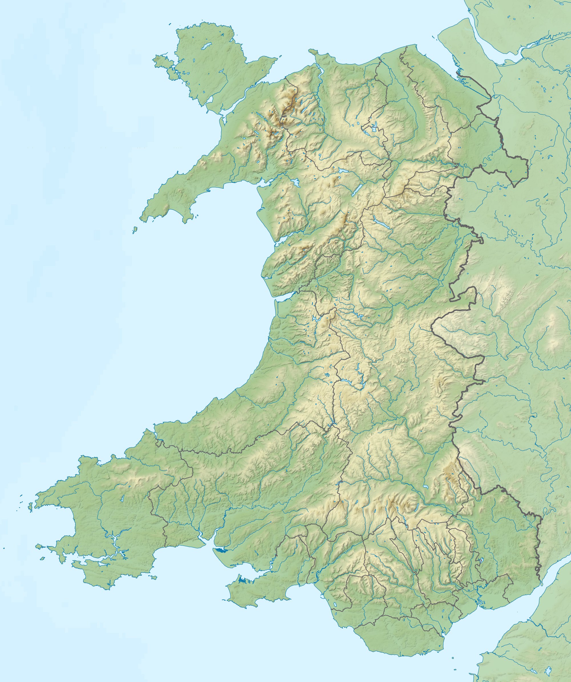
Relief map of Wales, UK. Equirectangular map projection on WGS 84 datum, with N/S stretched 170%
|
| Сана | |
| Манбаъ |
|
| Муаллиф | Nilfanion, created using Ordnance Survey data |
| Иҷозат (Пешроҳандозии ин парванда) |
This file is licensed under the Creative Commons Attribution-Share Alike 3.0 Unported license. Тахсис: Contains Ordnance Survey data © Crown copyright and database right
|
| Other versions | File:Wales location map.svg - Blank map |
Таърихи файл
Рӯи таърихҳо клик кунед то нусхаи марбути парвандаро бубинед.
| Таърих | Бандангуштӣ | Андоза | Корбар | Тавзеҳ | |
|---|---|---|---|---|---|
| нусхаи феълӣ | 11:53, 9 Декабри 2011 | | 2 000 × 2 390 (742 кбайт) | Nilfanion | {{Information |Description=Relief map of Wales, UK. Equirectangular map projection on WGS 84 datum, with N/S stretched 170% *West: 5.5W *East: 2.5W *North: 53.5N *South: 51.3N |Source=Ordnance Survey [https://www.ordnan |
Пайвандҳо
Саҳифаҳои зерин ба ин акс пайванданд:
Истифодаи саросарии парванда
Викиҳои дигари зерин ин файлро истифода мекунанд:
- Истифода дар ar.wikipedia.org
- Истифода дар ast.wikipedia.org
- Истифода дар az.wikipedia.org
- Истифода дар ba.wikipedia.org
- Истифода дар bg.wikipedia.org
- Ланголен
- Кардиф
- Суонзи
- Брекън
- Нюпорт
- Мърдър Тидфил (град)
- Денби
- Тремадог
- Колуин Бей
- Уитфорд
- Бангор (Уелс)
- Сейнт Дейвидс
- Ъск
- Престатин
- Рил
- Коруен
- Карог
- Ридлан
- Ридин
- Сейнт Асаф
- Моулд
- Багилт
- Бъкли
- Ъстрад Мънах
- Кайруис
- Конас Кий
- Юлоу
- Флинт (Уелс)
- Хардън
- Бротън
- Хоулиуел
- Куинсфери
- Солтни
- Шотън
- Чърк
- Рексъм (град)
- Амлух
- Биумарис
- Бенлех
- Хоулихед
- Лангевни
- Менай Бридж
- Абергеле
- Конуи (град)
View more global usage of this file.