
Акс:Ngemplak Interchange with Lawu Mountain.jpg

Андозаи ин пешнамоиш: 800 × 600 пиксел. Дигар кайфиятҳо: 320 × 240 пиксел | 640 × 480 пиксел | 1 024 × 768 пиксел | 1 280 × 960 пиксел | 2 560 × 1 920 пиксел | 4 096 × 3 072 пиксел.
Акси аслӣ ((4 096 × 3 072 пиксел, ҳаҷми парванда: 4,77 Мбайт, навъи MIME: image/jpeg))
Хулоса
| Тавсифот |
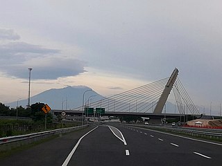
Bahasa Indonesia: Simpang susun Ngemplak Jalan Tol Solo–Ngawi berlatar Gunung Lawu English: Ngemplak Interchange Solo–Ngawi Tollroad with Lawu Mountain |
| Сана | 14 Май 2020 (according to Exif data) |
| Манбаъ | Кори худ |
| Муаллиф | Naufal06 |
| Camera location | | View this and other nearby images on: OpenStreetMap |
|---|
Иҷозатнома
I, the copyright holder of this work, hereby publish it under the following license:
This file is licensed under the Creative Commons Attribution 3.0 Unported license.
- Шумо озодед:
- мубодилот намудан – копӣ, паҳн ва фиристадани асар
- ремикс кардан – татбиқи кор
- Under the following conditions:
- тахсис – You must give appropriate credit, provide a link to the license, and indicate if changes were made. You may do so in any reasonable manner, but not in any way that suggests the licensor endorses you or your use.
| This file was uploaded via Mobile Android App (Commons mobile app) 2.12.3~dc08a5e88. |
Таърихи файл
Рӯи таърихҳо клик кунед то нусхаи марбути парвандаро бубинед.
| Таърих | Бандангуштӣ | Андоза | Корбар | Тавзеҳ | |
|---|---|---|---|---|---|
| нусхаи феълӣ | 09:58, 14 май 2020 | | 4 096 × 3 072 (4,77 Мбайт) | NaufalF | Uploaded using Commons Mobile App |
Пайвандҳо
Ин акс дар ҳеҷ саҳифа истифода намешавад.
Истифодаи саросарии парванда
Викиҳои дигари зерин ин файлро истифода мекунанд:
- Истифода дар en.wikipedia.org
- Истифода дар en.wikisource.org
- Истифода дар id.wikipedia.org
- Истифода дар id.wikisource.org