
Акс:Channel Islands location map (+parishes).svg

Ҳаҷми пешнамоиши PNG барои файли кунунии SVG: 460 × 600 пиксел. Дигар кайфиятҳо: 184 × 240 пиксел | 368 × 480 пиксел | 589 × 768 пиксел | 785 × 1 024 пиксел | 1 570 × 2 048 пиксел | 1 325 × 1 728 пиксел.
Акси аслӣ (SVG парванда, исмӣ 1 325 × 1 728 пиксел, андозаи парванда: 298 кбайт)
.svg)
Хулоса
| Тавсифот |
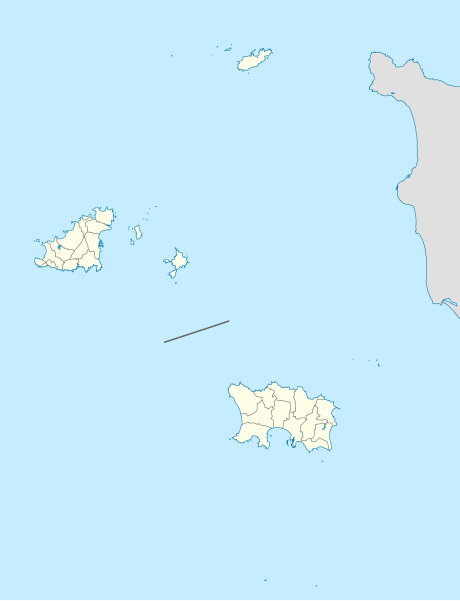
Deutsch: Positionskarte der Kanalinseln
Geographische Begrenzung der Karte:
English: Location map of the Channel Islands
Geographic limits of the map:
|
| Сана | |
| Манбаъ |
Кори худ This W3C-unspecified vector image was created with Adobe Illustrator. This SVG file was uploaded with Commonist. This vector image includes elements that have been taken or adapted from this file: This vector image includes elements that have been taken or adapted from this file: This vector image includes elements that have been taken or adapted from this file: |
| Муаллиф |
TUBS |
Иҷозатнома
I, the copyright holder of this work, hereby publish it under the following license:
This file is licensed under the Creative Commons Attribution-Share Alike 2.0 Generic license.
- Шумо озодед:
- мубодилот намудан – копӣ, паҳн ва фиристадани асар
- ремикс кардан – татбиқи кор
- Under the following conditions:
- тахсис – You must give appropriate credit, provide a link to the license, and indicate if changes were made. You may do so in any reasonable manner, but not in any way that suggests the licensor endorses you or your use.
- саҳми яксон – If you remix, transform, or build upon the material, you must distribute your contributions under the same or compatible license as the original.

|
I'd greatly appreciate, that you attribute this media file to Wikimedia Commons, if used outside Wikipedia or Commons. For use in publications such as books, newspapers, blogs, websites, please insert here the following line:
|
.svg&action=edit&redlink=1)
Таърихи файл
Рӯи таърихҳо клик кунед то нусхаи марбути парвандаро бубинед.
| Таърих | Бандангуштӣ | Андоза | Корбар | Тавзеҳ | |
|---|---|---|---|---|---|
| нусхаи феълӣ | 09:37, 21 май 2012 | | 1 325 × 1 728 (298 кбайт) | TUBS | == {{int:filedesc}} == {{Information |Description= {{de|Positionskarte der Kanalinseln}} Geographische Begrenzung der Karte: * N: 49.8° N * S: 48.95° N * W: 2.75° W * O: 1.75° W {{en|Location map of the [[:en:Channel Islands|Cha... |
Пайвандҳо
Саҳифаҳои зерин ба ин акс пайванданд:
Истифодаи саросарии парванда
Викиҳои дигари зерин ин файлро истифода мекунанд:
- Истифода дар ar.wikipedia.org
- Истифода дар bn.wikipedia.org
- Истифода дар bs.wikipedia.org
- Истифода дар ceb.wikipedia.org
- Истифода дар en.wikipedia.org
- Burhou
- St Helier
- Guernsey Airport
- Ortac
- Lager Sylt
- Saint Anne, Alderney
- Mont Orgueil
- Fremont Point transmitting station
- Jersey Airport
- Elizabeth Castle
- Muratti Vase
- Alderney Airport
- Jersey Open
- Vingtaine de Samarès
- Grande Vingtaine (St Clement)
- Vingtaine du Rocquier
- Vingtaine de la Rocque
- Vingtaine du Rouge Bouillon
- Vingtaine du Mont à l'Abbé
- Guernsey cricket team
- Jersey cricket team
- Acorn Jersey Open
- Haut de la Garenne
- La Motte, Jersey
- Nicolle Tower
- Les Platons
- Le Moulin
- Module:Location map/data/Channel Islands/doc
- Fort Clonque
- St Matthew's Church, Jersey
- Samarès Manor
- Saint Ouen's Manor
- Fort Regent
- Bréhon Tower
- User:The C of E/sandbox
- User:Michael!/Project:Location map templates/United Kingdom
- Talk:2013–14 RFU Championship
- Parish Church of St Clement
- Town Church, Guernsey
- Saint Peter Port Lifeboat Station
- St Martin's Parish Church, Guernsey
- Module:Location map/data/Channel Islands
- 2021–22 Combined Counties Football League
- Ville-ès-Nouaux
View more global usage of this file.
.svg)
.svg)