
Акс:Oklahoma topographic map-en.svg

Ҳаҷми пешнамоиши PNG барои файли кунунии SVG: 800 × 405 пиксел. Дигар кайфиятҳо: 320 × 162 пиксел | 640 × 324 пиксел | 1 024 × 518 пиксел | 1 280 × 648 пиксел | 2 560 × 1 296 пиксел | 3 952 × 2 000 пиксел.
Акси аслӣ (SVG парванда, исмӣ 3 952 × 2 000 пиксел, андозаи парванда: 14,9 Мбайт)
Хулоса
| Тавсифот |
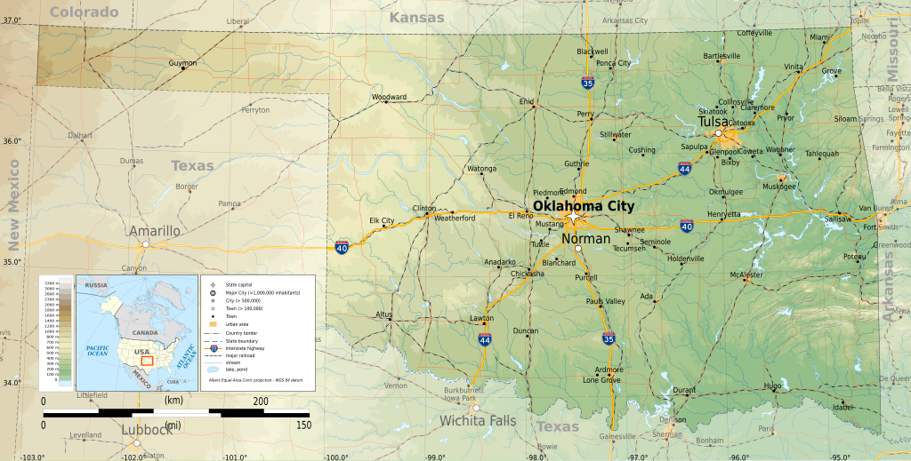
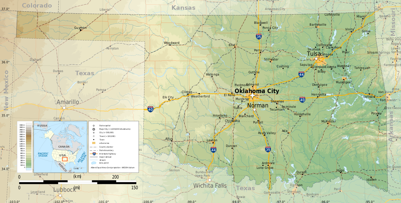
English: Topographic map of Oklahoma
Albers Equal-Area Conic projection, WGS84 datum Geographic limits of the map:
|
| Сана | |
| Манбаъ |
Кори худ
|
| Муаллиф | Ikonact |

|
This SVG file contains embedded text that can be translated into your language, using any capable SVG editor, text editor or the SVG Translate tool. For more information see: About translating SVG files. |
Иҷозатнома
I, the copyright holder of this work, hereby publish it under the following license:
This file is licensed under the Creative Commons Attribution-Share Alike 4.0 International license.
- Шумо озодед:
- мубодилот намудан – копӣ, паҳн ва фиристадани асар
- ремикс кардан – татбиқи кор
- Under the following conditions:
- тахсис – You must give appropriate credit, provide a link to the license, and indicate if changes were made. You may do so in any reasonable manner, but not in any way that suggests the licensor endorses you or your use.
- саҳми яксон – If you remix, transform, or build upon the material, you must distribute your contributions under the same or compatible license as the original.
Таърихи файл
Рӯи таърихҳо клик кунед то нусхаи марбути парвандаро бубинед.
| Таърих | Бандангуштӣ | Андоза | Корбар | Тавзеҳ | |
|---|---|---|---|---|---|
| нусхаи феълӣ | 23:31, 9 марти 2015 | | 3 952 × 2 000 (14,9 Мбайт) | Ikonact | =={{int:filedesc}}== {{Information |description={{en|1=Topographic map of en:Oklahoma}} Albers Equal-Area Conic projection, WGS84 datum Geographic limits of the map: *West: 103.2° W *East: 94.2° W *North: 37.2° N *South: 33.4° N |date=2015-03... |
Пайвандҳо
Саҳифаҳои зерин ба ин акс пайванданд:
Истифодаи саросарии парванда
Викиҳои дигари зерин ин файлро истифода мекунанд:
- Истифода дар ang.wikipedia.org
- Истифода дар az.wikipedia.org
- Истифода дар be.wikipedia.org
- Истифода дар bg.wikipedia.org
- Истифода дар ca.wikipedia.org
- Истифода дар en.wikipedia.org
- Истифода дар ga.wikipedia.org
- Истифода дар gl.wikipedia.org
- Истифода дар hu.wikipedia.org
- Истифода дар hy.wikipedia.org
- Истифода дар mhr.wikipedia.org
- Истифода дар os.wikipedia.org
- Истифода дар tt.wikipedia.org
- Истифода дар www.wikidata.org