
Акс:United Arab Emirates relief location map.jpg
Андозаи ин пешнамоиш: 698 × 600 пиксел. Дигар кайфиятҳо: 279 × 240 пиксел | 559 × 480 пиксел | 894 × 768 пиксел | 1 228 × 1 055 пиксел.
Акси аслӣ ((1 228 × 1 055 пиксел, ҳаҷми парванда: 668 кбайт, навъи MIME: image/jpeg))
| Тавсифот |
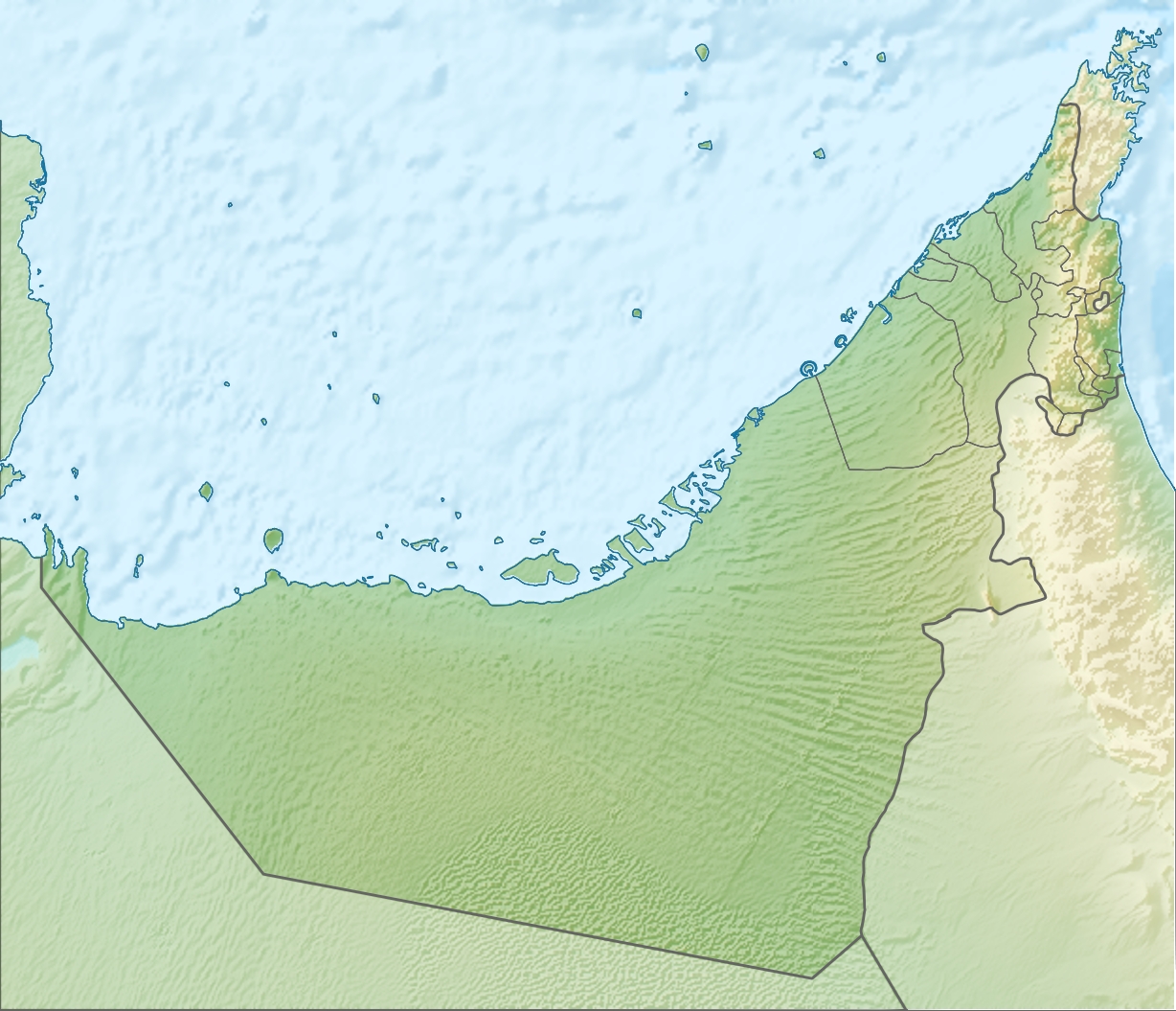
Deutsch: Positionskarte der Vereinigten Arabischen Emirate Quadratische Plattkarte, N-S-Streckung 109 %. Geographische Begrenzung der Karte: * N: 26.5° N * S: 22.4° N * W: 51.4° O * O: 56.6° O English: Location map of the United Arab Emirates Equirectangular projection, N/S stretching 109 %. Geographic limits of the map: * N: 26.5° N * S: 22.4° N * W: 51.4° E * E: 56.6° E |
| Сана | (UTC) |
| Манбаъ | |
| Муаллиф |
|
| Other versions |
Derivative works of this file: Liwa oasis location.jpg
|

| This is a retouched picture, which means that it has been digitally altered from its original version. Modifications: relief map. The original can be viewed here: United Arab Emirates location map.svg:
|
I, the copyright holder of this work, hereby publish it under the following license:
This file is licensed under the Creative Commons Attribution-Share Alike 3.0 Unported license.
- Шумо озодед:
- мубодилот намудан – копӣ, паҳн ва фиристадани асар
- ремикс кардан – татбиқи кор
- Under the following conditions:
- тахсис – You must give appropriate credit, provide a link to the license, and indicate if changes were made. You may do so in any reasonable manner, but not in any way that suggests the licensor endorses you or your use.
- саҳми яксон – If you remix, transform, or build upon the material, you must distribute your contributions under the same or compatible license as the original.
Original upload log
This image is a derivative work of the following images:
- File:United_Arab_Emirates_location_map.svg licensed with Cc-by-sa-3.0
- 2009-11-02T20:02:51Z NordNordWest 1228x1056 (243829 Bytes) '
- 2009-11-02T19:16:49Z NordNordWest 1228x1056 (244905 Bytes) {{int:filedesc}} {{Information |Description= {{de|Positionskarte der [[:de:Vereinigte Arabische Emirate|Vereinigten Arabischen Emirate]]}} Quadratische Plattkarte, N-S-Streckung 109 %. Geographische Begrenzung der Karte: * N:
Uploaded with derivativeFX
Таърихи файл
Рӯи таърихҳо клик кунед то нусхаи марбути парвандаро бубинед.
| Таърих | Бандангуштӣ | Андоза | Корбар | Тавзеҳ | |
|---|---|---|---|---|---|
| нусхаи феълӣ | 09:30, 5 августи 2010 | | 1 228 × 1 055 (668 кбайт) | Uwe Dedering | {{Information |Description={{de|Positionskarte der Vereinigten Arabischen Emirate}} Quadratische Plattkarte, N-S-Streckung 109 %. Geographische Begrenzung der Karte: * N: 26.5° N * S: 22.4° N * W: 51.4° O * O: 56.6� |
Пайвандҳо
Саҳифаҳои зерин ба ин акс пайванданд:
Истифодаи саросарии парванда
Викиҳои дигари зерин ин файлро истифода мекунанд:
- Истифода дар af.wikipedia.org
- Истифода дар als.wikipedia.org
- Истифода дар ar.wikipedia.org
- Истифода дар ast.wikipedia.org
- Истифода дар av.wikipedia.org
- Истифода дар az.wikipedia.org
- Истифода дар ba.wikipedia.org
- Истифода дар be.wikipedia.org
- Истифода дар bg.wikipedia.org
- Истифода дар bh.wikipedia.org
- Истифода дар bn.wikipedia.org
- Истифода дар bs.wikipedia.org
- Истифода дар bxr.wikipedia.org
- Истифода дар ca.wikipedia.org
- Истифода дар ceb.wikipedia.org
- Истифода дар ce.wikipedia.org
View more global usage of this file.