
Акс:Enderby Land, Antarctica.jpg

Акси аслӣ ((1 750 × 1 300 пиксел, ҳаҷми парванда: 465 кбайт, навъи MIME: image/jpeg))
Хулоса
| Тавсифот |
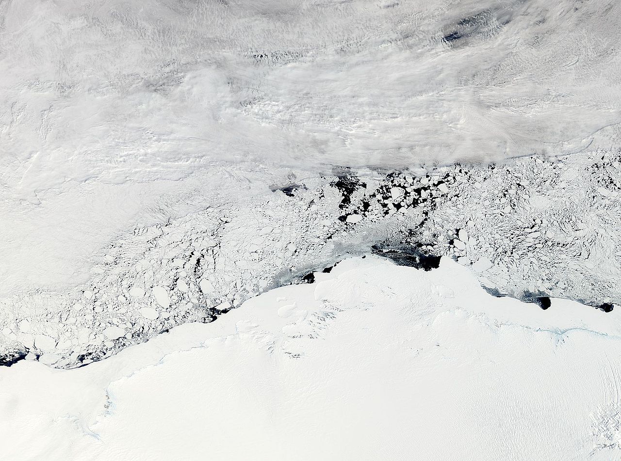
NASA image acquired November 3, 2011 The Moderate Resolution Imaging Spectroradiometer (MODIS) instrument on NASA's Aqua satellite captured this image of Enderby Land, Antarctica on November 3, 2011 at 11:20 UTC (7:20 a.m. EDT). The ice and snow appear bright white at the bottom of the image. Clouds grace the top of the image, and sea ice floats in William Scoresby Bay. Enderby Land is an Antarctic land mass that extends from Shinnan Glacier to William Scoresby Bay. Discovered in 1831, it was named after the Enderby Brothers of London. Operation Ice Bridge is exploring Antarctic ice, and more information can be found at www.nasa.gov/icebridge. Image Credit: NASA Goddard MODIS Rapid Response Team NASA Goddard Space Flight Center enables NASA’s mission through four scientific endeavors: Earth Science, Heliophysics, Solar System Exploration, and Astrophysics. Goddard plays a leading role in NASA’s accomplishments by contributing compelling scientific knowledge to advance the Agency’s mission. |
| Сана | |
| Манбаъ |
NASA Satellite Sees Enderby Land, Antarctica
|
| Муаллиф | NASA Goddard Space Flight Center from Greenbelt, MD, USA |
Иҷозатнома
- Шумо озодед:
- мубодилот намудан – копӣ, паҳн ва фиристадани асар
- ремикс кардан – татбиқи кор
- Under the following conditions:
- тахсис – You must give appropriate credit, provide a link to the license, and indicate if changes were made. You may do so in any reasonable manner, but not in any way that suggests the licensor endorses you or your use.
| This file is in the public domain in the United States because it was solely created by NASA. NASA copyright policy states that "NASA material is not protected by copyright unless noted". (See Template:PD-USGov, NASA copyright policy page or JPL Image Use Policy.) | ||
 |
Warnings:
|
| This image, originally posted to Flickr, was reviewed on November 8, 2011 by the administrator or reviewer File Upload Bot (Magnus Manske), who confirmed that it was available on Flickr under the stated license on that date. |
Таърихи файл
Рӯи таърихҳо клик кунед то нусхаи марбути парвандаро бубинед.
| Таърих | Бандангуштӣ | Андоза | Корбар | Тавзеҳ | |
|---|---|---|---|---|---|
| нусхаи феълӣ | 03:34, 8 ноябри 2011 | | 1 750 × 1 300 (465 кбайт) | File Upload Bot (Magnus Manske) | {{Information |Description=NASA image acquired November 3, 2011 The Moderate Resolution Imaging Spectroradiometer (MODIS) instrument on NASA's Aqua satellite captured this image of Enderby Land, Antarctica on November 3, 2011 at 11:20 UTC (7:20 a.m. EDT) |
Пайвандҳо
Саҳифаҳои зерин ба ин акс пайванданд:
Истифодаи саросарии парванда
Викиҳои дигари зерин ин файлро истифода мекунанд:
- Истифода дар ar.wikipedia.org
- Истифода дар arz.wikipedia.org
- Истифода дар bg.wikipedia.org
- Истифода дар ca.wikipedia.org
- Истифода дар ceb.wikipedia.org
- Истифода дар ce.wikipedia.org
- Истифода дар de.wikipedia.org
- Истифода дар en.wikipedia.org
- Истифода дар eo.wikipedia.org
- Истифода дар eu.wikipedia.org
- Истифода дар he.wikipedia.org
- ארץ אנדרבי
- הרי טולה
- תבנית:הרי טולה
- הרי נייפייר
- תבנית:הרי נייפייר
- הר אלקינס
- הר דנהאם (אנטארקטיקה)
- הר המפסון
- הר קייזר
- הר ריידר
- הר קינג (אנטארקטיקה, הרי טולה)
- הר סוקק
- רכס פיקוק (אנטארקטיקה)
- הר הארדי (אנטארקטיקה)
- הר אולדפילד (אנטארקטיקה)
- פסגת פיתגורס
- הר סטורר
- הר ריסר-לארסן
- הר פורטאוס
- הר ברטלט (אנטארקטיקה, ארץ אנדרבי)
- הר הארווי (אנטארקטיקה)
- נונאטאקי יאנג
- הר מילר (ארץ אנדרבי)
- הר מוריסון (ארץ אנדרבי)
- הר בסט
- נונאטאקי הארווי
- הר דאנג'י
- הר דגרפלדט
- הר רודס (אנטארקטיקה)
- הר בונד (אנטארקטיקה)
- Истифода дар hi.wikipedia.org
- Истифода дар hy.wikipedia.org
- Истифода дар it.wikipedia.org
- Истифода дар ja.wikipedia.org
- Истифода дар mk.wikipedia.org
- Истифода дар nl.wikipedia.org
- Истифода дар nn.wikipedia.org
View more global usage of this file.