
Акс:STS040-610-50.jpg
Андозаи ин пешнамоиш: 600 × 600 пиксел. Дигар кайфиятҳо: 240 × 240 пиксел | 480 × 480 пиксел | 768 × 768 пиксел | 1 024 × 1 024 пиксел | 2 048 × 2 048 пиксел | 5 266 × 5 266 пиксел.
Акси аслӣ ((5 266 × 5 266 пиксел, ҳаҷми парванда: 6,8 Мбайт, навъи MIME: image/jpeg))
Хулоса
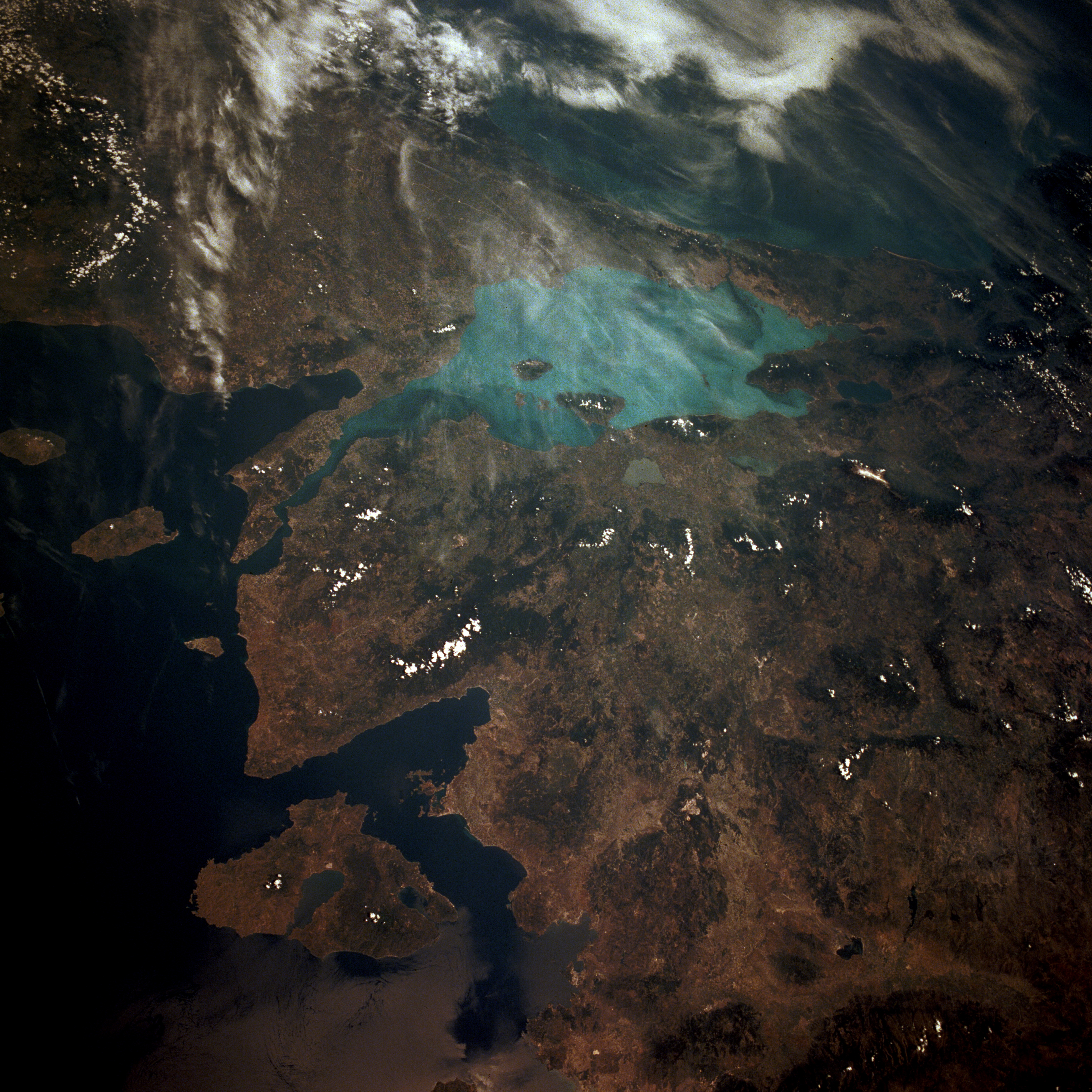
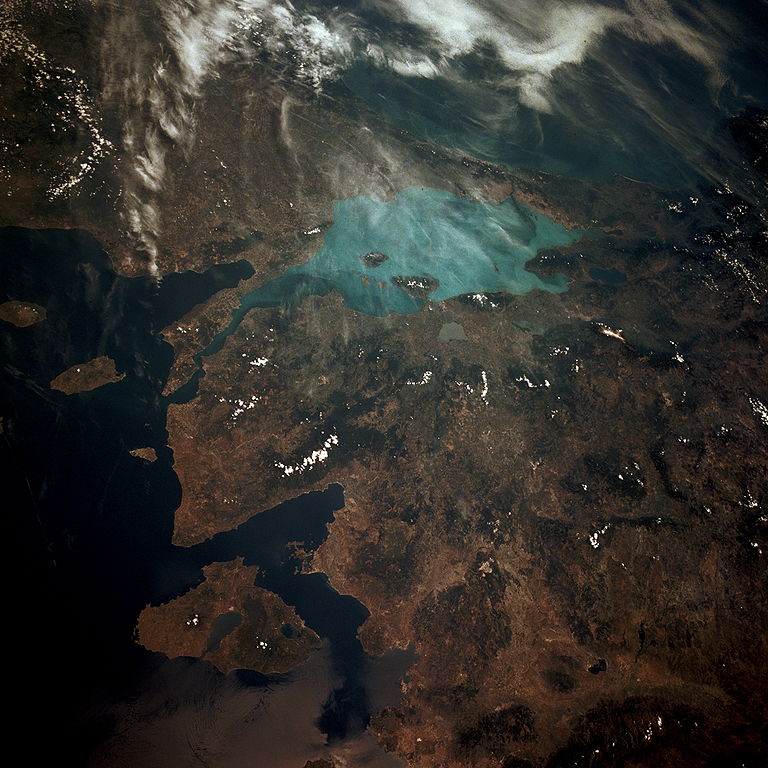
Español: Vista vía satélite del Mar de Marmara
Sea of Marmara in Turkey.
From STS 40, June 1991. NASA image information page
This image or video was catalogued by one of the centers of the United States National Aeronautics and Space Administration (NASA) under Photo ID: STS040-610-50. This tag does not indicate the copyright status of the attached work. A normal copyright tag is still required. See Commons:Licensing. Other languages:
|
| This file is in the public domain in the United States because it was solely created by NASA. NASA copyright policy states that "NASA material is not protected by copyright unless noted". (See Template:PD-USGov, NASA copyright policy page or JPL Image Use Policy.) | ||
 |
Warnings:
|
Таърихи файл
Рӯи таърихҳо клик кунед то нусхаи марбути парвандаро бубинед.
| Таърих | Бандангуштӣ | Андоза | Корбар | Тавзеҳ | |
|---|---|---|---|---|---|
| нусхаи феълӣ | 15:24, 27 Январ 2007 | | 5 266 × 5 266 (6,8 Мбайт) | Delirium | Much higher-resolution version of the same image (from the NASA site's "request high-resolution version" feature). |
| 11:54, 4 июни 2005 |  | 639 × 639 (128 кбайт) | Edward | Sea of Marmara in Turkey. {{CopyrightNASA}} |
Пайвандҳо
Саҳифаҳои зерин ба ин акс пайванданд:
Истифодаи саросарии парванда
Викиҳои дигари зерин ин файлро истифода мекунанд:
- Истифода дар af.wikipedia.org
- Истифода дар an.wikipedia.org
- Истифода дар ar.wikipedia.org
- Истифода дар arz.wikipedia.org
- Истифода дар ast.wikipedia.org
- Истифода дар az.wikipedia.org
- Истифода дар ba.wikipedia.org
- Истифода дар be-tarask.wikipedia.org
- Истифода дар bn.wikipedia.org
- Истифода дар ca.wikipedia.org
- Истифода дар cs.wikipedia.org
- Истифода дар cy.wikipedia.org
- Истифода дар de.wikipedia.org
- Истифода дар diq.wikipedia.org
- Истифода дар en.wikipedia.org
- Истифода дар eo.wikipedia.org
- Истифода дар es.wikipedia.org
- Истифода дар eu.wikipedia.org
- Истифода дар fa.wikipedia.org
- Истифода дар fr.wikipedia.org
- Истифода дар fy.wikipedia.org
- Истифода дар ga.wikipedia.org
- Истифода дар gl.wikipedia.org
- Истифода дар he.wikipedia.org
- Истифода дар hy.wikipedia.org
- Истифода дар ia.wikipedia.org
- Истифода дар ilo.wikipedia.org
- Истифода дар incubator.wikimedia.org
- Истифода дар it.wikipedia.org
- Истифода дар jv.wikipedia.org
- Истифода дар kab.wikipedia.org
- Истифода дар ka.wikipedia.org
- Истифода дар la.wikipedia.org
- Истифода дар lt.wikipedia.org
- Истифода дар mzn.wikipedia.org
- Истифода дар nl.wikipedia.org
- Истифода дар nn.wikipedia.org
- Истифода дар no.wikipedia.org
View more global usage of this file.